- Peterborough, South Australia
-
"Peterborough, Australia" redirects here. For the town in Victoria, Australia, see Peterborough, Victoria.
Peterborough
South Australia
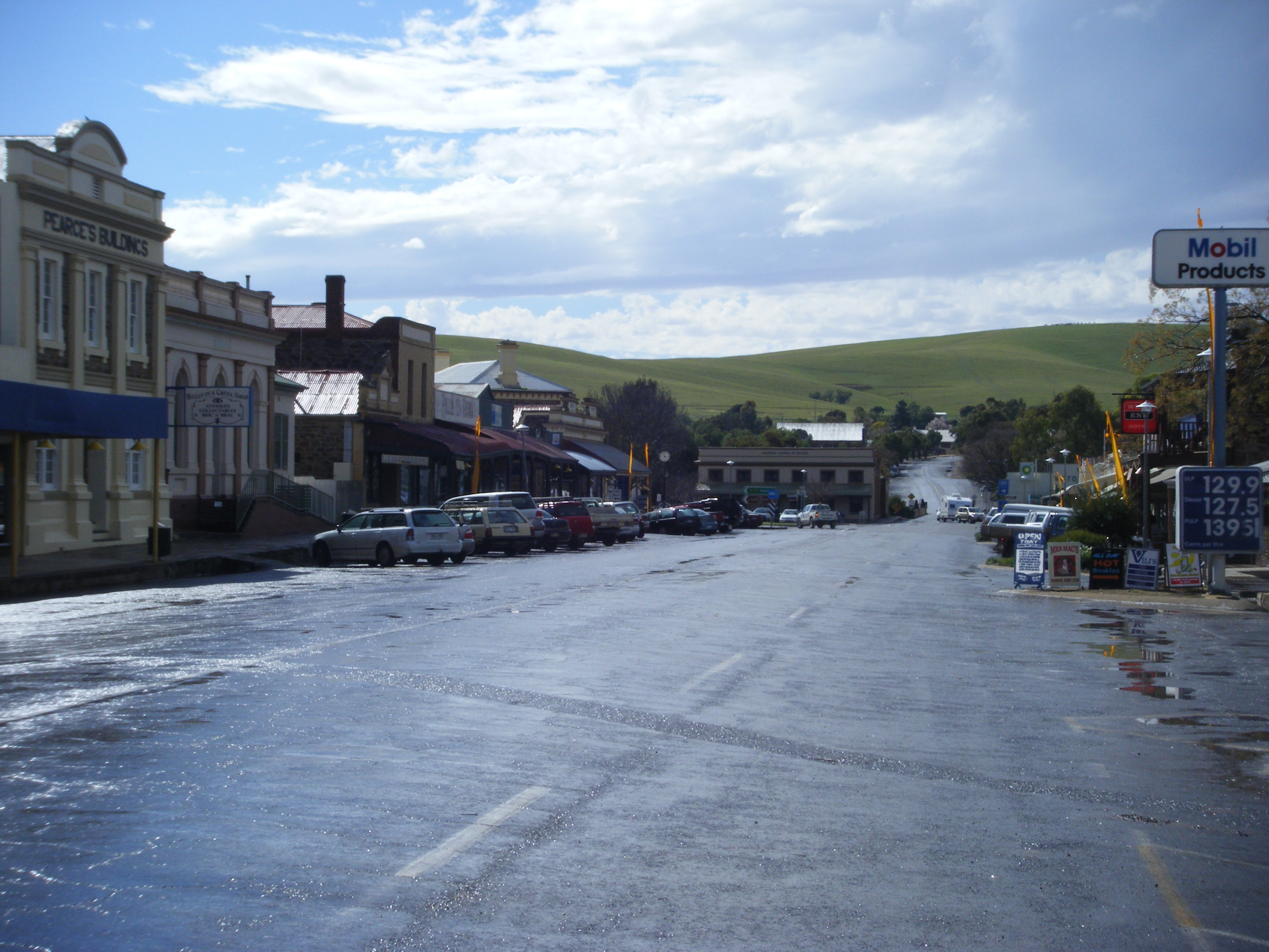
Main street of Peterborough
 Peterborough
Population: 1,689 (2006 Census)[1] Established: 1879 Postcode: 5422 Coordinates: 32°58′S 138°50′E / 32.967°S 138.833°E Elevation: 535 m (1,755 ft) Location: - 220 km (137 mi) N of Adelaide
- 113 km (70 mi) SE of Port Augusta
LGA: District Council of Peterborough State District: Stuart Federal Division: Division of Grey Peterborough is a town in the mid north of South Australia, in wheat country, just off the Barrier Highway. At the 2006 census, Peterborough had a population of 1,689.[1]
It was originally named Petersburg after the landowner, Peter Doecke, who sold land to create the town. It was one of 69 places in South Australia renamed in 1917 due to anti-German sentiments during World War I.
Contents
History
The first settlers in the area purchased land from the government in 1875. The first building in the town was constructed four years later. Settler Peter Doecke transferred his land to J H Koch in 1876, who found out in 1880 that the land would be the site of a railway junction. He subdivided it and sold 33 acres (13 ha) for £1700, after failing to get £500 for it in 1879.[2] By 1880 a hotel and post office had been erected, followed by a school in 1883, and a town hall in 1884.[3]
Government
Peterborough is the seat of the District Council of Peterborough. It is the largest town in the council area. It is bounded by the District Council of Orroroo Carrieton in the northwest, Northern Areas Council to the southwest, and the Regional Council of Goyder to the south, with unincorporated areas to the north and east. Peterborough is in the state electorate of Stuart and federal Division of Grey. Peterborough at one point in time had its own town council (Corporation of the Town of Peterborough)[4] surrounded by the district council.
Railways
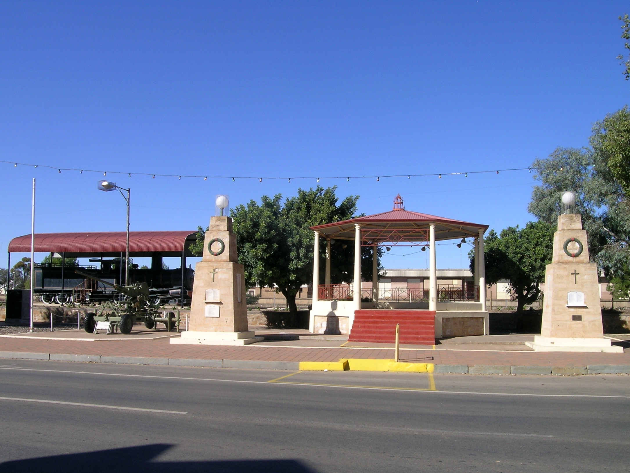
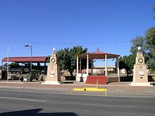 A "Y" Class number 82 Locomotive situated alongside the rotunda in the main street of Peterborough
Peterborough sits on the intersection of the East-West railway linking Port Pirie and Broken Hill, and the North-South railway linking Adelaide eventually to Alice Springs via Quorn, both narrow gauge (1,067 mm (3 ft 6 in)) lines.
The line from Port Pirie and Jamestown arrived in 1881, followed shortly after by the line from Terowie in the south. The line to Broken Hill was completed in 1887.[5] Peterborough was the home town for Bob the Railway Dog who is remembered by a bronze statue located in the Main Street.
In 1970, the East-West line was converted to standard gauge (1,435 mm (4 ft 8 1⁄2 in)), and the line south of Peterborough to Terowie to broad gauge (1,600 mm (5 ft 3 in)). Thus Peterborough became one of three, triple-gauge railway junctions in Australia. The others being Gladstone and Port Pirie, all on the same railway corridor[6].
The broad-gauge connection to Adelaide, via Burra, was severed in the late 1980s. The narrow-gauge line north to Quorn last carried freight in 1980, and was removed, between Eurelia and Bruce in the mid-1980s. Grain trains ran as far as Orroroo into the mid 1980s. In its later years it was used by tourist trains from Steamtown as far as Eurelia. Steamtown ceased operations in 2002, however the roundhouse is still used to display its coaches and locomotives. The District Council, with funding from the three tiers of government and recovery of the Eurelia line, have subsequently established the Steamtown Heritage Rail Centre, with SA's first Sound & Light Show. [7]
The town is still served by the twice-weekly Indian Pacific train run by Great Southern Railways, which heads to Adelaide on Sundays and Thursdays, and to Sydney on Tuesdays and Fridays.
Preceding station Great Southern Railway Following station towards East PerthIndian Pacific Broken Hilltowards SydneyEducation
Peterborough High School was opened in 1927 and caters for students from years 8 to 12.[8]
Peterborough Primary School was opened in 1883 and caters for students from years reception to 7.
References
- ^ a b Australian Bureau of Statistics (25 October 2007). "Peterborough (Urban Centre/Locality)". 2006 Census QuickStats. http://www.censusdata.abs.gov.au/ABSNavigation/prenav/LocationSearch?collection=Census&period=2006&areacode=UCL420600&producttype=QuickStats&breadcrumb=PL&action=401. Retrieved 20 October 2011.
- ^ "Peterborough Urban Conservation Area, Peterborough, SA Profile". www.aussieheritage.com.au. http://www.aussieheritage.com.au/listings/sa/Peterborough/PeterboroughUrbanConservationArea/11166. Retrieved 2008-05-05.
- ^ "Peterborough - South Australia - Australia - Travel - smh.com.au". www.smh.com.au. 2004-02-08. http://www.smh.com.au/news/South-Australia/Peterborough/2005/02/17/1108500204567.html. Retrieved 2008-05-05.
- ^ http://www.architectsdatabase.unisa.edu.au/arch_full.asp?Arch_ID=39 Report on the Town Hall to theCorporation of the Town of Peterborough
- ^ "Peterborough Railway Roundhouse and Turntable, Peterborough, SA Profile". www.aussieheritage.com.au. http://www.aussieheritage.com.au/listings/sa/Peterborough/PeterboroughRailwayRoundhouseandTurntable/11165. Retrieved 2008-05-05.
- ^ Australian Railway Historical Society Bulletin, July, 1987 pp145-157
- ^ "South Australia - Barrier Highway". www.southaustralia.com. http://www.southaustralia.com/BarrierHighway.aspx. Retrieved 2008-05-05.
- ^ Peterborough High School accessed 2010-05-05
External links
Local Government Areas of South Australia Metropolitan Adelaide Adelaide · Adelaide Hills · Burnside · Campbelltown · Charles Sturt · Gawler · Holdfast Bay · Marion · Mitcham · Norwood Payneham & St Peters · Onkaparinga · Playford · Port Adelaide Enfield · Prospect · Salisbury · Tea Tree Gully · Unley · Walkerville · West TorrensEyre Peninsula Ceduna · Cleve · Elliston · Franklin Harbour · Kimba · Lower Eyre Peninsula · Port Augusta · Port Lincoln · Streaky Bay · Tumby Bay · Wudinna · WhyallaCentral Barossa · Barunga West · Clare and Gilbert Valleys · Copper Coast · Flinders Ranges · Goyder · Light · Mallala · Mount Remarkable · Northern Areas · Orroroo Carieton · Peterborough · Port Pirie · Wakefield · Yorke PeninsulaSouthern and Hills Murray Mallee Southeast Outback Categories:- Towns in South Australia
- Local Government Areas of South Australia
- Mid North (South Australia)

Wikimedia Foundation. 2010.