Yongala, South Australia

Yongala, South Australia

Infobox Australian Place | type = town
name = Yongala
state = sa


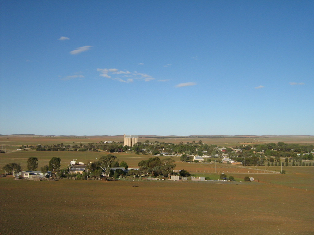
caption = Scene from the hill overlooking Yongala
county = Dalhousie
lga = District Council of Peterborough
postcode = 5493
est =
pop = 80
elevation= 512
maxtemp = 21.8
mintemp = 7.2
rainfall = 363.4
stategov = Stuart
fedgov = Grey
dist1 = 238
dir1 = North
location1= Adelaide via
dist2 = 91
dir2 = East
location2=Port Pirie
dist3 = 11
dir3 = southwest
location3=Peterborough

Yongala is a small town located in the state of South Australia, Australia. It has a population of approximately 80 people and is situated on the Clare Peterborough Road (B79). The town was proclaimed on 23 May 1876 and within 5 years would have a population of 353 as developers anticipated the connection of a railway. The railway instead went through the nearby town of Peterborough.cite web
year = 2007
url = http://www.peterboroughsa.com.au/yongala.php
title = Yongala
publisher = Peterborough Tourist Promotion Association
accessdate = 2007-04-09
]

Yongala is situated on a high plateau and winter snowfalls are common. The town holds several records for the lowest minimum temperature in South Australia.

History of settlement

Yongala was established as a hundred and part of the Dalhousie county in 1871 as one of the first of the 12 hundreds to be declared in that county. Land could be purchased in a hundred as soon as it had been declared.cite web
year = 2006
url = http://www.adelaideco-op.familyhistorysa.info/hundreds.html
title = Counties and Hundreds - South Australia
publisher = Adelaide Co-operative History
accessdate = 2007-04-09
]

Trivia

The steamship SS "Yongala" launched in 1903 and owned by the Adelaide Steamship Company was named after the town. It sank in a storm in 1911 and the wreck is now protected off the coast of Townsville, Queensland.

References


Wikimedia Foundation. 2010.

Игры ⚽ Поможем сделать НИР

Look at other dictionaries:

  • South Australia — For the song, see South Australia (song). Coordinates: 30°0′S 135°0′E / 30°S 135°E / 30; 135 …   Wikipedia

  • Lands administrative divisions of South Australia — The 37 counties of South Australia in 1886; later 12 more were proclaimed …   Wikipedia

  • Dutton, South Australia — …   Wikipedia

  • Geography of South Australia — South Australia occupies the south central part of the continent of Australia. It is one of the six states of Australia. South Australia is bordered on the west by Western Australia, to the north by the Northern Territory, Queensland to the… …   Wikipedia

  • Yongala — may refer to: * Yongala, South Australia, a town in the mid north of South Australia * SS Yongala a ship that sank off the coast of Queensland in 1911 …   Wikipedia

  • Yongala — steht für: eine Stadt in Südaustralien, siehe Yongala (South Australia) ein Schiff, siehe Yongala (Schiff) Diese Seite ist eine Begriffsklärung zur Unterscheidung mehrerer mit demselben Wort bezeichneter Begriffe …   Deutsch Wikipedia

  • Mount Bryan, South Australia — Mount Bryan is a town in north east South Australia. The town is situated on the Barrier Highway, 20 kilometres (12 mi) north of Burra, in the Regional Council of Goyder. At the 2006 census, Mount Bryan had a population of 137.[1] The town… …   Wikipedia

  • List of cities and towns in South Australia — This is a list of town and locality names in South Australia outside of the metropolitan postal area of Adelaide.:For a list of suburbs in metropolitan areas of Adelaide, see lists inside following individual city council articles: City of… …   Wikipedia

  • Yongala (Schiff) — Yongala p1 …   Deutsch Wikipedia

  • List of postcodes in South Australia/numeric sort — Postcodes are used by Australia Post to identify postal districts in Australia. This list is sorted numerically to facilitate seeing which towns/suburbs share a postcode.5000s inner suburbs* 5000 Adelaide * 5001 GPO Boxes * 5005 University of… …   Wikipedia

Share the article and excerpts

Direct link
Do a right-click on the link above
and select “Copy Link”