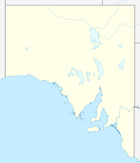
- Dutton, South Australia
-
Dutton is a settlement in South Australia.[1]
References
- ^ "2905.0 - Statistical Geography: Volume 2 -- Census Geographic Areas, Australia, 2006". Australian Bureau of Statistics. http://www.abs.gov.au/AUSSTATS/abs@.nsf/Latestproducts/2905.0Appendix82006?opendocument&tabname=Notes&prodno=2905.0&issue=2006&num=&view=. Retrieved 08 December 2009.
Coordinates: 34°21′32″S 139°08′35″E / 34.359°S 139.143°E
Towns and localities of the Regional Council of Goyder Aberdeen · Apoinga · Australia Plain · Baldina · Baldry · Booborowie · Bower · Brady Creek · Braemar (Station) · Bright · Brownlow · Buchanan · Bundey · Burra · Burra Eastern Districts · Burra North · Canowie · Canowie Belt · Collinsville · Copperhouse · Deep Creek · Dutton · Emu Downs (Hill) · Eudunda · Farrell Flat · Franklyn · Frankton · Geranium Plains · Gum Creek · Hallelujah Hills · Hallett · Hampden · Hansborough · Hanson · Julia · Ketchowla · Koonoona · Kooringa · Leighton · Mallet (Reservoir) · Mongolata · Mount Bryan · Neales · Neath Vale · Ngapala · North Booborwie · Pandappa · Peep Hill · Point Bass · Porter Lagoon · Robertstown · Rocky Plain · Steinfeld · Sutherlands · Terowie · Thistle Beds · Tracy · Ulooloo · Whyte-Yarcowie · Willalo · Worlds End · Worlds End Creek · Yarcowie · Yongala ValeCategories:- Towns in South Australia
- South Australia geography stubs
Wikimedia Foundation. 2010.

