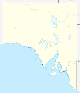
- Cummins, South Australia
-
Cummins
South AustraliaPopulation: 705 Postcode: 5631 Location: - 638 km (396 mi) W of Adelaide
- 63 km (39 mi) N of Port Lincoln
- 40 km (25 mi) W of Tumby Bay
LGA: District Council of Lower Eyre Peninsula State District: Flinders Federal Division: Grey Cummins is a town on Eyre Peninsula in South Australia, 67 km north of Port Lincoln and 68 m above sea level. At the 2006 census, the town had a population of 705.[1]
Cummins was named after William Patrick Cummins, a member of the South Australian House of Assembly from 1896 to 1907.[2] Cummins was surveyed in 1902 a few years after the first settlers in the area arrived. The railway to Port Lincoln arrived in 1907.
The major industries are sheep and grain growing. There is a narrow gauge railway line to the deep-water port at Port Lincoln for exporting grain.
Cummins is the headquarters of the District Council of Lower Eyre Peninsula. It is in the state electoral district of Flinders and the federal Division of Grey.
References
- ^ Australian Bureau of Statistics (25 October 2007). "Cummins (L) (Urban Centre/Locality)". 2006 Census QuickStats. http://www.censusdata.abs.gov.au/ABSNavigation/prenav/LocationSearch?collection=Census&period=2006&areacode=UCL406200&producttype=QuickStats&breadcrumb=PL&action=401. Retrieved 2008-02-02.
- ^ Praite, R. and Tolley, J.C. (1970) Place Names of South Australia, p. 33. Adelaide: Rigby Limited. ISBN 0-85179-083-6
Towns and Localities of the District Council of Lower Eyre Peninsula Big Swamp · Boston · Brimpton Lake · Charlton Gully · Coffin Bay · Coomunga · Coulta · Cummins · Edillilie · Flinders · Green Patch · Kapinnie · Karkoo · Kiana · Lake Wangary · Lincoln · Little Swamp · Louth · Louth Bay · Mitchell · Mortlock · Mount Drummond · Mount Dutton Bay · Mount Hope · North Shields · Poonindie · Proper Bay · Shannon · Sleaford · Sleaford Bay · Stamford · Tod River · Tulka · Uley · Ulipa · Wangary · Wanilla · Warrow · White Flat · YeelannaEyre Peninsula, South Australia Cities Townships Arno Bay · Baird Bay · Ceduna · Cleve · Coffin Bay · Cowell · Cummins · Darke Peak · Denial Bay · Elliston · Iron Knob · Kimba · Kyancutta · Lock · Minnipa · Poochera · Port Kenny · Port Neill · Pygery · Sceale Bay · Smoky Bay · Streaky Bay · Thevenard · Tumby Bay · Venus Bay · Wangary · Wirrulla · Wudinna · Yaninee · YeelannaNational parks Coffin Bay National Park · Gawler Ranges National Park · Lake Gilles Conservation Park · Lincoln National ParkIslands Councils Categories:- Towns in South Australia
- Eyre Peninsula
- South Australia geography stubs
Wikimedia Foundation. 2010.

