- Smoky Bay, South Australia
Infobox Australian Place | type = town
name = Smoky Bay
state = sa
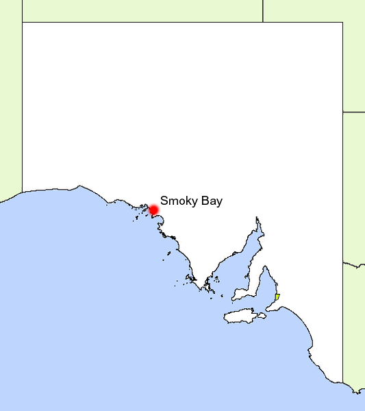
caption = Location of Smoky Bay
lga = District Council of Ceduna
postcode = 5680
est = 1913
pop = 200
elevation= 1
maxtemp =
mintemp =
rainfall =
stategov = Flinders
fedgov = Grey
dist1 = 69
dir1 = North West
location1= Streaky BaySmoky Bay is a small
coastal village located on the West Coast of theEyre Peninsula ,South Australia . Previously used as aport , the town is now a residential settlement and populartourist destination known for its recreational fishing, with a boat ramp andjetty located in the town.History
Smoky Bay's
coastline was first sighted and mapped by CaptainMatthew Flinders in 1802, who named it 'Smoky Bay' after the amount ofsmoke fromfire s lit by the area's Aboriginal people. [Citation
last = State Library of South Australia | title = Smoky Bay | url = http://www.slsa.sa.gov.au/manning/pn/s/s4.htm#smokyB | access-date = 2007-06-12 ]Whalers were the first Europeans to inhabit the coastline near the current site of the town, just north of Pt. Collinson. Recently,
dune erosion has uncovered parts of theruins of their camps, with pieces ofwhale bone and three one-hundred gallon cooking pots were recovered.Citation
last = Ceduna Tourism | title = Smoky Bay | url = http://www.cedunatourism.com.au/smoky2.html | access-date = 2007-06-12 ]In the early 1900s the area was opened up, with the first building a tin hut erected in 1905. Scrubcutters cleared the area by 1906, and by 1911 a
post office , repeating station and living quarters had been built. The town continued to grow, with aschool andhall opened in 1909. Ajetty was proposed for erection in 1908, and finally completed in 1913. ]The town of Smoky Bay was surveyed in 1913 under the name of "'Wallanippie", along with the aforementioned jetty and a
Harbour 's Board reserve. A largegalvanised iron goods shed and arailway line extending to the far end of the jetty were established, allowing the town to operate as a port.The town's original name of 'Wallanippie' was officially changed to 'Smoky Bay' in 1940, after continued use of this name by locals since the town's establishment. The town became less important throughout the mid 1900s, and its capacity as a port was diminished, leaving the town as a
residential , as well as anagricultural centre for the surrounding community. ]The growing of
Oysters was established in the bay in 1988, providing a neweconomic facet for the town, and adding to the town's promise as atourist destination.Citation
last = Oysterfest Site | title = History | url = http://www.communitywebs.org/CedunaOysterFest/oysterfarms.htm | access-date = 2007-05-25 ]During the 2002/2003 summer, a ban on taking all shellfish from the waters of the bay was imposed after a deadly biotoxin was discovered in the shellfish. [Citation
last = Primary Industries and Resources | title = Smoky Bay Closure | url = http://www.pir.sa.gov.au/pages/showcase/media/archive/2003/15.12.smokybay.htm:sectID=1934&tempID=1 | access-date = 2007-06-12 ]Geography
The town of Smoky Bay lies on the bay of the same name, north of
Streaky Bay . The bay is shielded fromocean swells by a small promenade of land that leads to Point Brown. Around 10 km offshore lies 'Eyre Island', a small, sandy island that also protects thebay . [Citation
last = SA waterways | title = Smoky Bay | url = http://users.senet.com.au/~gittins/smoky.html | access-date = 2007-05-25 ]Offshore lie a number of small, granitic islands which are home to many
seabird s andtiger snake s that feed on the birds. A number ofarchipelago s lie to the west, but are very isolated and mostly inaccessible.Inside the bay, the calm waters are dominated by shallow stretches of
seagrass , sandflats,mudflats , as well as numerous channels or 'creeks' that allowboat access, with slightly deeper water. [Citation
last = Maps of Estuaries | title = Smoky Bay | url = www.environment.gov.au/coasts/publications/estuaries/smoky.html | access-date = 2007-05-25 ]Surrounding the bay is a mixture of
mangroves to the south and coastalsand dune vegetation to the north. The mangroves tend to give the water in some parts of the bay a yellow stain, presumed to be fromtannin s and decayingleaf matter.The town itself is situated on a long, sandy
beach that ends at the boat ramp. Inland is dominated byagricultural land, used for cropping andgrazing ofsheep .The bay is home to a large variety of
seabird s, as well as manyfish species, includingGreat White Shark s, which are frequent visitors from the offshore islands. Seals also enter the bay, providing further incentive for sharks to enter the bay.Citation
last = Emma Pedler, ABC | title = Fatal Shark Attack at Smoky Bay | url = http://www.abc.net.au/eyre/stories/s544441.htm | access-date = 2007-05-25 ]Economy
The town has long since ceased function as a
port , but since 1988 has experienced a surge in theaquaculture ofoysters . The initial area allocation was of 85 ha within Smoky Bay, with individual farms having a maximum size of 10 ha. This has since been increased to 165 ha (including 40 ha ofsubtidal ordeepwater culture). Smoky Bay oysters are well recognized withinSouth Australia , along with other producers such asCoffin Bay . ]Tourism has been a rapidly expanding sector of the town's economy, with acaravan park and numerousbeach sideshack s established. Recreationalfishing is the largest draw to the town, with thejetty and boat ramp heavily used in the summer holidays. Other water based sports such asswimming andsnorkelling are popular, with a large shark proof cage constructed on the side of the jetty. Swimming outside of this enclosure can be risky, as evident by a recent death caused by a large shark in the bay. ]The local
oyster industry has been the source of tourist attractions also, with guided tours now established.Community
The town has around 200 permanent residents, with that number swelling to around 1000 in the peak summer months. The small town has a single
grocery store withpetrol anddiesel available, but no other outlets. [Citation
last = Nullabor.net | title = Smoky Bay | url = http://www.nullarbornet.com.au/towns/smokyBay.html | access-date = 2007-05-25 ]There is a sporting club north of the
caravan park with anoval andtennis courts . The club serves meals and is open to the general public. [Citation
last = DC of Ceduna | title = Smoky Bay | url = http://www.ceduna.net/site/page.cfm?u=195 | access-date = 2007-05-25 ]There is a single church, of the Uniting denomination opposite the caravan park. The town has a recently constructed boat ramp with a fee payable to Ceduna Council for its use. The old jetty, which has been shortened due to
storm damage still stands, with the remnants of the original structure still standing off the end of the jetty.Transport
Smoky Bay is accessed from the Flinders Highway, which runs along the coast of the Peninsula. Stateliner
bus services also run buses to the town, with the town's station located opposite thegeneral store . [Citation
last = Premier Stateliner | title = Eyre Peninsula Stateliner Bus Service | url = http://www.premierstateliner.com.au/ttables/ced_adl.html | access-date = 2007-06-12 ]The
Streaky Bay andCeduna airfield s also offer flights to the area, however another form of transport must be found to get down to Smoky Bay.References
External links
* [http://www.cedunatourism.com.au/smoky2.html Ceduna Tourist Site]
* [http://www.tep.com.au/region/smoky_bay.htm Tourism Eyre Peninsula Page]
* [http://www.tep.com.au/maps/map7.htm West Eyre Peninsula Map]
Wikimedia Foundation. 2010.