- Coffin Bay National Park
-
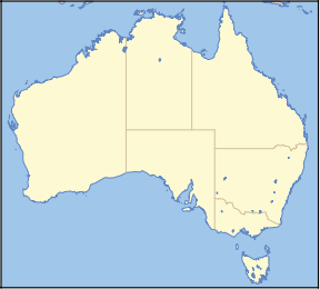
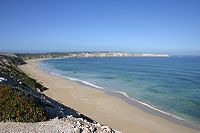
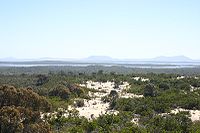
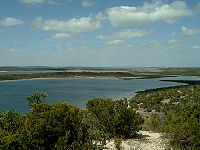
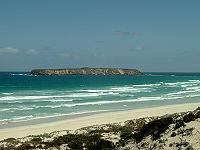
Coffin Bay National Park Nearest town/city Port Lincoln Coordinates 34°34′56″S 135°19′19″E / 34.58222°S 135.32194°E Area 310 km² Established 1982 Managing authorities Department for Environment and Heritage Official site Coffin Bay National Park Coffin Bay is a national park in on the Eyre Peninsula of South Australia (Australia), 301 km west of Adelaide, and 46 km west of Port Lincoln. The township of Coffin Bay is near the entrance to the National Park. The National Park features a long peninsula with a sheltered bay, coastal dunes, swamps and a spectacular coastline of islands, reefs, limestone cliffs and white surf beaches.
To the east of Point Avoid are Almonta and Gunyah Beaches, used for surfing. Reefs extend out to sea from Point Avoid to Golden island with Price Island further out. There is a camping area at Yangie Bay with camping fees payable on entry to the National Park. Access to the majority of the park's area north of Yangie Bay is via four wheel drive tracks only.
Contents
Wildlife
There is a great variety of wildlife in the national park, including until February 2004 wild horses, known as the Coffin Bay Ponies. Many seabirds can be seen including White-bellied Sea Eagles and Ospreys as well as various albatrosses and petrels.
The area covered by the national park is also classified by BirdLife International as an Important Bird Area. It supports over 1% of the world populations of Pied and Sooty Oystercatchers, as well as significant numbers of Fairy Terns, Hooded Plovers, Western Whipbirds, Rock Parrots and Blue-breasted Fairy-wrens.[1]
See also
References
- ^ "IBA: Coffin Bay". Birdata. Birds Australia. http://www.birdata.com.au/iba.vm. Retrieved 2011-06-16.
- Coffin Bay National Park from Tourism Eye Peninsula
- park areas
Gallery
Protected areas of South Australia National Parks Belair · Canunda · Coffin Bay · Coongie Lakes · Coorong · Flinders Chase · Flinders Ranges · Gawler Ranges · Innes · Lake Eyre · Lake Gairdner · Lake Torrens · Lincoln · Mount Remarkable · Murray River · Naracoorte Caves · Nullarbor · Onkaparinga River · Vulkathunha-Gammon Ranges · Witjira
Conservation Parks Acraman Creek · Billiatt · Black Hill · Cape Gantheaume · Cleland · Cox Scrub · Danggali · Deep Creek · Fairview · Finniss · Fort Glanville · Gum Laqoon · Kelly Hill · Hacks Lagoon · Hallett Cove · Horsnell Gully · Kaiserstuhl · Lake Gilles · Mamungari · Marino · Monarto · Morialta · Mount Magnificent · Naracoorte Caves · Ngarkat · Peebinga · Piccaninnie Ponds · Scott Creek · Seal Bay · Simpson Desert · Spring Gully · Talisker
Recreation Parks Regional Reserves Innamincka · Lake Frome · Nullarbor · Simpson Desert · Strzelecki
Conservation Reserves Wilderness Protection Areas Game Reserves Eyre Peninsula, South Australia Cities Townships Arno Bay · Baird Bay · Ceduna · Cleve · Coffin Bay · Cowell · Cummins · Darke Peak · Denial Bay · Elliston · Iron Knob · Kimba · Kyancutta · Lock · Minnipa · Poochera · Port Kenny · Port Neill · Pygery · Sceale Bay · Smoky Bay · Streaky Bay · Thevenard · Tumby Bay · Venus Bay · Wangary · Wirrulla · Wudinna · Yaninee · YeelannaNational parks Coffin Bay National Park · Gawler Ranges National Park · Lake Gilles Conservation Park · Lincoln National ParkIslands Councils Categories:- IUCN Category II
- South Australia geography stubs
- South Australia protected area stubs
- National parks of South Australia
- Eyre Peninsula
- Protected areas established in 1982
- 1982 establishments in Australia
- Important Bird Areas of Australia
Wikimedia Foundation. 2010.

