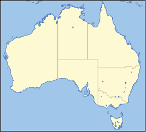
- Nullarbor National Park
-
Nullarbor National Park Nearest town/city Eucla Coordinates 31°23′55″S 130°08′16″E / 31.39861°S 130.13778°ECoordinates: 31°23′55″S 130°08′16″E / 31.39861°S 130.13778°E Area 578,127 ha[1] Established 1979 Managing authorities Department for Environment and Heritage Official site Nullarbor National Park and Regional Reserve Nullarbor National Park is a national park located in South Australia (Australia), 887 km west of Adelaide.
The northern boundary is with the Nullarbor Regional Reserve, its western end is at the Western Australia-South Australia state border - with Border Village as the main locality at that boundary. The eastern boundary is located in line with the Nullarbor Roadhouse.
The Eyre Highway in its current alignment, and the Old Eyre Highway alignment, run through the centre of the reserve. The old alignment also has ruins and abandoned tanks along its route: Bunabi Tank, Coompana Tank, Yangoonie Tank, Cundalabbie Tank, Number 2 Tank, and Mallabie Tank [2]
It adjoins the Great Australian Bight Marine Park and includes the Bunda Cliffs that exist just south of the new Eyre Highway route for most of its traverse within the park.
See also
References
- ^ "List of Protected Areas in South Australia". South Australian National Parks and Reserves. Government of South Australia - Department for Environment and Heritage. 27 June 2008. http://www.environment.sa.gov.au/parks/pdfs/PARKS_PDFS_PROTECTED_AREAS.PDF. Retrieved 4 December 2008.
- ^ Hema Maps (2007)Great Desert Tracks, South Central Sheet ISBN 10: 1-86500-164-3 - the iconic Ivy Tank ruin (the most northern location on the old highway route) is not in this park but it is located in the Nullarbor Regional Reserve
Protected areas of South Australia National Parks Belair · Canunda · Coffin Bay · Coongie Lakes · Coorong · Flinders Chase · Flinders Ranges · Gawler Ranges · Innes · Lake Eyre · Lake Gairdner · Lake Torrens · Lincoln · Mount Remarkable · Murray River · Naracoorte Caves · Nullarbor · Onkaparinga River · Vulkathunha-Gammon Ranges · Witjira
Conservation Parks Acraman Creek · Billiatt · Black Hill · Cape Gantheaume · Cleland · Cox Scrub · Danggali · Deep Creek · Fairview · Finniss · Fort Glanville · Gum Laqoon · Kelly Hill · Hacks Lagoon · Hallett Cove · Horsnell Gully · Kaiserstuhl · Lake Gilles · Mamungari · Marino · Monarto · Morialta · Mount Magnificent · Naracoorte Caves · Ngarkat · Peebinga · Piccaninnie Ponds · Scott Creek · Seal Bay · Simpson Desert · Spring Gully · Talisker
Recreation Parks Regional Reserves Innamincka · Lake Frome · Nullarbor · Simpson Desert · Strzelecki
Conservation Reserves Wilderness Protection Areas Game Reserves Categories:- IUCN Category II
- National parks of South Australia
- Nullarbor Plain
- Protected areas established in 1979
- 1979 establishments in Australia
- South Australia geography stubs
- South Australia protected area stubs
Wikimedia Foundation. 2010.

