- Flinders Ranges National Park
Infobox_protected_area_of_Australia | name = Flinders Ranges National Park
iucn_category = II
caption =
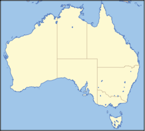
locator_x = 176
locator_y = 152
nearest_town_or_city = Hawker
coordinates = coord|31|25|20|S|138|42|18|E|
area = 912 km²
established = 1945
visitation_num =
visitation_year =
managing_authorities =Department for Environment and Heritage
official_site = [http://www.environment.sa.gov.au/parks/flinders_ranges/ Flinders Ranges National Park]The
Flinders Ranges areSouth Australia 's largestmountain range , and is situated approximately 400 km north of Adelaide. The discontinuous ranges stretch for over 430 km fromPort Pirie toLake Callabonna . Its most characteristic landmark isWilpena Pound , a large,sickle -shaped, naturalamphitheatre covering nearly 80 square kilometres, containing the range's and South Australia's highest peak,St Mary Peak (1170m).The Flinders Ranges National Park is located in the northern part of the Flinders Ranges. The park covers an area of 912 square kilometres, northeast of the small town of Hawker. The park includes the Wilpena Pound and St Mary Peak.
The
Heysen Trail andMawson Trail pass through the park.There are many lookouts, scenic vistas, small canyons and unusual rock formations located in the park. These include Wilpena Pound, Wilkawillina Gorge, Hucks Lookout, Brachina Gorge, Bunyeru Gorge and Arkaroo Rock . An amazing rock formation called the Great Wall of China is located just outside the park. The park centre at Wilpena Pound is accessible by sealed road from Hawker. Other areas in the park can be reached by un-sealed roads, which are mostly accessible by two-wheel drive vehicles except in exceptionally bad weather. Camping is permitted at many locations in the park.
Geology
The Flinders Ranges are largely composed of folded and faulted sediments of the
Adelaide Geosyncline . This very thick sequence of sediments were deposited in a large basin during theNeoproterozoic on the passive margin of the ancient continent ofRodinia . During theCambrian , approximately 540 million years ago, the area underwent the Delamerianorogeny where the geosynclinal sequence was folded and faulted into a large mountain range. Since this time the area has undergone erosion resulting in the relatively low ranges today.Most of the high ground and ridgetops in the Flinders are sequences of
quartzite s that outcrop along strike. The high walls ofWilpena Pound are formed by the outcropping beds of the eponymous Pound Quartzite in a synclinal structure. The same formation forms many of the other high parts of the Flinders, including the high plateau of theGammon Ranges and the Heysen Range.Cuesta forms are also very common in the Flinders.Flora and Fauna
The
flora of the Flinders Ranges is composed largely of species adapted to a semi-arid environment such as cypress-pine,mallee , andblack oak . Moister areas near Wilpena Pound supportgrevillea s, Guinea flowers, lilies andfern s. Reeds and sedges grow near permanent water sources such as springs andwaterhole s.Since the eradication of
dingo s and the establishment of permanent waterholes for stock, the numbers ofred kangaroo s,western grey kangaroo s and euros in the Flinders Ranges have increased. The yellow-footed rock-wallaby, which neared extinction after the arrival of Europeans due to hunting and predation by foxes, has now stabilized. Other endemic marsupials includedunnart s,planigale s andechidna s. Insectivorousbat s make up significant proportion of mammals in the area. There are a large number of bird species includingparrot s,galah s,emu s, thewedge-tailed eagle and small numbers of water birds. Reptiles includegoanna s,snake s, dragon lizards,skink s andgecko s. The streambank froglet is an endemicamphibian .External links
* [http://www.southaustralia.com/FlindersRangesOutback.aspx SouthAustralia.com Flinders Rangers & Outback - Travel Guides, Accommodation, Maps, Events etc]
References
ee also
*
Wilpena Pound
*Protected areas of South Australia
*Ediacara
*Arkaroola
*Gammon Ranges
*Mawson Plateau
*Mount Chambers

Wikimedia Foundation. 2010.