- Mumbles
-
- For the Irish band, see The Mumbles.
Coordinates: 51°34′23″N 3°59′57″W / 51.5730°N 3.9992°W
Mumbles Welsh: Y Mwmbwls 
Mumbles viewed from Oystermouth castle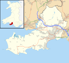
 Mumbles
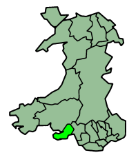
Mumbles shown within SwanseaPopulation 4,315 (2001 census) OS grid reference SS614879 Principal area Swansea Ceremonial county West Glamorgan Country Wales Sovereign state United Kingdom Post town SWANSEA Postcode district SA3 Dialling code 01792 Police South Wales Fire Mid and West Wales Ambulance Welsh EU Parliament Wales UK Parliament Gower Welsh Assembly Gower List of places: UK • Wales • Swansea Mumbles or The Mumbles (Welsh: Y Mwmbwls) is an area and community in Swansea, Wales which takes its name from the adjacent headland stretching into Swansea Bay. The area includes the ruin of Oystermouth Castle and the Mumbles Lighthouse, and is made up of the Mayals, Newton, Oystermouth and West Cross electoral wards, and has an elected community council.
Contents
History

Archaeological evidence indicates that an ancient submerged forest was located on what is now the foreshore of Mumbles Bay[citation needed] The bones of bears, wolves, hyenas, deer, rhinoceros and mammoth have been discovered there. A bone cave at the western tip of Caswell Bay was excavated in 1832[citation needed] but has since been destroyed by the sea. Another cave, at the Inner Sound, Mumbles Head, was blown up by quarrymen in 1838 but not before elephant bones had been found. Also scattered around the bays of Mumbles and Gower are the bones of sixteen Ice Age mammals, including a mammoth tooth measuring ten centimetres across, which is on display in Swansea Museum.
The first human crop growers arrived in Mumbles over 3,000 years ago[citation needed]: Swansea Museum has two well-finished flint axe-heads, one from Newton and one from an allotment on Mumbles Hill. Much of what we know about the first metalworkers, in the Bronze Age, has been learned from their tombs: pieces of pottery, a cairn and remains of a hut were found. The cliffs above the Redcliffe flats at Caswell Bay contain the ridged remnants of a Redley Cliff Iron Age hillfort.
There is evidence that the Romans were based in Mumbles in a villa on the site of the present All Saints Church in Oystermouth. When the site was being extended in 1860, workmen removing a bank of earth on the south side of the original building accidentally broke up a Roman tessellated pavement, or mosaic floor. This was previously a pagan site, as were many sites of worship in the UK which subsequently became places of worship at the onset of Christianity. Indeed, in this area it has been reported that Romano British gentlemen of Roman Wales may have eaten oysters from the oysterbeds off the shore below the site at Oystermouth, Ystumllwynarth.
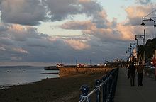 Mumbles seafront
Three of the bells in All Saints Church once belonged to the Jesuit church of La Compañía ("The Company") in Santiago, Chile. They seem to have been brought to Mumbles by Aubrey Vivian after the fire of 1863 burnt down the Jesuit church, killing 2,000 people. The family of industrialist Henry Vivian had business connections with the copper mines of Chile.
In 1793, the Mumbles Lighthouse was erected on the outer of the two tidal islands of Mumbles Head.[1] In 1806, the Oystermouth Railway was built between Oystermouth and Swansea with the intention of carrying coal to Swansea. The potential for carrying passengers was soon seen and a horse-drawn railway passenger service was started on March 25, 1807, making it the first such service in the world. It became enormously popular and was commonly called 'the Mumbles train'. Following the development of the rail service, Mumbles became a popular tourist destination. To capitalise on this, the Mumbles railway was extended and a pier was constructed and opened in 1898 to serve as the new terminus. An RNLI lifeboat slipway was added to the pier in the summer of 1916 and a boathouse was finally built on it in 1922; these remain in use.
Mumbles was part of Oystermouth Urban District established in 1894,[2] which was merged with the County Borough of Swansea in 1918.[3] On 23 April 1947, the Mumbles lifeboat lost a crew of eight men while attempting to rescue the crew of the Samtampa that had run aground on Sker Point. The Mumbles railway was closed in January 1960 and dismantled - a controversial decision that still resonates in the locality (calls to "bring back the Mumbles train" are still frequently heard and printed in local newspapers).
An amusement complex was developed at the land end of the Mumbles Pier in 1966, replacing an earlier popular dance hall. This proved to be a profitable attraction to visitors, resulting in the addition of a new building containing an amusement arcade, restaurant and bowling alley.
 Swansea Lifeboat Station from Mumbles Pier
The 'Mumbles Mile' is a stretch of road in Mumbles once notable for its concentration of pubs. It has long been a popular destination for pub crawls and binge drinking. Famous poet Dylan Thomas was said to have enjoyed many hours at The Mermaid. The 'Mumbles Mile' began to decline in popularity during the 1990s, owing to pressure from the local council and increased competition from Swansea's night attractions. Now, there are only five pubs on the 'mile', whereas there were once upwards of twenty.
The Encyclopedia of Wales says that Mumbles has always been considered a place apart... as the verse puts it:
- Mumbles is a funny place,
- A church without a steeple,
- Houses made of old ships wrecked
- And most peculiar people.[1]
The origin of the name "Mumbles" is obscure. Wyn Owen and Morgan (2008) cite several possibilities: Middle English momele ("to mumble"), describing the "mumbling" of the sea next to the rocks; Latin mamillae meaning "breasts", in reference to the breast shaped silhouette of the islands and headland, and Old Norse múli (snout, promontory).[4]
Notable people
- Richard Valentine Pitchford (aka Cardini) Master Magician and sleight of hand legend was born in Mumbles in 1895.
- Catherine Zeta-Jones and Michael Douglas have a house in Mumbles.
- Catherine Zeta-Jones grew up in Mumbles.
- Ian Hislop was born in Mumbles.
- Joanna Page was born in Mumbles.
- Bonnie Tyler lives in Mumbles.
- The 2004 mini-series Mine All Mine starring Griff Rhys Jones was filmed in Mumbles.
- The Right Reverend Graham Charles Chadwick served in curacy at All Saints Church and is buried in Oystermouth Cemetery.
- Thomas Bowdler is buried in Oystermouth.
- Jean Jenkins, an Australian senator (1987–1990), was brought up in Mumbles,
- Mal Pope lives in Mumbles
- Peter Richards actor and theatre director lives in Mumbles
- Andy Secombe, Welsh actor, voice actor, and author was born in Mumbles
- Melanie Walters actress (Gavin & Stacey) lives in Mumbles
- Alan Curtis ex-Welsh international footballer lives in Mumbles
- Robert Pugh actor lives in Mumbles
- Hannah Stone Royal Harpist, grew up in Mumbles
See also
- Gower Peninsula
- Mumbles RFC
- Breast shaped hill
Notes
- ^ a b The Welsh Academy Encyclopedia of Wales. Cardiff: University of Wales Press 2008
- ^ West Glamorgan Archive Service, Oystermouth Urban District Council Records
- ^ Oystermouth Urban District Council - City and County of Swansea
- ^ Wyn Owen, H. and Morgan, R. (2008) Dictionary of the Place-names of Wales. Llandysul: Gomer.
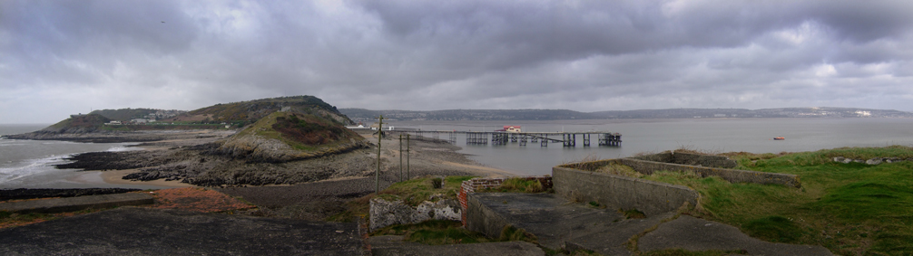
 Bracelet bay, Mumbles and Swansea bay, seen from the Mumbles Lighthouse
External links
- Mumbles Community Council
- Oystermouth Historical Association - A History of Mumbles
- Mumbles information and photographs
- Mumbles Tourist Information Centre
- Report of the loss of Edward, Prince of Wales (the Mumbles lifeboat) in 1947
- Surf school Mumbles
- Locality website
- Mumbles Pier
- Mumbles Pier information and photographs
- Mumbles webcam and images of area by a local photographer
- Mumbles Lifeboat
- Mumbles Yacht Club
- Mumbles Rangers Football Club
- www.geograph.co.uk Photos of The Mumbles and surrounding area
- Virtual tour of Mumbles Head
- Mumbles Mile Pub Crawl
Categories:- Seaside resorts in Wales
- Villages in Swansea
- Gower Peninsula
- Swansea Bay
- Populated coastal places in Wales


Wikimedia Foundation. 2010.