- Morriston (electoral ward)
-
Morriston Ward 
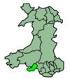
Ordnance Survey OS grid reference: Maps for SS6698 Geography Principal locality Morriston Total population 16,781 (2001 census) Land area (km²) 7.32 (2001 census) Administration Local council: City and County of Swansea Number of councillors: 5 Nation: Wales Post office and telephone Postcode(s): SA5, SA6 Dialling code: +44-1792 Politics Welsh Assembly: Swansea East UK Parliament: Swansea East European Parliament: Wales Morriston ((Welsh:Treforys or Treforus)) is an electoral ward in Swansea, Wales. Morriston is one of two five member wards in the City and County of Swansea local authority area. In population terms, it is the largest ward in the Welsh Assembly constituency of Swansea East and it is the largest ward the City and County of Swansea.[1]
The electoral ward consists of some or all of the following geographical areas: Caemawr, Cwmrhydyceirw, Graig Felen, Morriston, Parc Gwernfadog, Pant-lasau, Ynysforgan and Ynystawe, in the parliamentary constituency of Swansea East. The ward is bounded by the wards of Llansamlet and Clydach to the east; Bonymaen and Landore to the south; Mynydd-Bach and Llangyfelach to the west; and Mawr to the north.
The ward is broken down into a number of polling districts by the local council. These are: Parc-y-Duc, Glantawe, Pentrepoeth, Tircanol, Caemawr, Cwmrhydyceirw East, Cwmrhydyceirw West, Parc Gwernfadog and Ynystawe.
Morriston is one of only two wards in Swansea which returns five councillors to the local council. The other being Sketty. Morriston currently returns five Labour councillors: Mike Hedges, Robert Francis-Davies, John Davies, Bob Lloyd and Rob Stewart.
In the 2008 local election the Ward will be contested by all five incumbent Labour Councillors, and by five Liberal Democrats, five Conservatives, two Plaid Cymru candidates and one British National Party candidate. The poll will take place on 1 May 2008, along with elections in every other ward of Swansea.
The turnout of the 2008 local elections in Morriston was 34.53%. The results were:
Candidate Party Votes Status Michael John Hedges Labour 2159 Labour hold Robert John Lloyd Labour 1776 Labour hold Robert Charles Stewart Labour 1768 Labour hold William John Francis Davies Labour 1741 Labour hold Robert Francis-Davies Labour 1669 Labour hold Helen Ceri Clarke Liberal Democrats 1528 Jonathan Clarke Liberal Democrats 1427 Owen Roberts Liberal Democrats 1223 Rachael Elizabeth Hitchinson Liberal Democrats 1214 Robert Morrison Samuel Liberal Democrats 1142 Richard Jones Jones Plaid Cymru 778 Alan Bateman BNP 678 Hywel Rhys Couch Plaid Cymru 619 Michael James Byrne Conservatives 584 Robert Ivor James Conservatives 574 Paul Frank Briggs Conservatives 557 Thomas Patrick Caradog Morgan Conservatives 523 Sheila Morgan Conservatives 500 References
External links
Categories:- Swansea electoral wards
- Communities of Swansea
Wikimedia Foundation. 2010.

