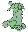
- Cwmbwrla (electoral ward)
-
Cwmbwrla Ward 
Ordnance Survey OS grid reference: Maps for SS6595 Geography Principal locality Cwmbwrla Total population 8,217 (2001 census) Land area (km²) 1.50 (2001 census) Administration Local council: City and County of Swansea Number of councillors: 3 Nation: Wales Post office and telephone Postcode(s): SA5 Dialling code: +44-1792 Politics Welsh Assembly: Swansea East - Mike Hedges UK Parliament: Swansea East - Sian James European Parliament: Wales Cwmbwrla is the name of an electoral ward, a community and a suburb in the City and County of Swansea, Wales. The community does not have a community council.
The electoral ward consists of some or all of the following settlements: Brondeg, Brynhyfryd, Cwmbwrla, Cwmdu, Gendros and Manselton, in the parliamentary constituency of Swansea East. The ward is bounded by the wards of Cockett to the west; Castle and Townhill to the south; Landore to the east; and Penderry and Mynydd-Bach to the north.
For the purposes of local elections, Cwmbwrla is broken down into the following polling districts: Manselton South, Cwmdu, Manselton North and Brynhyfryd. The ward returns 3 councillors to the local council. The ward is currently represented by: Peter Black (Lib Dems), Chris Holley (Lib Dems) and Graham Thomas (Lib Dems).
2008 local council elections
The results of the 2008 local council elections for Cwmbwrla were:
Candidate Party Votes Status Peter Malcolm Black Liberal Democrats 1804 Liberal Democrats hold Christopher Ashleigh Holley Liberal Democrats 1662 Liberal Democrats hold Lewis Graham Thomas Liberal Democrats 1335 Liberal Democrats hold Cyril Anderson Labour 526 Peter David Meehan Labour 453 Terence James Hennegan Labour 403 Peter James Demery Conservative 139 Joanne Harvey Conservative 111 Margaret Chegwin Jones Conservative 103 Categories:- Swansea electoral wards
- Communities of Swansea
Wikimedia Foundation. 2010.

