- Ceredigion
-
For other uses, see Ceredigion (disambiguation).
Ceredigion Sir Ceredigion 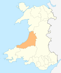
Geography Area
- Total
- % WaterRanked 4th
1,795 km2
? %Admin HQ Aberaeron / Aberystwyth ISO 3166-2 GB-CGN ONS code 00NQ Demographics Population:
- (2010 est.)
- Density
Ranked 19th
76,900
Ranked 21st
43 / km2Ethnicity 99.5% White Welsh language
- Any skillsRanked 4th
61.2%Politics Arms of Ceredigion County Council
Ceredigion County Council
http://www.ceredigion.gov.uk/Motto Golud Gwlad Rhyddid (Wealth, Land, Freedom) Control NOC (Independent-led coalition) MP AMs - Elin Jones
(Constituency) - Mid and West Wales
(Regional)
MEPs Wales Ceredigion (Welsh pronunciation: [kɛrɛˈdɪɡjɔn]) is a county and former kingdom in mid-west Wales. As Cardiganshire (Welsh: Sir Aberteifi), it was created in 1282, and was reconstituted as a county under that name in 1996, reverting to Ceredigion a day later. In extent the current county is more or less identical to the historic county.
Contents
Geography
See also: List of places in CeredigionCeredigion is a coastal county, bordered by Cardigan Bay to the west, Gwynedd to the north, Powys to the east, Carmarthenshire to the south and Pembrokeshire to the south-west. Its area is 440,630 acres (1783 km2). The population of the county at the 2001 census was 74,941.
The main settlements are Aberaeron, Aberarth, Aberporth, Aberystwyth, Borth, Cardigan, Lampeter, Llanddewi Brefi, Llandysul, Llanilar, Llanrhystud, New Quay, Penparcau and Tregaron. The largest of these are Aberystwyth and Cardigan.
The Cambrian Mountains cover much of the east of the county; this large area forms part of the desert of Wales. In the south and west, the surface is less elevated. The highest point is Pumlumon at 2,467 feet (752 m), where five rivers have their source: the Severn, the Wye, the Dulas, the Llyfnant and the Rheidol, the last of which meets the Afon Mynach in a 300 feet (91 m) plunge at the Devil's Bridge chasm. The largest river is the River Teifi which forms the border with Carmarthenshire and Pembrokeshire for part of its length. Other significant rivers include the River Aeron which has its estuary at Aberaeron, and the River Ystwyth and the River Rheidol both of which reach the sea in Aberystwyth harbour.
Ceredigion's 50 miles (80 km) of coastline boasts some fine sandy beaches and high quality transparent sea water. Ceredigion has the only permanent summer residence of bottle-nosed dolphins in the United Kingdom.
Ceredigion had the largest population growth of any county in Wales, with a 19.5% increase from 1991 to 2003[1]. Tourism and agriculture, chiefly hill farming, are the most important industries. In addition, two universities are within the county boundaries: Aberystwyth University and the Lampeter campus of the University of Wales, Trinity Saint David. The National Library of Wales, founded in 1907, is in Aberystwyth.
The county has no large commercial areas. The nearest substantial settlements are located at least 1 hour 45 minutes drive away. Approximate road distances from Ceredigion's largest town, Aberystwyth, are: Swansea, 75 miles (121 km) to the south; Shrewsbury, 76 miles (122 km) to the east, in the English county of Shropshire; and Wrexham, 82 miles (132 km) to the northeast. The capital, Cardiff, is over 100 miles (160 km) from most parts of the county.
Although Ceredigion and Gwynedd share a boundary, it is not possible to travel directly between the two as all road and rail links avoid the Dyfi estuary and pass through Dyfi Junction or Machynlleth in Powys.
In recent years, the county has gained more recognition of its connection with Dylan Thomas: he lived in New Quay and Talsarn and frequented Aberaeron and Lampeter. The Dylan Thomas Trail runs through part of the county, linking the places associated with the poet.[2]
History
 Ceredigion, shown on a map with traditional boundaries.
The name Ceredigion means Land of Ceredig, who was a son of Cunedda, a chieftain who re-conquered much of Wales from the Irish around the 5th century. It remained a kingdom ruled by his descendants until it expanded and changed its name, first to Seisyllwg in the late 7th century and, after the union of Seisyllwg with Dyfed, it was incorporated into Deheubarth in the mid 10th century.
In 1282, Edward I of England conquered the principality of Wales and divided the area into counties. The name Cardigan was an Anglicisation of the name for the historic kingdom of Ceredigion. One of thirteen traditional counties in Wales, Cardiganshire was also a vice-county. The area of the county became a district under the name Ceredigion in 1974 under the Local Government Act 1972 and, since 1996, has formed the county of Ceredigion.
Timeline
- Kingdom of Ceredigion: 5th c. - 7th c. Incorporated into Seisyllwg, then in 10th c. into Deheubarth.
- 1282 County of Cardiganshire (Welsh: Sir Aberteifi)
- 1974 Ceredigion, a district within Dyfed
- 1996–present Ceredigion, a county in Wales
Local government
See also: Ceredigion County CouncilBetween 1888 and 1974, the county was governed by Cardiganshire County Council, which took over the functions of county administration from the Quarter Sessions court in 1889. The county was abolished in 1974 by the Local Government Act 1972 — and it was succeeded by the district of Ceredigion in the new county of Dyfed. This district became a unitary authority on 1 April 1996 under the name of Cardiganshire, only to change its name back to Ceredigion the following day. It has, apart from minor realignments, identical borders to the former county.
A referendum was held on 20 May 2004 on whether to have a directly elected mayor for the county; this was rejected by a large majority.
Language
Ceredigion has the third highest proportion of Welsh speakers in the population (52% at the 2001 census); only Gwynedd and the Isle of Anglesey have a higher proportion. The number of Welsh speakers declined in Ceredigion from 59.1% in 1991 to 51.8% in 2003.[1]
Non-Welsh speakers tend to be more concentrated in and around the two university towns and along the coast, e.g. in Borth only 40% of the population was born in Wales and 36% of residents are Welsh-speaking.[citation needed]
Places of interest
- Aberystwyth Castle
- Aberystwyth Electric Cliff Railway,
- Ceredigion Museum, Aberystwyth
- Cwmystwyth Mines
- Devil's Bridge
- Elvis Rock
- Hafod Estate
- Llanerchaeron
- Nanteos Mansion
- Strata Florida Abbey
- Trawsgoed
- Vale of Rheidol Railway
- Welsh Gold Centre, Tregaron
- National Library of Wales
- Pumlumon- the source of the rivers Severn and Wye.
See also
- List of Lord Lieutenants of Cardiganshire
- List of High Sheriffs of Cardiganshire
- Centre points of the United Kingdom
- Menter Iaith
References
- ^ a b Census shows Welsh language rise Friday, 14 February, 2003 extracted 12-04-07
- ^ The Dylan Thomas Trail by D. N. Thomas, Y Lolfa 2002
External links
- Ceredigion at the Open Directory Project
- Ceredigion County Council
- Ceredigion Tourist Information
- Tourist Information from the Welsh Assembly Government
Ceredigion Principal settlements 
Towns and villages Aberarth · Aberbanc · Aberffrwd · Aberlerry · Abermagwr · Aber-meurig · Aberporth · Alltyblacca · Betws Ifan · Beulah · Blaencelyn · Borth · Bow Street · Caemorgan · Caerwedros · Capel Bangor · Capel Dewi · Ciliau Aeron · Comins Coch · Cribyn · Cwmann · Cwmystwyth · Devil's Bridge · Dôl-y-bont · Eisteddfa Gurig · Eglwys Fach · Elerch · Ffostrasol · Furnace · Glandyfi · Gorsgoch · Gwbert · Llanarth · Llanbadarn Fawr · Llanddewi Brefi · Llandre (Llanfihangel Genau'r Glyn) · Llandyfriog · Llandygwydd · Llanfarian · Llanfihangel-y-Creuddyn · Llanfihangel Ystrad · Llangeitho · Llangoedmor · Llangrannog · Llangybi · Llangynfelyn · Llanilar · Llanon · Llanrhystud · Llansantffraed · Llanwenog · Llechryd · Lledrod · Lovesgrove · Melindwr · Mwnt · Oakford · Penbryn · Penparc · Penparcau · Penrhyn-coch · Penuwch · Peny-y-garn · Ponterwyd · Pontrhydfendigaid · Pontrhydygroes · Pont-Siân · Rhydowen · Rhydypennau · Salem · Silian · Talgarreg · Tal-y-bont · Tirymynach · Trefeurig · Tregaron · Tresaith · Tre-Taliesin · Tre'r Ddôl · Troed y Rhiw · Troedyraur · Upper Borth · Waunfawr · Y Faenor · Y Ferwig · Ynyslas · Ysbyty Ystwyth · Ystrad Aeron · Ystrad Meurig · Ystumtuen
Universities Aberystwyth University · University of Wales, Trinity Saint DavidRivers Castles Islands Clwyd Dyfed Gwent Gwynedd Mid Glamorgan Powys South Glamorgan West Glamorgan Lliw Valley • Neath • Port Talbot • Swansea
Principal areas of Wales Anglesey • Blaenau Gwent • Bridgend • Caerphilly • Cardiff • Carmarthenshire • Ceredigion • Conwy • Denbighshire • Flintshire • Gwynedd • Merthyr Tydfil • Monmouthshire • Neath Port Talbot • Newport • Pembrokeshire • Powys • Rhondda Cynon Taf • Swansea • Torfaen • Vale of Glamorgan • Wrexham
Anglesey • Brecknockshire • Caernarfonshire • Carmarthenshire • Cardiganshire • Denbighshire • Flintshire • Glamorganshire • Merionethshire • Monmouthshire • Montgomeryshire • Pembrokeshire • Radnorshire
Categories:- Ceredigion
- Counties of Wales
- Principal areas of Wales
- 1282 establishments
- History of Ceredigion
- Historic counties of Wales
- Elin Jones

Wikimedia Foundation. 2010.