- Meirionnydd
-
Coordinates: 52°45′29″N 3°50′06″W / 52.758°N 3.835°W
Meirionnydd 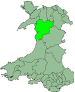
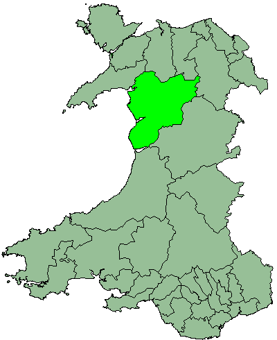
Geography Status District HQ Dolgellau History Created 1974 Abolished 1996 Succeeded by Gwynedd Demography 1971 population 29,531[citation needed] 1992 (estimate) population 32,900[citation needed] 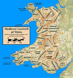 Map of Welsh cantrefs
Meirionnydd is a coastal and mountainous region of Wales. It has been a kingdom, a cantref, a district and, as Merionethshire, a county.
Contents
Kingdom
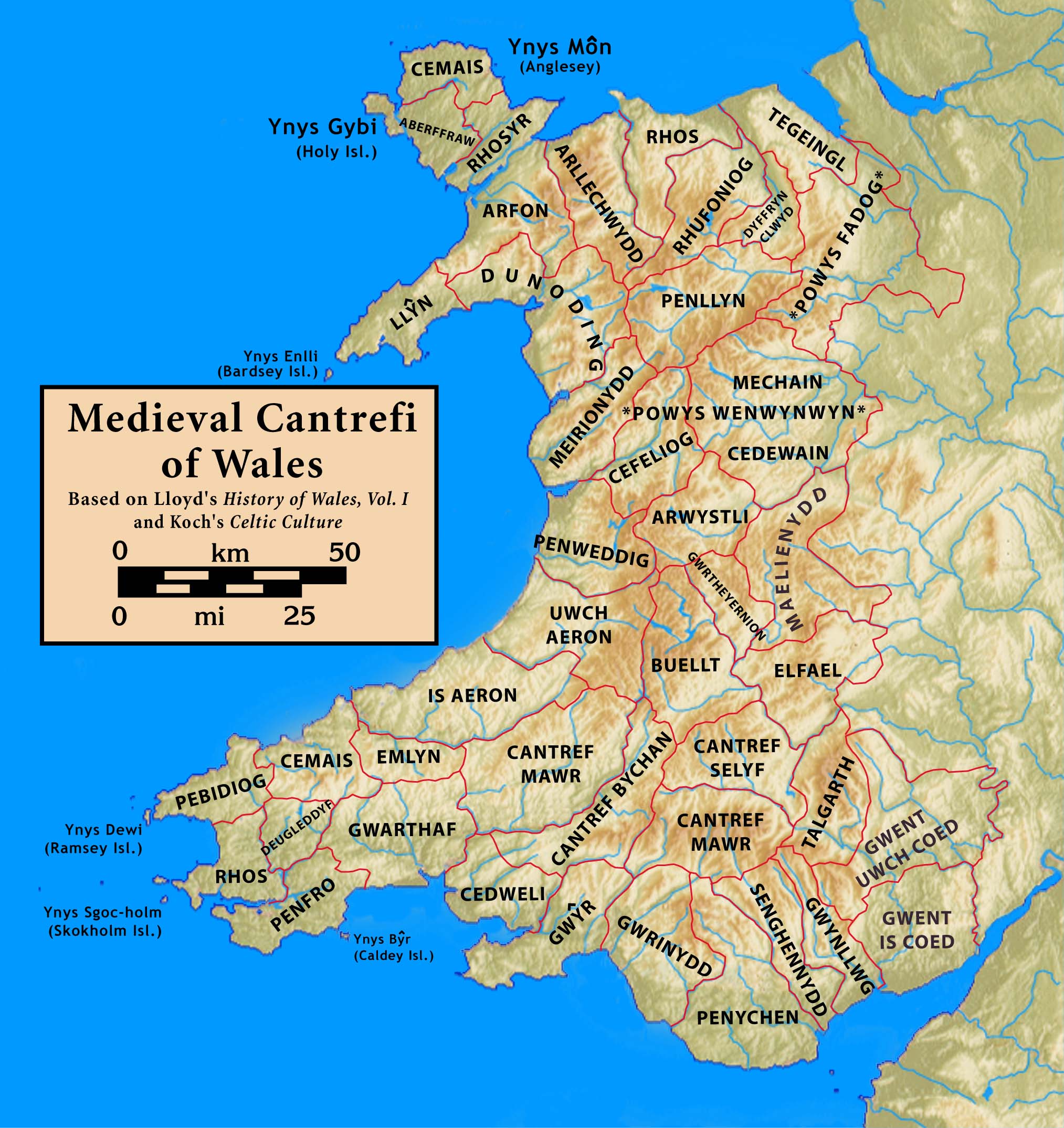
Meirionnydd was a sub-kingdom of Gwynedd, founded according to legend by Meirion, a grandson of Cunedda, a warrior-prince who brought his family to Wales from the 'Old North' (southern Scotland today), probably in the early 5th century. His dynasty seems to have ruled there for the next four hundred years. The kingdom lay between the River Mawddach and the River Dovey, spreading in a north-easterly direction.
Cantref
The cantref of Meirionnydd held the presumed boundaries of the previous kingdom but now as a fief of the Kingdom of Gwynedd where it continued to enjoy long spells of relative independence. It was abolished in 1284 following the Statute of Rhuddlan and reorganised with the addition of some neighbouring cantrefi to form the county of Merionethshire.
County
Main article: MerionethshireThe borders of Meirionnydd were expanded as a county (both historic and administrative) to include the old cantrefi of Penllyn and Ardudwy. It took the name Merionethshire under English Law. In 1974 it merged with the counties of Caernarfonshire and Anglesey to create the revived Gwynedd (county).
District
Meirionnydd was one of five districts of Gwynedd from 1974 to 1996. The district comprised the majority of the administrative county of Merionethshire and reverted to the Welsh spelling of the county's name.
The district was created by the Local Government Act 1972, and replaced the following local government areas of Merionethshire:
- The urban districts of Bala, Barmouth, Dolgellau, Ffestiniog and Tywyn
- The rural districts of Deudraeth, Dolgellau and Penllyn
Meirionnydd District was abolished in 1996 by the Local Government (Wales) Act 1994, becoming part of the unitary authority of 'Caernarfonshire and Merionethshire', which was immediately renamed Gwynedd as the first act of the new council. An area committee of Gwynedd Council now covers the area.
Clwyd Dyfed Gwent Gwynedd Mid Glamorgan Powys South Glamorgan West Glamorgan Lliw Valley • Neath • Port Talbot • Swansea
Categories:- Cantrefs
- Gwynedd
- Kingdoms of Wales
- History of Gwynedd
- Geography of Gwynedd
- Merionethshire
- States and territories established in 1974
- Gwynedd geography stubs
Wikimedia Foundation. 2010.