- Ciliau Aeron
-
Coordinates: 52°12′26″N 4°11′47″W / 52.20719°N 4.19637°W
Ciliau Aeron 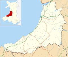
 Ciliau Aeron
Ciliau Aeron shown within CeredigionOS grid reference SN500588 Principal area Ceredigion Ceremonial county Dyfed Country Wales Sovereign state United Kingdom Post town ABERAERON Postcode district SA46 Dialling code 01545 Police Dyfed-Powys Fire Mid and West Wales Ambulance Welsh EU Parliament Wales UK Parliament Ceredigion List of places: UK • Wales • Ceredigion Ciliau Aeron (English: where the valley of the river Aeron narrows) is a small village 4 miles from Aberaeron in Ceredigion, Wales on the left bank of the River Aeron.
The word Ciliau comes from the Welsh for corners. Aeron Corners in English refers to the many bends taken by the river through this area.
The village post office has long gone, but Ciliau has a thriving school and a well-used village hall. There are also fishing lakes in the village, as well as garden nurseries, an organic farm shop and a self-catering holiday centre for special needs children operated by the Ty Glyn Davis Trust. The Trust also runs an eighteenth-century walled garden alongside the River Aeron; it is open to the public from dawn to dusk, every day of the week, without charge.
The Dylan Thomas Trail runs through Ciliau Aeron, passing the Tyglyn Hotel, which once was the holiday home of the publisher, Geoffrey Faber – T. S. Eliot used to holiday there in the 1930s. Eliot’s time in the village is described in A Farm, Two Mansions and a Bungalow, which also gives an account of the time spent by Dylan Thomas in nearby New Quay and Talsarn.[1]
The dockworker-poet James Hughes was born in Ciliau in 1799, and the poet-priest David Davis (Dafis Castellhywel, 1745-1827) had his first ministry in the village’s Unitarian chapel. [2]
Just a mile away is the National Trust’s Llanerchaeron estate.
References
- ^ Dylan Thomas: A Farm, Two Mansions and a Bungalow by D N Thomas, Seren 2000
- ^ Telyn Dewi by D. Davis, Longman 1824
External links
Ceredigion Principal settlements 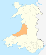
Towns and villages Aberarth · Aberbanc · Aberffrwd · Aberlerry · Abermagwr · Aber-meurig · Aberporth · Alltyblacca · Betws Ifan · Beulah · Blaencelyn · Borth · Bow Street · Caemorgan · Caerwedros · Capel Bangor · Capel Dewi · Ciliau Aeron · Comins Coch · Cribyn · Cwmann · Cwmystwyth · Devil's Bridge · Dôl-y-bont · Eisteddfa Gurig · Eglwys Fach · Elerch · Ffostrasol · Furnace · Glandyfi · Gorsgoch · Gwbert · Llanarth · Llanbadarn Fawr · Llanddewi Brefi · Llandre (Llanfihangel Genau'r Glyn) · Llandyfriog · Llandygwydd · Llanfarian · Llanfihangel-y-Creuddyn · Llanfihangel Ystrad · Llangeitho · Llangoedmor · Llangrannog · Llangybi · Llangynfelyn · Llanilar · Llanon · Llanrhystud · Llansantffraed · Llanwenog · Llechryd · Lledrod · Lovesgrove · Melindwr · Mwnt · Oakford · Penbryn · Penparc · Penparcau · Penrhyn-coch · Penuwch · Peny-y-garn · Ponterwyd · Pontrhydfendigaid · Pontrhydygroes · Pont-Siân · Rhydowen · Rhydypennau · Salem · Silian · Talgarreg · Tal-y-bont · Tirymynach · Trefeurig · Tregaron · Tresaith · Tre-Taliesin · Tre'r Ddôl · Troed y Rhiw · Troedyraur · Upper Borth · Waunfawr · Y Faenor · Y Ferwig · Ynyslas · Ysbyty Ystwyth · Ystrad Aeron · Ystrad Meurig · Ystumtuen
Universities Aberystwyth University · University of Wales, Trinity Saint DavidRivers Castles Islands Categories:- Villages in Ceredigion
- Ceredigion geography stubs


Wikimedia Foundation. 2010.