- Mwnt
-
Coordinates: 52°08′13″N 4°38′20″W / 52.13684°N 4.63878°W
Mwnt Welsh: Mwnt 
Mwnt Church from the headland
 Mwnt
Mwnt
Mwnt shown within CeredigionOS grid reference SN194520 Principal area Ceredigion Ceremonial county Dyfed Country Wales Sovereign state United Kingdom Post town CARDIGAN Postcode district SA43 Dialling code 01239 Police Dyfed-Powys Fire Mid and West Wales Ambulance Welsh EU Parliament Wales UK Parliament Ceredigion Welsh Assembly Ceredigion List of places: UK • Wales • Ceredigion Mwnt is a very small community and ancient parish in south Ceredigion, Wales, on the Irish Sea coast about 4.5 miles from Cardigan. It gets its name from the prominent steep conical hill, a landmark from much of Cardigan Bay, that rises above the beach.
It was the site of an unsuccessful invasion by Flemings in 1155, and its defeat was long afterwards celebrated on the first Sunday in January as "Sul Coch y Mwnt". It is said[by whom?] that the bones of the defeated invaders would occasionally be visible under the sand when uncovered by windy conditions in the early 20th century.[1]
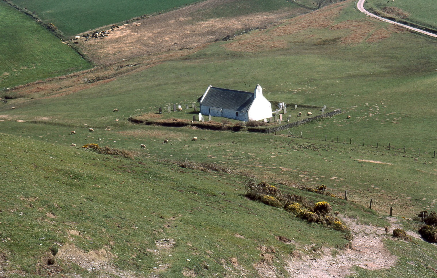
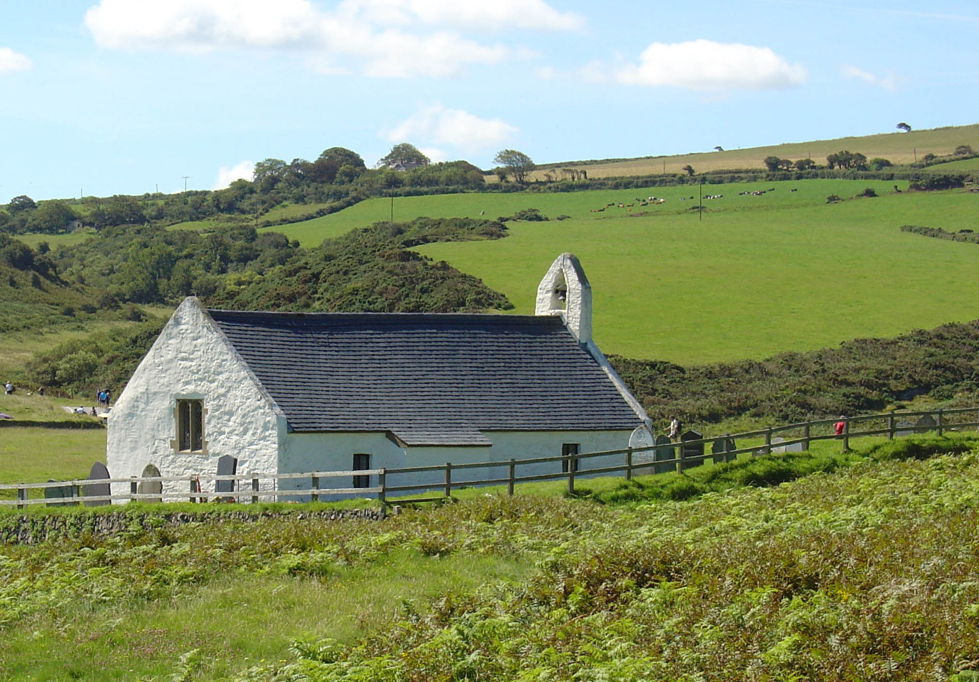
The Church of the Holy Cross (Welsh: Eglwys y Grog) is an example of a medieval sailor's chapel of ease. The site is said to have been used since the Age of the Saints, but the present building is probably 14th century. It has an example of a 12th or 13th century font made of Preseli stone. Mwnt was a civil parish in its own right for several centuries, but before the 17th century it was a detached chapelry of the parish of Llangoedmor. Since 1934, it has been part of the parish of Y Ferwig.
The beach, but not the church, is owned by the National Trust who exercise a conservation remit over both. The Irish Sea off Mwnt is rich in wildlife, being a regular summer home to dolphins, seals and porpoises.
Images of Mwnt 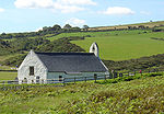 Mwnt Church
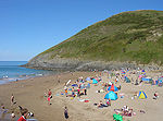 Mwnt Beach
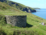 Lime kiln at Mwnt
See also
References
External links
Ceredigion Principal settlements 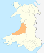
Towns and villages Aberarth · Aberbanc · Aberffrwd · Aberlerry · Abermagwr · Aber-meurig · Aberporth · Alltyblacca · Betws Ifan · Beulah · Blaencelyn · Borth · Bow Street · Caemorgan · Caerwedros · Capel Bangor · Capel Dewi · Ciliau Aeron · Comins Coch · Cribyn · Cwmann · Cwmystwyth · Devil's Bridge · Dôl-y-bont · Eisteddfa Gurig · Eglwys Fach · Elerch · Ffostrasol · Furnace · Glandyfi · Gorsgoch · Gwbert · Llanarth · Llanbadarn Fawr · Llanddewi Brefi · Llandre (Llanfihangel Genau'r Glyn) · Llandyfriog · Llandygwydd · Llanfarian · Llanfihangel-y-Creuddyn · Llanfihangel Ystrad · Llangeitho · Llangoedmor · Llangrannog · Llangybi · Llangynfelyn · Llanilar · Llanon · Llanrhystud · Llansantffraed · Llanwenog · Llechryd · Lledrod · Lovesgrove · Melindwr · Mwnt · Oakford · Penbryn · Penparc · Penparcau · Penrhyn-coch · Penuwch · Peny-y-garn · Ponterwyd · Pontrhydfendigaid · Pontrhydygroes · Pont-Siân · Rhydowen · Rhydypennau · Salem · Silian · Talgarreg · Tal-y-bont · Tirymynach · Trefeurig · Tregaron · Tresaith · Tre-Taliesin · Tre'r Ddôl · Troed y Rhiw · Troedyraur · Upper Borth · Waunfawr · Y Faenor · Y Ferwig · Ynyslas · Ysbyty Ystwyth · Ystrad Aeron · Ystrad Meurig · Ystumtuen
Universities Aberystwyth University · University of Wales, Trinity Saint DavidRivers Castles Islands Categories:- National Trust properties in Wales
- Villages in Ceredigion
- Seaside resorts in Wales
- Beaches of Wales
- Visitor attractions in Ceredigion
- Beaches of Ceredigion
- Ceredigion geography stubs


Wikimedia Foundation. 2010.