- Preseli Hills
-
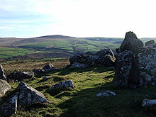 Carn Edward with view to Cerrig Lladron, Preseli
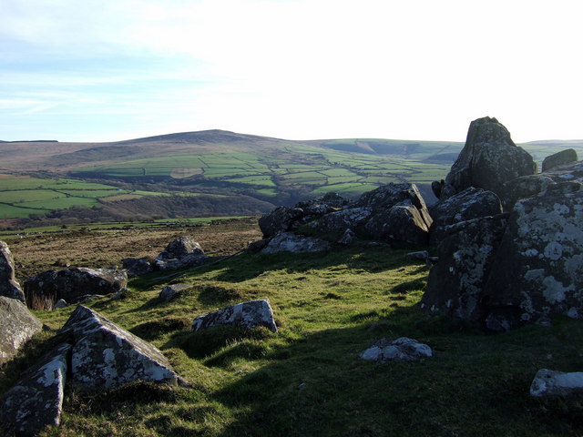
The Preseli Hills or Preseli Mountains (Welsh: Mynydd Y Preseli / Y Preselau - also spelt Presely) (and also recorded as Mynydd Prescelly[1]) are a range of hills in north Pembrokeshire, West Wales. They form part of the Pembrokeshire Coast National Park.
The hills rise to 536 metres above sea level at Foel Cwmcerwyn and are dotted with prehistoric remains including evidence of Neolithic settlement. In 1923, the petrologist Herbert Henry Thomas identified that bluestone from the hills corresponded to that used to build the inner circle of Stonehenge[2] and more recent geologists have identified Carn Menyn, sometimes called Carn Meini, as one of the bluestone sources.[3] Others theorise that bluestone from the area was deposited close to Stonehenge by glaciation.[4]
Slate quarrying was once big business in the Preseli Hills and remnants of the quarries can still be seen in Rosebush, Pembrokeshire and there is a slate workshop today still at Llangolman where authentic Welsh slate is still used in a variety of craft items.
During the Second World War, the UK War Office used the Preseli Hills for training exercises. Its continued use for training exercises following the war was the subject of protest by Plaid Cymru.
Sacred and historic sites
Sacred and historic sites of the Preseli Mountains include: Beddyrafanc
Bedd Arthur
Bedd Morris
Budloy Stone
Carn Alw
Carn Besi
Carn Bica
Carn Meini
Carn Menyn Chambered Cairn
Carn Sian
Carreg Coetan Arthur
Castell Henllys
Castell Pen yr Allt
Cerreg Lladron
Cerreg Meibion Arthur
Cerreg y Gof
Coitan Arthur
Crugiau Dwy
Crug-yr-Hwch
Dyffryn Stones
Foel Feddau
Frenni Fawr
Garreg Hir
Glandy Cross Complex
Glyn Gath
Gors Fawr
Llech-y-Drybedd
Maenllwyd y Rhos
Maen-y-Parc "A"
Maen-y-Parc "B" and "C"
Moel Drygarn
Mynyedd Carningli
Mynyedd Melyn
Parc-y-Meirw
Parc Carrig Hirion
Perc y Tywood Maenhir
Penian Stones
Pentre Ifan
Rhos fach Standing Stones
The Stone River
St Teilo's Church
Tafarn y Bwlch
Temple Druid Standing Stone
Tre-Fach Standing Stone
Trellyffant
Ty Meini
Waun Lwyd Stones
Waun Mawn Row or Circle
Waun Mawn StoneReferences
- ^ OS One inch 7th series map sheet 138/151 Fishguard and Pembroke 1965
- ^ Thomas, H.H. 1923. The source of the stones of Stonehenge. Antiquaries Journal 3, 239-260.
- ^ Archaeologists Figure Out Mystery of Stonehenge Bluestones
- ^ Thorpe, R.S et al. 1991. The geological sources and transport of the bluestones of Stonehenge, Wiltshire. Proceedings of the Pregistoric Society, 57, 103-57.
External links
Categories:- Mountains and hills of south Wales
- Geography of Pembrokeshire
- Sites of Special Scientific Interest in Pembrokeshire
Wikimedia Foundation. 2010.