- Douglaston Hill Historic District
-
Douglaston Hill Historic District
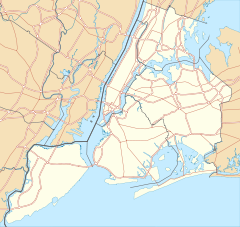
Location: Roughly bounded by Douglaston Pkwy., Northern Blvd., 244th St., 243rd St., and Long Island RR, Douglaston, New York Coordinates: 40°46′3″N 73°44′43″W / 40.7675°N 73.74528°WCoordinates: 40°46′3″N 73°44′43″W / 40.7675°N 73.74528°W Area: 22.5 acres (9.1 ha) Architect: Hamilton, William J.; Stuart, John, et al. Architectural style: Queen Anne, Shingle Style, et al. Governing body: Local NRHP Reference#: 00001016[1] Added to NRHP: August 31, 2000 Douglaston Hill Historic District is a national historic district in Douglaston, Queens, New York. It includes 83 contributing buildings and two contributing sites. The buildings include Zion Episcopal Church (1830), houses and garages, and commercial buildings. The sites are Zion cemetery and public park. It was laid out with very large lots in 1853, at the very beginning of a movement in the United States to create suburban gardens. The buildings include a number of fine examples of late-19th and early 20th century architectural styles such as Queen Anne, Shingle Style, and Colonial Revival. The majority of the buildings date between 1890 and 1940.[2]
It was listed on the National Register of Historic Places in 2000.[1] The area was recognized as an Historic District of New York City in December 2004 by the New York City Landmarks Preservation Commission.[3]
References
- ^ a b "National Register Information System". National Register of Historic Places. National Park Service. 2009-03-13. http://nrhp.focus.nps.gov/natreg/docs/All_Data.html.
- ^ Kathy Howe (June 2000). "National Register of Historic Places Registration: Douglaston Hill Historic District". New York State Office of Parks, Recreation and Historic Preservation. http://www.oprhp.state.ny.us/hpimaging/hp_view.asp?GroupView=7444. Retrieved 2011-01-16. See also: "Accompanying 36 photos". http://www.oprhp.state.ny.us/hpimaging/hp_view.asp?GroupView=7455.
- ^ Landmarks Preservation Commission Designates the Douglaston Hill Historic District in Queens, New York City Landmarks Preservation Commission, 2004-12-14
New York City Historic Sites NRHP: Manhattan – Brooklyn – Queens – Staten Island – Bronx • NHL: New York State
NYC: Manhattan – Brooklyn – Queens – Staten Island – Bronx
Neighborhoods in the New York City Borough of Queens Arverne · Astoria · Astoria Heights · Auburndale · Bayside · Bayswater · Bay Terrace · Beechhurst · Bellaire · Belle Harbor · Bellerose · Blissville · Boulevard Gardens · Breezy Point · Briarwood · Broad Channel · Broadway-Flushing · Cambria Heights · College Point · Corona · Ditmars · Douglaston · Dutch Kills · East Elmhurst · Edgemere · Electchester · Elmhurst · Far Rockaway · Floral Park · Flushing · Forest Hills · Forest Hills Gardens · Fresh Meadows · Fresh Pond · Glendale · Glen Oaks · Hamilton Beach · Hammels · Hillcrest · Hollis · Hollis Hills · Holliswood · Howard Beach · Howard Park · Hunters Point · Jackson Heights · Jamaica · Jamaica Estates · Jamaica Hills · Kew Gardens · Kew Gardens Hills · Laurelton · LeFrak City · Linden Hill · Lindenwood · Little Neck · Locust Manor · Long Island City · Malba · Maspeth · Meadowmere · Middle Village · Murray Hill · Neponsit · North Corona · North Shore Towers · Oakland Gardens · Old Howard Beach · Ozone Park · Pomonok · Queensboro Hill · Queensbridge · Queens Village · Ramblersville · Ravenswood · Rego Park · Richmond Hill · Ridgewood · Rochdale · Rockaway · Rockaway Beach · Rockaway Park · Rockwood Park · Rosedale · Roxbury · St. Albans · Seaside · South Jamaica · South Ozone Park · Springfield Gardens · Sunnyside · Sunnyside Gardens · Tudor Village · Utopia · Warnerville · Whitestone · Willets Point · Woodhaven · Woodside · Wyckoff Heights

Community Boards: 1 · 2 · 3 · 4 · 5 · 6 · 7 · 8 · 9 · 10 · 11 · 12 · 13 · 14 Categories:- Historic districts in New York City
- National Register of Historic Places in New York City
- Queen Anne architecture in New York
- Shingle Style architecture in New York
- National Register of Historic Places in Queens County, New York
- Queens County, New York Registered Historic Place stubs
Wikimedia Foundation. 2010.


