- Douglaston Historic District
-
Not to be confused with Douglaston Hill Historic District.Douglaston Historic District
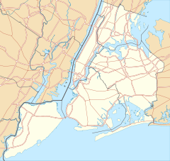

Location: Roughly bounded by Shore Rd., Marinette St., Douglas Rd. and Cherry St., Douglaston, New York Coordinates: 40°46′33″N 73°45′2″W / 40.77583°N 73.75056°WCoordinates: 40°46′33″N 73°45′2″W / 40.77583°N 73.75056°W Area: 197 acres (80 ha) Architect: Raymond Chan; others Architectural style: Late 19th and 20th Century Revivals, Late 19th and Early 20th Century American Movements Governing body: Local NRHP Reference#: 05000937[1] Added to NRHP: September 1, 2005 Douglaston Historic District is a national historic district in Douglaston, Queens, New York. It includes 631 contributing buildings and three contributing sites on a mile-long peninsula extending into Little Neck Bay. All but one of the buildings are in residential use and the majority were built in the early- to mid-20th century as a planned suburban community known as Douglas Manor. In the early 20th century, the Rickert-Finlay Realty Company of Manhattan purchased 175 acres (0.71 km2) of the Douglas' family holdings, and formed the Douglas Manor Association, creating a planned community. Many of the houses in this area were built in architectural styles popular at the time, such as Tudor, Mediterranean, Colonial Revival, and Arts and Crafts. Located within the district is the separately listed Cornelius Van Wyck House (c. 1735). Other notable early buildings are the Van Zandt manor house (c. 1819), and Benjamin Allen House (c. 1848-1850).[2]
It was listed on the National Register of Historic Places in 2005.[1] In 1997, New York City's Landmarks Preservation Commission designated Douglas Manor as the Douglaston Historic District, ensuring that no new buildings or external alterations could be made without the commission's approval.[3][4]
References
- ^ a b "National Register Information System". National Register of Historic Places. National Park Service. 2009-03-13. http://nrhp.focus.nps.gov/natreg/docs/All_Data.html.
- ^ Kathy Howe, James Warren, Virginia L. Bartos (June 2005). "National Register of Historic Places Registration: Douglaston Historic District". New York State Office of Parks, Recreation and Historic Preservation. http://www.oprhp.state.ny.us/hpimaging/hp_view.asp?GroupView=101832. Retrieved 2011-01-16. See also: "Accompanying 23 photos". http://www.oprhp.state.ny.us/hpimaging/hp_view.asp?GroupView=101836. and "Additional documentation". http://www.oprhp.state.ny.us/hpimaging/hp_view.asp?GroupView=101833.
- ^ LeDuff, Charlie (June 29, 1997). "A Place 'Like No Other Place' Is Now a Landmark, Too". The New York Times. http://www.nytimes.com/1997/06/29/nyregion/a-place-like-no-other-place-is-now-a-landmark-too.html. Retrieved 2009-08-21.
- ^ LIVING IN | Douglas Manor, Queens Where People Stay, and ‘Play Musical Houses’ The New York Times, January 7, 2010
New York City Historic Sites NRHP: Manhattan – Brooklyn – Queens – Staten Island – Bronx • NHL: New York State
NYC: Manhattan – Brooklyn – Queens – Staten Island – Bronx
Neighborhoods in the New York City Borough of Queens Arverne · Astoria · Astoria Heights · Auburndale · Bayside · Bayswater · Bay Terrace · Beechhurst · Bellaire · Belle Harbor · Bellerose · Blissville · Boulevard Gardens · Breezy Point · Briarwood · Broad Channel · Broadway-Flushing · Cambria Heights · College Point · Corona · Ditmars · Douglaston · Dutch Kills · East Elmhurst · Edgemere · Electchester · Elmhurst · Far Rockaway · Floral Park · Flushing · Forest Hills · Forest Hills Gardens · Fresh Meadows · Fresh Pond · Glendale · Glen Oaks · Hamilton Beach · Hammels · Hillcrest · Hollis · Hollis Hills · Holliswood · Howard Beach · Howard Park · Hunters Point · Jackson Heights · Jamaica · Jamaica Estates · Jamaica Hills · Kew Gardens · Kew Gardens Hills · Laurelton · LeFrak City · Linden Hill · Lindenwood · Little Neck · Locust Manor · Long Island City · Malba · Maspeth · Meadowmere · Middle Village · Murray Hill · Neponsit · North Corona · North Shore Towers · Oakland Gardens · Old Howard Beach · Ozone Park · Pomonok · Queensboro Hill · Queensbridge · Queens Village · Ramblersville · Ravenswood · Rego Park · Richmond Hill · Ridgewood · Rochdale · Rockaway · Rockaway Beach · Rockaway Park · Rockwood Park · Rosedale · Roxbury · St. Albans · Seaside · South Jamaica · South Ozone Park · Springfield Gardens · Sunnyside · Sunnyside Gardens · Tudor Village · Utopia · Warnerville · Whitestone · Willets Point · Woodhaven · Woodside · Wyckoff Heights
 Categories:
- Historic districts in New York City
- National Register of Historic Places in New York City
- National Register of Historic Places in Queens County, New York
- Queens County, New York Registered Historic Place stubs


Wikimedia Foundation. 2010.