- Shinjuku, Tokyo
-
For other uses, see Shinjuku (disambiguation).
Shinjuku
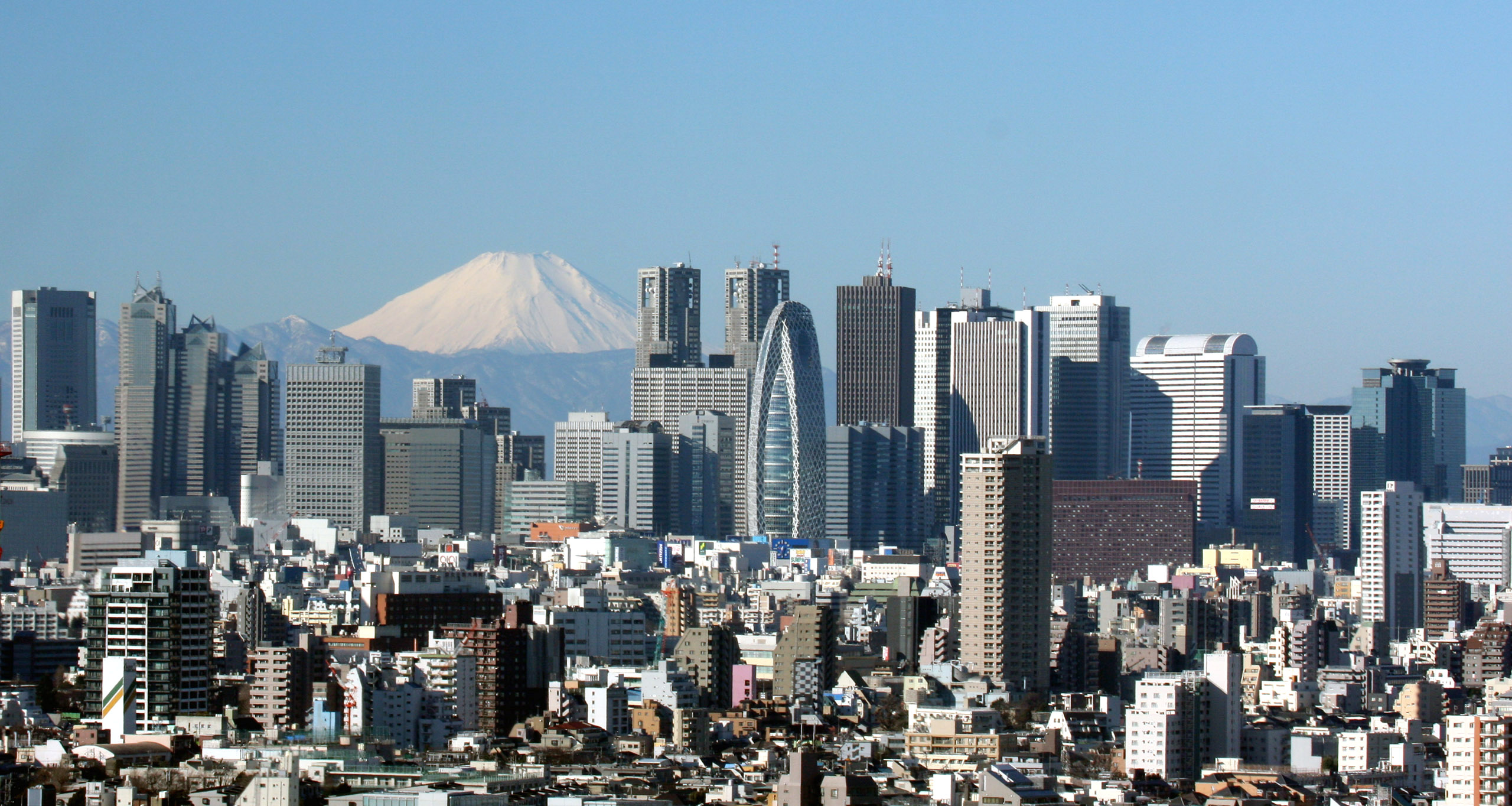
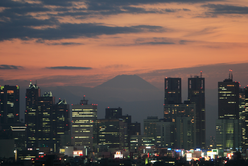
新宿— Special ward — 新宿区 · Shinjuku City[1] Skyscrapers of Shinjuku with Mt Fuji in the background.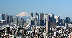

FlagLocation of Shinjuku in Tokyo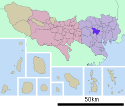

 Shinjuku
Coordinates: 35°41′37.82″N 139°42′12.78″E / 35.6938389°N 139.70355°ECoordinates: 35°41′37.82″N 139°42′12.78″E / 35.6938389°N 139.70355°E Country Japan Region Kantō Prefecture Tokyo Government - Mayor Hiroko Nakayama Area - Total 18.23 km2 (7 sq mi) Population (November 2009) - Total 318,270 - Density 17,460/km2 (45,221.2/sq mi) Time zone Japan Standard Time (UTC+9) City Symbols - Tree Zelkova serrata - Flower Azalea Phone number 03-3209-1111 Website Shinjuku Shinjuku (新宿区 Shinjuku-ku) is one of the 23 special wards of Tokyo, Japan. It is a major commercial and administrative center, housing the busiest train station in the world (Shinjuku Station) and the Tokyo Metropolitan Government Building, the administration center for the government of Tokyo.
As of 2008, the ward has an estimated population of 312,418 and a density of 17,140 persons per km². The total area is 18.23 km².[2]
As of October 1, 2005, 29,353 non-Japanese with 107 different nationalities were registered in Shinjuku.[citation needed]
Contents
Geography
Surrounding Shinjuku are six other wards: Chiyoda to the east; Bunkyo and Toshima to the north; Nakano to the west, and Shibuya and Minato to the south.[3] In addition, Nerima is only a hundred meters away[citation needed]. The highest point in Shinjuku is Hakoneyama (箱根山) in Toyama Park at 44.6 m[citation needed]. The lowest point is 4.2 m near Iidabashi[citation needed].
Neighbourhoods
 Street level in Shinjuku
Although the area immediately surrounding Shinjuku Station is home to hotels, department stores, specialist electronic and camera shops, cinemas, restaurants, and bars, the rest of the city is a mix of residential with commercial areas concentrated around railway stations[citation needed].
Notable areas of Shinjuku include:
- Ichigaya: A commercial area in eastern Shinjuku, site of the Ministry of Defense.
- Golden Gai: An area of tiny shanty-style bars and clubs. Musicians, artists, actors and directors gather here, and the ramshackle walls of the bars are literally plastered with movie posters.
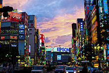
- Kabukichō: A red-light district well-known for its bars, restaurants, and sex-related establishments.
- Kagurazaka: Once one of Tokyo's last remaining hanamachi or geisha districts. Sometimes nicknamed "Little Paris," Kagurazaka currently hosts a sizable French community. [4]
- Nishi-Shinjuku: Home to Tokyo's largest concentration of skyscrapers. Several of the tallest buildings in Tokyo are located in this area, including the Tokyo Metropolitan Government Building, KDDI Building and Park Tower. Located west of Shinjuku Station.
- Ōkubo: Tokyo's best-known Korean district[citation needed].
- Shinjuku Gyoen is a large park, 58.3 hectares, 3.5 km in circumference, blending Japanese traditional, English Landscape and French Formal style gardens.
- Shinjuku Ni-chōme: Tokyo's best-known gay district[citation needed].
- Takadanobaba and Waseda: The area between Waseda University, one of the most prestigious private universities in Japan, and Takadanobaba Station is a major residential and nightlife area for students[citation needed].
- Yotsuya: An upscale residential and commercial district; the Arakichō area is well-known for its many small restaurants, bars, and izakaya.
History
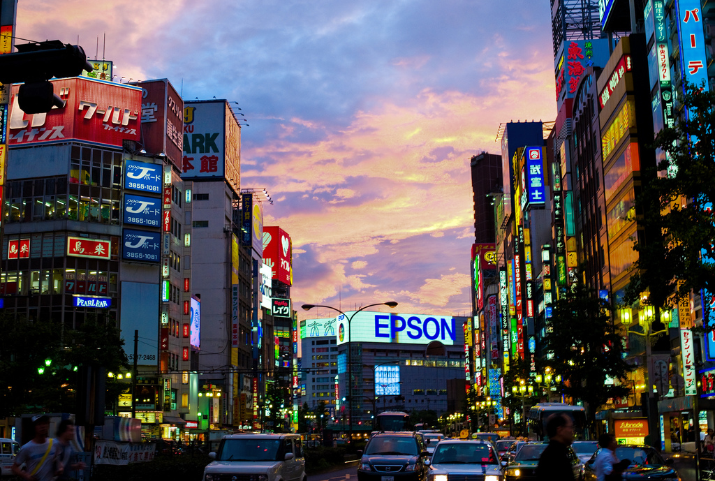
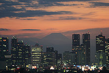 Shinjuku at night.
In 1634, during the Edo period, as the outer moat of the Edo Castle was built, a number of temples and shrines moved to the Yotsuya area on the western edge of Shinjuku. In 1698, Naitō-Shinjuku had developed as a new (shin) station (shuku or juku) on the Kōshū Kaidō, one of the major highways of that era. Naitō was the family name of a daimyo whose mansion stood in the area; his land is now a public park, the Shinjuku Gyoen.
In 1920, the town of Naitō-Shinjuku that comprised large parts of present-day Shinjuku, parts of Nishi-Shinjuku and Kabukichō was integrated into Tokyo City. Shinjuku began to develop into its current form after the Great Kantō earthquake in 1923, since the seismically stable area largely escaped the devastation. Consequently, West Shinjuku is one of the few areas in Tokyo with many skyscrapers.
The Tokyo air raids from May to August 1945 destroyed almost 90% of the buildings in the area in and around Shinjuku Station.[5] The pre-war form of Shinjuku, and the rest of Tokyo, for that matter, was retained after the war because the roads and rails, damaged as they were, remained, and these formed the heart of the Shinjuku in the post-war construction. Only in Kabuki-cho was a grand reconstruction plan put into action.[6]
The present ward was established on March 15, 1947 with the merger of the former wards of Yotsuya, Ushigome, and Yodobashi. It served as part of the athletics 50 km walk and marathon course during the 1964 Summer Olympics.[7]
In 1991, the Tokyo Metropolitan Government moved from the Marunouchi district of Chiyoda to the current building in Shinjuku. (The Tokyo International Forum stands on the former site vacated by the government.)
Economy
Many companies have their headquarters or Tokyo offices in Shinjuku.
- Seiko Epson's Tokyo office is in the Shinjuku NS Building in Nishi-Shinjuku.[8]
- Atlus has its headquarters in Kagurazaka.[9]
- Nissin Foods's Tokyo offices are in Shinjuku.[10]
- Airtransse, a regional airline, has its headquarters near Shinjuku Gyoen.[11]
- Shinchosha has its headquarters in Yaraichō, Shinjuku[12]
- Futabasha has its headquarters in Higashigokenchō, Shinjuku[13]
- Yoshinoya has its headquarters in the Da Vinci Shinjuku Building (ダヴィンチ新宿ビル Davinchi Shinjuku Biru) in Shinjuku.[14]
- H.I.S.'s headquarters is in the Shinjuku Oak Tower in Nishi-Shinjuku[15]
- Jorudan has its headquarters in Shinjuku.[16][17]
In March 1990 the headquarters of Bandai Visual moved to the Shinjuku neighborhood in Shinjuku Ward. In August 1991 the headquarters moved to Taitō, Tokyo.[18] Previously the headquarters of MOS Burger were in Shinjuku.[19]
Government and politics
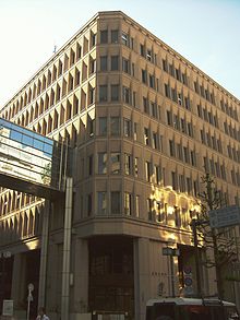 Shinjuku City Office
Like the other wards of Tokyo, Shinjuku has a status equivalent to that of a city. The current mayor is Hiroko Nakayama. The ward council (区議会 kugikai) consists of 38 elected members; the Liberal Democratic Party and New Komeitō Party together currently hold a majority. The Democratic Party of Japan, Japanese Communist Party and the Social Democratic Party are also represented together with four independents. Shinjuku's city office (区役所 kuyakusho) is located on the southeastern edge of Kabukichō.
Shinjuku is also the location of the metropolitan government of Tokyo. The governor's office, the metropolitan assembly chamber, and all administrative head offices are located in the Tokyo Metropolitan Government Building.
Elections
Transportation
Further information: Transportation in Greater TokyoShinjuku is a major urban transit hub. JR Shinjuku Station sees an estimated 3.64 million passengers pass through each day, making it the busiest station in the world. It houses interchanges to three subway lines and three privately owned commuter lines, as well as several JR lines.
Rail
A list of railway lines passing through and stations located within Shinjuku includes:
- JR East
- Yamanote Line: Takadanobaba, Shin-Ōkubo, Shinjuku
- Chūō Line (Rapid), Chūō-Sōbu Line: Yotsuya, Shinanomachi, Shinjuku, Ōkubo
- Saikyō Line, Shōnan-Shinjuku Line: Shinjuku
- Tokyo Metro
- Marunouchi Line: Yotsuya, Yotsuya-sanchōme, Shinjuku-gyoenmae, Shinjuku-sanchōme, Shinjuku, Nishi-Shinjuku
- Yūrakuchō Line: Ichigaya, Iidabashi
- Tōzai Line: Kagurazaka, Waseda, Takadanobaba, Ochiai
- Fukutoshin Line: Nishi-Waseda, Higashi-Shinjuku, Shinjuku-sanchōme
- Namboku Line: Iidabashi, Ichigaya, Yotsuya
- Tokyo Metropolitan Bureau of Transportation
- Toei Shinjuku Line: Akebonobashi, Shinjuku-sanchōme, Shinjuku
- Toei Ōedo Line: Ochiai-Minaminagasaki, Nakai, Nishi-Shinjuku-gochōme, Tochō-mae, Kokuritsu-Kyōgijō, Ushigome-Kagurazaka, Ushigome-Yanagichō, Wakamatsu-Kawada, Higashi-Shinjuku, Shinjuku-Nishiguchi
- Toden Arakawa Line: Omokagebashi, Waseda
- Odakyū Electric Railway Odawara Line: Shinjuku
- Keio Corporation Keiō Line, Keiō New Line: Shinjuku
- Seibu Railway Seibu Shinjuku Line: Seibu-Shinjuku, Takadanobaba, Shimo-Ochiai, Nakai
Roads
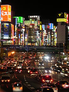 Traffic on Ōme-kaidō heading towards Kabukichō at night
- No.4 Shinjuku Route (Miyakezaka JCT - Takaido)
- No.5 Ikebukuro Route (Takebashi JCT - Bijogi JCT)
- National Route 20 (Shinjuku-dōri, Kōshū-kaidō)
Other major routes:
- Tokyo Metropolitan Route 8 (Mejiro-dōri, Shin-Mejiro-dōri)
- Tokyo Metropolitan Route 302 (Yasukuni-dōri, Ōme-kaidō)
- Tokyo Metropolitan Route 305 (Meiji-dōri)
Education
Colleges and universities
- Chuo University graduate school
- Gakushuin Women's College
- Japan Electronics College
- Keio University Medical College
- Kogakuin University
- Lakeland College Japan
- Mejiro University
- Tokyo Fuji University
- Tokyo Medical University
- Tokyo University of Science
- Tokyo Women's Medical University
- Waseda University
Schools
Public elementary and junior high schools in Shinjuku are operated by the Shinjuku City Board of Education. Public high schools are operated by the Tokyo Metropolitan Government Board of Education.
- Koishikawa Technical High School
- Ichigaya Commercial High School
- Shinjuku High School
- Shinjuku Yamabuki High School
- Toyama High School
Public institutions
Libraries
Shinjuku operates several public libraries, including the Central Library (with the Children's Library), the Yotsuya Library, the Tsurumaki Library, Tsunohazu Library, the Nishi-Ochiai Library, the Toyama Library, the Kita-Shinjuku Library, the Okubo Library, and the Nakamachi Library. In addition there is a branch library, Branch Library of Central Library in the City Office, located in the city office.[20]
Hospitals
There are several major hospitals located within the city limits.
- Keio University Hospital
- International Medical Center of Japan
- Social Insurance Chūō General Hospital
- Tokyo Medical University Hospital
- Tokyo Women's Medical University Hospital
- Tokyo Metropolitan Health and Medical Treatment Corporation Ohkubo Hospital
Cultural centers
Museums
- National Printing Bureau Banknote and Postage Stamp Museum
- National Museum of Nature and Science, Shinjuku Branch
- Shinjuku Historical Museum
- Tokyo Fire Department Museum
Halls
- Tokyo Opera City
- Shinjuku Bunka Center
- WelCity Tokyo
- Meiji Yasuda Life Hall
- Shinjuku Koma Theater
Sightseeing
Shinjuku is home to many well-known sights and tourist attractions.
- Shinjuku Gyoen
- Shinjuku Central Park (Shinjuku Chūō Kōen)
- Tokyo Metropolitan Government Building (designed by renowned architect Kenzo Tange)
- Park Hyatt Tokyo and Park Tower (featured in the film Lost in Translation)
- Waseda University's Ōkuma Auditorium
- Waseda El Dorado building
- Meiji Shrine Outer Gardens and the Meiji Memorial Picture Gallery
Sister cities
Shinjuku has sister city agreements with several localities:[21]
 Lambeth, London, England
 Lefkada, Greece
 Mitte, Berlin, Germany
 Dongcheng, Beijing, People's Republic of China
See also
- Tokyo
- Tourism in Japan
- Shinjuku Boys
References
- ^ Shinjuku City
- ^ Shinjuku City
- ^ Tokyo Special Wards Map
- ^ [http://www.japanvisitor.com/index.php?cID=430&pID=1874
- ^ History of Shinjuku
- ^ Ichikawa, 2003
- ^ 1964 Summer Olympics official report. Volume 2. Part 1. p. 74.
- ^ "Head Office & Japanese Facilities." Seiko Epson. Retrieved on January 13, 2009.
- ^ "Contact Us." Atlus. Retrieved on February 13, 2009.
- ^ "Company Profile." Nissin Foods. Retrieved on August 15, 2009.
- ^ "会社概要." Airtransse. Retrieved on May 20, 2009.
- ^ "会社情報." Shinchosha. Retrieved on June 17, 2011. "〒162-8711 東京都新宿区矢来町71"
- ^ "会社概要." Futabasha. Retrieved on January 7, 2011. "所在地 〒162-8540 東京都新宿区東五軒町3-28" (GIF map of location) (PDF of location)
- ^ "会社概要." Yoshinoya. Retrieved on February 25, 2010.
- ^ "Company Info." H.I.S. Retrieved on March 11, 2010.
- ^ "About Us." Jorudan. Retrieved on September 12, 2010. "Zip Code 160-0022 2-1-9 Shinjuku, Shinjuku-ku, Tokyo, Japan"
- ^ "Headquarter." Jorduan. Retrieved on January 7, 2011. "ZIP 160-0022 2-1-9 Shinjuku, Shinjuku-ku, Tokyo, Japan" (map)
- ^ "History." Bandai Visual. Retrieved on March 16, 2010.
- ^ "Outline." MOS Burger. April 17, 2001. Retrieved on January 6, 2011. "Headquarters 22, Tansu-machi, Shinjuku-ku, Tokyo 162-8501, Japan." Address in Japanese: "本社所在地 〒162-8501 東京都新宿区箪笥町22番地" Map in Japanese
- ^ http://www.city.shinjuku.tokyo.jp/foreign/english/guide/shisetsu/shisetsu_2.html
- ^ Friendship cities
- Shinjuku Ward Office, History of Shinjuku
- Hiroo Ichikawa "Reconstructing Tokyo: The Attempt to Transform a Metropolis" in C. Hein, J.M. Diefendorf, and I. Yorifusa (Eds.) (2003). Building Urban Japan after 1945. New York: Palgrave.
External links
- Shinjuku City official website (Japanese)
- Shinjuku City official website (English)
- Shinjuku travel guide from Wikitravel (English)
- Shinjuku Architecture and Map
Tokyo Metropolis Special Wards 

Cities Districts and
SubprefecturesMetropolitan cities of Japan Tokyo Metropolis Designated cities Core cities Akita · Amagasaki · Aomori · Asahikawa · Fukuyama · Funabashi · Gifu · Hakodate · Higashiōsaka · Himeji · Iwaki · Kagoshima · Kanazawa · Kashiwa · Kawagoe · Kōchi · Kōriyama · Kumamoto · Kurashiki · Kurume · Maebashi · Matsuyama · Miyazaki · Morioka · Nagano · Nagasaki · Nara · Nishinomiya · Ōita · Okazaki · Ōtsu · Shimonoseki · Takamatsu · Takasaki · Takatsuki · Toyama · Toyohashi · Toyota · Utsunomiya · Wakayama · YokosukaSpecial cities Akashi · Atsugi · Chigasaki · Fuji · Fukui · Hachinohe · Hirakata · Hiratsuka · Ibaraki · Ichinomiya · Isesaki · Jōetsu · Kakogawa · Kasugai · Kasukabe · Kawaguchi · Kishiwada · Kōfu · Koshigaya · Kumagaya · Kure · Matsumoto · Mito · Nagaoka · Neyagawa · Numazu · Odawara · Ōta · Sasebo · Sōka · Suita · Takarazuka · Tokorozawa · Tottori · Toyonaka · Tsukuba · Yamagata · Yamato · Yao · YokkaichiPrefectural capitals
(not included above)Neighborhoods of Tokyo Akasaka · Akihabara · Aoyama · Asagaya · Asakusa · Asakusabashi · Azabu · Daikanyama · Den-en-chōfu · Ebisu · Futako Tamagawa · Ginza · Gotanda · Hamamatsuchō · Harajuku · Hibiya · Hongō · Ichigaya · Iidabashi · Ikebukuro · Iwamotochō · Jiyūgaoka · Jinbōchō · Jūjō · Kabukichō · Kagurazaka · Kajichō · Kamata · Kanda · Kasumigaseki · Kichijōji · Koishikawa · Kugayama · Kyōbashi · Kōenji · Kōjimachi · Marunouchi · Mita · Meguro-Mita · Nagatachō · Nihonbashi · Nishi-Shinjuku · Nishikichō · Ochanomizu · Odaiba · Ogawamachi · Ōizumigakuenchō · Ōmori · Omotesandō · Ōtemachi · Roppongi · Ryōgoku · San'ya · Sendagaya · Shiba · Shibaura · Shibuya · Shimokitazawa · Shinbashi · Shinjuku · Shinjuku ni-chōme · Shiodome · Shirokane · Shirokanedai · Sudachō · Sugamo · Surugadai · Takadanobaba · Takanawa · Tamachi · Tateishi · Tsukiji · Tsukishima · Uchi-Kanda · Uchisaiwaichō · Ueno · Wakasu · Yaesu · Yayoi · Yōga · Yotsuya · Yoyogi · Yūrakuchō
Venues of the 1964 Summer Olympics Asaka Nezu Park · Asaka Shooting Range · Chofu City · Enoshima · Fuchu City · Hachioji City · Hachioji Velodrome · Karasuyama-machi · Karuizawa · Kemigawa · Komazawa Gymnasium · Komazawa Hockey Field · Komazawa Olympic Park Stadium · Komazawa Volleyball Courts · Korakuen Ice Palace · Lake Sagami · Mitsuzawa Football Field · Osaka Nagai Stadium · National Gymnasium · Tokyo National Stadium · Nippon Budoka Hall · Nishikyogoku Athletic Stadium · Ōmiya Football Field · Prince Chichiba Memorial Football Field · Sasazuka-machi · Shibuya Public Hall · Shinjuku · Toda Rowing Course · Tokorozawa Shooting Range · Tokyo Metropolitan Gymnasium · Tokyo Metropolitan Indoor Swimming Pool · Waseda Memorial Hall · Yokohama Cultural GymnasiumCategories:- 1964 Summer Olympic venues
- Olympic athletics venues
- Wards of Tokyo
- Shinjuku, Tokyo


Wikimedia Foundation. 2010.