- Kiyose, Tokyo
Japanese city
Name=Kiyose
JapaneseName=清瀬市
Prefecture=Tokyo
Region=Kantō
Area_km2=10.19
Population=73,601
PopDate=2007
Density_km2=7221
Coords =
Postal code=
Area code=
Mayor= Shigeru Hoshino (星野繁 "Hoshino Shigeru")
Tree=Zelkova serrata | Flower=Camellia sasanqua | Bird=Azure-winged Magpie
Symbol
CityHallAddress= 5-842 Nakazato, Kiyose, Tokyo
CityHallPhone= 81-42-492-5111
CityHallLink = [http://www.city.kiyose.tokyo.jp/ Kiyose] | City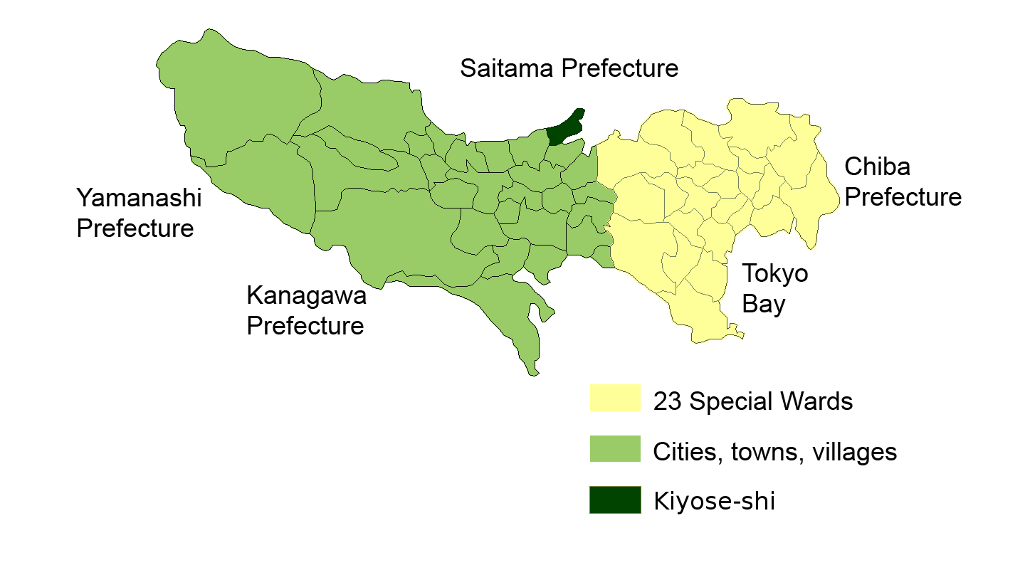
Elevation=Kiyose (清瀬市; -shi) is a city which is located in
Tokyo ,Japan .Demography
As of
1 July 2007 , the city has an estimatedpopulation of 73,601 (men and women are respectively 35,781 and 37,820), the density of 7,222.87 persons per km² and there are 31,712 households in the city.Geography
Kiyose City is located in the area in the shape of the wedge into Niiza and Tokorozawa Cities, Saitama Prefecture of north. Tokorozawa City of west borders on Yanase River and Higashikurume City, Tokyo, of south edges Nobidome Water. Kiyose City has a lot of green tracts, where are the land of 46%.
Kiyose is located in the tableland of about 15km to the northeastern edge of Musashino Plateau. The area has the part which the distances are respectively 6.5km between northeast and southewest and 2km between northwest and southeast (the total area is 10.19 km²), that is same with the bank of the plateau and the west side is higher than the east. Height is respectively 65m in Takeoka in the west side and 20m in Shitajuku in the northeastern side and the difference is 45m at the distance of 6.5km. The city has the most area of diluvial soil except a small area of alluvial soil by Yanase River which runs on the edge of the region. Loamy and conglomerate layers are piled up around a housing estate near the river.
History
First mankind had come to Kiyose about 20 thousand years ago, during the last glacial maximum. The population had most increased in about four thousand years ago but people had hardly lived from about three thousand five hundred years ago to mid-10th century because of decrease in population. Whilst Kiyose had been in increase in population in late 10th century, people had live in Noshio, Nakazato and Shitajuku near the bank of Yanase River because they could not drill wells deeply.
After
Ashikaga Takauji had begun the new government, Kiyose was under Oishi Nobushige from Saku, Shinano (now Nagano Prefecture). Oishi constructed a castle named "Takinojo" but it was lost during battles withToyotomi Hideyoshi .In the modern days since 1868, the authorities changed the administrative areas on a large scale and merging the communities named Kamikiyoto, Nakakiyoto, Shimokiyoto, Kiyotoshitajuku, Noshio and Nakazato together, on
1 April 1889 Kiyose was established as a village in Kitamagun, Kanagawa Prefecture. In 1893 Kitatamagun moved to Tokyo together with two other Tama, Nishitamagun and Minamitamagun, with compliance with the wishes of people in those areas. In 1915 a railway was opened to traffic but there is not any station in the region then. In 1954 Kiyose changed from the village to a town because of increase in population. On1 October 1970 it changed from the town to a city because of more increase in population.Kiyose has many sanatoria for
tuberculosis . Whilst they are less than other illness recent years, the city has the second most beds after Chiyoda Ward.Education
Kiyose operates its public elementary and junior high schools.
Tokyo Metropolitan Government Board of Education operatesKiyose High School [http://www.kiyose-h.metro.tokyo.jp/] .ee also
References
External links
* [http://www.city.kiyose.tokyo.jp/ Kiyose official website] in Japanese
Wikimedia Foundation. 2010.