- Osborne, Kansas
-
Osborne, Kansas — City — Location of Osborne, Kansas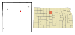 Detailed map of Osborne
Coordinates: 39°26′26″N 98°41′50″W / 39.44056°N 98.69722°WCoordinates: 39°26′26″N 98°41′50″W / 39.44056°N 98.69722°W Country United States State Kansas County Osborne Founded 1871 Incorporated 1878 Government – Mayor George Eakin – City Clerk Sharlene Ubelaker Area – Total 1.5 sq mi (3.9 km2) – Land 1.5 sq mi (3.9 km2) – Water 0.0 sq mi (0.0 km2) Elevation 1,552 ft (473 m) Population (2010)[1] – Total 1,431 – Density 954/sq mi (368.3/km2) Time zone Central (CST) (UTC-6) – Summer (DST) CDT (UTC-5) ZIP code 67473 Area code(s) 785 FIPS code 20-53325[2] GNIS feature ID 0472281[3] Website DiscoverOsborne.com Osborne is a city in and the county seat of Osborne County, Kansas, United States.[4] As of the 2010 census, the city population was 1,431.[1]
Contents
History
Settlers from southeastern Pennsylvania founded Osborne City in May 1871.[5] They named the settlement after Vincent B. Osborne, a Union Army veteran of the American Civil War, same as the county.[6][7] Osborne City became the permanent county seat in November 1872.[5] A district judge officially proclaimed it a city in May 1873, but the townspeople failed to legally organize a government. Five years later, a second attempt was successful, and the settlement incorporated as a city in 1878.[8] “City” was dropped from its name by the mid-1890s.[5]
Geography
Osborne is located at 39°26′26″N 98°41′50″W / 39.44056°N 98.69722°W (39.440651, -98.697118),[9] at an elevation of 1,552 feet (473 m).[3] It lies on the north side of the South Fork Solomon River in the Smoky Hills region of the Great Plains.[10] The Osborne Canal, part of the U.S. Bureau of Reclamation's Webster Unit Project, runs east along the northern edge of the city.[11][12] Located at the intersection of U.S. Route 281 and U.S. Route 24 in north-central Kansas, Osborne is approximately 134 miles (216 km) northwest of Wichita, 219 miles (352 km) west-northwest of Kansas City, and 339 miles (546 km) east of Denver.[10][13]
According to the United States Census Bureau, the city has a total area of 1.5 square miles (3.9 km2), all of it land.[14]
Climate
On average in Osborne, July is the warmest month, January is the coldest month, and May is the wettest month. The hottest temperature recorded in Osborne was 116°F (47°C) in 1940; the coldest temperature recorded was -31°F (-35°C) in 1989.[15]
Climate data for Osborne, Kansas, USA Month Jan Feb Mar Apr May Jun Jul Aug Sep Oct Nov Dec Year Record high °F (°C) 80
(27)87
(31)94
(34)106
(41)105
(41)113
(45)116
(47)113
(45)112
(44)103
(39)88
(31)82
(28)116
(47)Average high °F (°C) 39
(4)46
(8)56
(13)67
(19)75
(24)87
(31)93
(34)91
(33)82
(28)71
(22)53
(12)42
(6)66.8
(19.4)Average low °F (°C) 12
(−11)17
(−8)26
(−3)37
(3)48
(9)59
(15)65
(18)62
(17)52
(11)38
(3)25
(−4)16
(−9)38.1
(3.4)Record low °F (°C) −24
(−31)−22
(−30)−17
(−27)9
(−13)21
(−6)33
(1)41
(5)38
(3)18
(−8)6
(−14)−10
(−23)−31
(−35)−31
(−35)Precipitation inches (mm) 0.60
(15.2)0.80
(20.3)2.21
(56.1)2.58
(65.5)4.02
(102.1)3.20
(81.3)3.91
(99.3)3.12
(79.2)2.30
(58.4)1.63
(41.4)1.60
(40.6)0.76
(19.3)26.73
(678.9)Source: The Weather Channel[15] Demographics
Historical populations Census Pop. %± 1880 719 — 1890 1,174 63.3% 1900 1,075 −8.4% 1910 1,566 45.7% 1920 1,635 4.4% 1930 1,881 15.0% 1940 1,876 −0.3% 1950 2,068 10.2% 1960 2,049 −0.9% 1970 1,980 −3.4% 1980 2,120 7.1% 1990 1,778 −16.1% 2000 1,607 −9.6% 2010 1,431 −11.0% U.S. Decennial Census As of the 2010 census, there were 1,431 people, 633 households, and 390 families residing in the city. The population density was 954 people per square mile (368.3/km²). There were 776 housing units at an average density of 517.3 per square mile (199/km²). The racial makeup of the city was 97.7% White, 0.6% American Indian, 0.5% Asian, 0.1% African American, 0.4% from some other race, and 0.6% from two or more races. 1.3% of the the population was Hispanic or Latino of any race.[1]
There were 633 households out of which 27.3% had children under the age of 18 living with them, 50.4% were married couples living together, 3.6% had a male householder with no wife present, 7.6% had a female householder with no husband present, and 38.4% were non-families. 36.0% of all households were made up of individuals, and 18.6% had someone living alone who was 65 years of age or older. The average household size was 2.16, and the average family size was 2.79.[1]
In the city, the population was spread out with 21.7% under the age of 18, 5.6% from 18 to 24, 17.1% from 25 to 44, 28.6% from 45 to 64, and 27.0% who were 65 years of age or older. The median age was 48.1 years. For every 100 females, there were 93.4 males. For every 100 females age 18 and over, there were 89.8 males age 18 and over.[1]
As of 2009, the median income for a household in the city was $36,818, and the median income for a family was $51,500. Males had a median income of $33,009 versus $21,435 for females. The per capita income for the city was $19,774. About 7.5% of families and 10.0% of the population were below the poverty line, including 7.1% of those under age 18 and 14.5% of those age 65 or over.[16]
Government
Osborne is a city of the second class with a mayor-council form of government.[17] The city council consists of six members and meets on the first and third Wednesday of each month.[17][18]
Education
Osborne USD 392 provides public primary and secondary education, operating two schools in the city: Osborne Elementary School (Grades K-6) and Osborne Junior/Senior High School (7-12).[19]
Transportation

U.S. Route 281 runs north-south through Osborne, meeting U.S. Route 24, an east-west route, just north of the city. At the junction, U.S. 24 turns north and runs concurrently with U.S. 281.[11]
Osborne Municipal Airport is located immediately southeast of the city. It is used primarily for general aviation.[20]
Osborne is the western terminus of a line of the Kyle Railroad.[21] The city is also the northwestern terminus of a line of the Kansas and Oklahoma Railroad.[22]
Media
Osborne has one weekly newspaper, The Osborne County Farmer.[23]
Culture
Points of interest
The Osborne County Historical Museum exhibits artifacts from local history, including antique farm equipment, period clothing and housewares, and American Indian artifacts, and maintains on site a one-room school house built in 1912.[24]
The Geodetic Center, located in Roadside Park at the north end of the city, displays information about the geodetic center of North America, which is located roughly 18 miles (29 km) south-southeast of the city, and hosts a replica of the geodetic marker at the site.[25]
Notable people
Notable individuals who were born in and/or have lived in Osborne include:
References
- ^ a b c d e "American FactFinder 2". United States Census Bureau. http://factfinder2.census.gov/faces/nav/jsf/pages/index.xhtml. Retrieved 2011-11-06.
- ^ "American FactFinder". United States Census Bureau. http://factfinder.census.gov. Retrieved 2008-01-31.
- ^ a b "US Board on Geographic Names". United States Geological Survey. 2007-10-25. http://geonames.usgs.gov. Retrieved 2008-01-31.
- ^ "Find a County". National Association of Counties. http://www.naco.org/Counties/Pages/FindACounty.aspx. Retrieved 2011-06-07.
- ^ a b c "The Beginning". Chamber of Commerce and Osborne Economic Development. http://www.discoverosborne.com/Document.aspx?id=9474. Retrieved 2011-03-26.
- ^ "The Creation and Organization of Osborne County, Kansas". Osborne County. http://www.osbornecounty.org/History/tabid/9200/Default.aspx. Retrieved 2011-03-26.
- ^ Kansas Place-Names,John Rydjord, University of Oklahoma Press, 1972, ISBN 0-8061-0994-7
- ^ Cutler, William G. (1883), "Osborne County, Part 2", History of the State of Kansas, Chicago: A.T. Andreas, http://www.kancoll.org/books/cutler/osborne/osborne-co-p2.html#OSBORNE_CITY, retrieved 2011-03-26
- ^ "US Gazetteer files: 2010, 2000, and 1990". United States Census Bureau. 2011-02-12. http://www.census.gov/geo/www/gazetteer/gazette.html. Retrieved 2011-04-23.
- ^ a b "2003-2004 Official Transportation Map". Kansas Department of Transportation. 2003. http://www.ksdot.org/burtransplan/maps/HistoricStateMaps/2003-04Mapside.pdf. Retrieved 2011-01-01.
- ^ a b "General Highway Map - Osborne County, Kansas". Kansas Department of Transportation. 1999. http://www.ksdot.org/burtransplan/maps/county-pdf/osborne.pdf. Retrieved 2010-03-25.
- ^ "Webster Unit Project". United States Bureau of Reclamation. 2009-05-13. http://www.usbr.gov/projects/Project.jsp?proj_Name=Webster%20Unit%20Project. Retrieved 2010-03-25.
- ^ "City Distance Tool". Geobytes. http://www.geobytes.com/citydistancetool.htm. Retrieved 2010-03-25.
- ^ "Kansas: 2000 - Population and Housing Counts". United States Census Bureau. July 2003. p. 23. http://www.census.gov/prod/cen2000/phc-3-18.pdf. Retrieved 2011-01-01.
- ^ a b "Average weather for Osborne, KS". The Weather Channel. http://www.weather.com/outlook/health/fitness/wxclimatology/monthly/graph/USKS0444. Retrieved 2010-10-11.
- ^ "Osborne city, Kansas - Selected Economic Characteristics: 2005-2009". 2005-2009 American Community Survey 5-Year Estimates. United States Census Bureau. http://factfinder.census.gov/servlet/ADPTable?_bm=y&-geo_id=16000US2053325&-qr_name=ACS_2009_5YR_G00_DP5YR3&-ds_name=ACS_2009_5YR_G00_&-_lang=en&-_sse=on. Retrieved 2011-11-06.
- ^ a b "Osborne". Directory of Kansas Public Officials. The League of Kansas Municipalities. http://www.lkm.org/directory/cities.php?ID=41. Retrieved 2011-11-06.
- ^ "Roster of City Officials". DiscoverOsborne.Com. http://www.discoverosborne.com/Document.aspx?id=11476. Retrieved 2010-09-26.
- ^ "Contact Us". Osborne USD 392. http://www.usd392.k12.ks.us/index.php?option=com_contact&view=category&catid=0&Itemid=19. Retrieved 2010-09-26.
- ^ "Osborne Municipal Airport". AirNav. http://www.airnav.com/airport/K75. Retrieved 2010-09-26.
- ^ "KYLE". RailAmerica. http://www.railamerica.com/RailServices/KYLE.aspx. Retrieved 2010-09-26.
- ^ "Kansas & Oklahoma Railroad - Detailed Map". Watco Companies. http://www.watcocompanies.com/railroads/ko/ko_map.htm. Retrieved 2011-01-01.
- ^ "About this Newspaper: Osborne County farmer.". Chronicling America. Library of Congress. http://chroniclingamerica.loc.gov/lccn/sn85029460/. Retrieved 2010-03-25.
- ^ "Osborne County Historical Museum". Chamber of Commerce and Osborne Economic Development. http://www.discoverosborne.com/Document.aspx?Mode=View&id=4090. Retrieved 2011-03-27.
- ^ "Don't Miss Out". Chamber of Commerce and Osborne Economic Development. http://www.discoverosborne.com/Document.aspx?id=4362. Retrieved 2011-03-27.
- ^ "Search: Scientists who Serve God". The American Scientific Affiliation. http://www.asa3.org/ASA/SEARCH/SEARCHKessel6-90.pdf. Retrieved 15 February 2011.
- ^ Clarkin, Mary (2010-09-01). "Alaskan candidate has deep Kan. roots". The Hutchinson News. http://www.hutchnews.com/Localregional/miller-s-KS-connection--2. Retrieved 2011-01-01.
Further reading
- History of the State of Kansas; William G. Cutler; A.T. Andreas Publisher; 1883. (Online HTML eBook)
- Kansas : A Cyclopedia of State History, Embracing Events, Institutions, Industries, Counties, Cities, Towns, Prominent Persons, Etc; 3 Volumes; Frank W. Blackmar; Standard Publishing Co; 944 / 955 / 824 pages; 1912. (Volume1 - Download 54MB PDF eBook),(Volume2 - Download 53MB PDF eBook), (Volume3 - Download 33MB PDF eBook)
External links
- City
- Schools
- USD 392, local school district
- Maps
- Osborne City Map, KDOT
- Osborne County Map, KDOT
Municipalities and communities of Osborne County, Kansas Cities 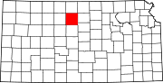
Townships Bethany | Bloom | Corinth | Delhi | Grant | Hancock | Hawkeye | Independence | Jackson | Kill Creek | Lawrence | Liberty | Mount Ayr | Natoma | Penn | Ross | Round Mound | Sumner | Tilden | Valley | Victor | Winfield
Unincorporated
communitiesBloomington | Corinth | Covert | Forney
Categories:- Populated places in Osborne County, Kansas
- Cities in Kansas
- County seats in Kansas


Wikimedia Foundation. 2010.