- Portis, Kansas
Infobox Settlement
official_name = Portis, Kansas
settlement_type =City
nickname =
motto =
imagesize =
image_caption =
image_
imagesize =
image_caption =
image_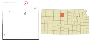
mapsize = 250px
map_caption = Location of Portis, Kansas
mapsize1 =
map_caption1 =subdivision_type = Country
subdivision_name =United States
subdivision_type1 = State
subdivision_name1 =Kansas
subdivision_type2 = County
subdivision_name2 = Osborne
government_footnotes =
government_type =
leader_title =
leader_name =
leader_title1 =
leader_name1 =
established_title =
established_date =unit_pref = Imperial
area_footnotes =
area_magnitude =
area_total_km2 = 0.7
area_land_km2 = 0.7
area_water_km2 = 0.0
area_total_sq_mi = 0.3
area_land_sq_mi = 0.3
area_water_sq_mi = 0.0population_as_of = 2000
population_footnotes =
population_total = 123
population_density_km2 = 174.8
population_density_sq_mi = 452.6timezone = Central (CST)
utc_offset = -6
timezone_DST = CDT
utc_offset_DST = -5
elevation_footnotes =
elevation_m = 470
elevation_ft = 1542
latd = 39 |latm = 33 |lats = 46 |latNS = N
longd = 98 |longm = 41 |longs = 29 |longEW = Wpostal_code_type =
ZIP code
postal_code = 67474
area_code = 785
blank_name = FIPS code
blank_info = 20-57100GR|2
blank1_name = GNIS feature ID
blank1_info = 0472158GR|3
website =
footnotes =Portis is a city in Osborne County,
Kansas ,United States . The population was 123 at the 2000 census.History
Portis is located on the north fork of the Solomon River. Since 1871 it has been an ideal trading point because of its location. When it first became a town in May 1879 it was named Bethany. The Central Branch Railroad made Bethany one of its stations, but years later, when they sold it to the Missouri Pacific Railroad it made for a second Bethany along the same railroad. Because the Missouri Pacific was embarrassed by having two stops with the same name along the same route, they wanted to change one of the town's names. By mutual consent, they decided to change the name of Bethany, Kansas to Portis Kansas rather than changing the Bethany, Missouri stop. They renamed it Portis after the Vice-President of the Missouri Pacific.
Geography
Portis is located at coor dms|39|33|46|N|98|41|29|W|city (39.562813, -98.691408)GR|1.
According to the
United States Census Bureau , the city has a total area of 0.3square mile s (0.7km² ), all of it land.Demographics
As of the
census GR|2 of 2000, there were 123 people, 58 households, and 33 families residing in the city. Thepopulation density was 452.6 people per square mile (175.9/km²). There were 87 housing units at an average density of 320.1/sq mi (124.4/km²). The racial makeup of the city was 96.75% White, 0.81% Asian, and 2.44% from two or more races. Hispanic or Latino of any race were 0.81% of the population.There were 58 households out of which 20.7% had children under the age of 18 living with them, 53.4% were married couples living together, 3.4% had a female householder with no husband present, and 43.1% were non-families. 39.7% of all households were made up of individuals and 19.0% had someone living alone who was 65 years of age or older. The average household size was 2.12 and the average family size was 2.91.
In the city the population was spread out with 24.4% under the age of 18, 1.6% from 18 to 24, 24.4% from 25 to 44, 23.6% from 45 to 64, and 26.0% who were 65 years of age or older. The median age was 45 years. For every 100 females there were 101.6 males. For every 100 females age 18 and over, there were 106.7 males.
The median income for a household in the city was $25,000, and the median income for a family was $28,333. Males had a median income of $25,000 versus $17,500 for females. The
per capita income for the city was $23,653. There were 3.6% of families and 6.6% of the population living below thepoverty line , including no under eighteens and 13.6% of those over 64.Cultural references
A memorial was put up in this small city in honor of Melvin "Tubby" Millar. Millar was the animator of the Looney Tune's cartoon character, Porky Pig. The Millar Memorial reads: "In memory of Melvin Tubby Millar, animator for Looney Tunes Porky Pig cartoons and assistant to
Friz Freleng , creator of Porky Pig." Millar included his hometown name into many of his cartoon episodes, including:1) In "Porky's Pet" (King, 1936) the train station has a poster in the background reading "When in Portis, Stop at Millar Manor".
2) In "
Bingo Crosbyana " (Freleng, 1936) there is a matchbox with the name "Portis Matches" and a wine glass with the label saying "90 Percent Portis".3) A crate in the episode "Porky of the North Woods" (Tashlin, 1936) reads "#2 Portis Kan". It is apparent by the label that the word "Kansas" did not get finished, thus ending with just "Kan" and half of an 'S'.
While the average commute time to work for the United States is 26 minutes, people in Portis, Kansas need only 13 minutes to get to work.
References
* [http://gregbrian.tripod.com/hidden/millar.html The Millar Memorial]
* [http://www.kancoll.org/books/cutler/osborne/osborne-co-p5.html PORTIS]
* [http://www.epodunk.com/cgi-bin/genInfo.php?locIndex=4954 Traffic]External links
Wikimedia Foundation. 2010.