- Old Zionsville, Pennsylvania
-
Old Zionsville, Pennsylvania — Unincorporated community — 
 Old Zionsville, Pennsylvania
Coordinates: 40°29′11″N 75°31′13″W / 40.48639°N 75.52028°WCoordinates: 40°29′11″N 75°31′13″W / 40.48639°N 75.52028°W Country United States State Pennsylvania County Lehigh Elevation 778 ft (237 m) Time zone Eastern (EST) (UTC-5) – Summer (DST) EDT (UTC-4) ZIP code 18068 Area code(s) 610 & 484 GNIS feature ID 1182959[1] Old Zionsville is an unincorporated community in Lehigh County, Pennsylvania, United States. Old Zionsville is located along Pennsylvania Route 29 and Pennsylvania Route 100 2.5 miles (4.0 km) southeast of Macungie. Old Zionsville has a box post office with ZIP code 18068.[2] Surrounding areas use the Zionsville zip code of 18092 or the Emmaus zip code of 18049. [1]
The township municipal building is located at 5671 Chestnut Street at the former site of Kings Highway Elementary School and offers live music on some Saturdays and a Saturday farmers' market. There are two churches of the Lutheran and UCC faiths in the village and two more of the Mennonite and Bible Fellowship faiths within a mile to the east near Zionsville.
External link
- Listen Live Music [2]
References

Shimerville Shimerville Vera Cruz Upper Milford Township 
Lower Milford Township  Old Zionsville

Hereford Powder Valley Zionsville Lehigh Valley States Counties Three Cities Cities and towns
100k-250kCities and towns
50k-99kCities and towns
10-50kBethlehem Township • Easton • Emmaus • Forks Township • Hanover Township • Lehigh Township • Lower Macungie Township • Lower Saucon Township • North Whitehall Township • Palmer Township • Phillipsburg • Salisbury Township • South Whitehall Township • Upper Macungie Township • Upper Saucon Township • Whitehall TownshipPeople List of people from the Lehigh ValleyMunicipalities and communities of Lehigh County, Pennsylvania Cities 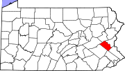
Boroughs Alburtis | Catasauqua | Coopersburg | Coplay | Emmaus | Fountain Hill | Macungie | Slatington
Townships Hanover | Heidelberg | Lower Macungie | Lower Milford | Lowhill | Lynn | North Whitehall | Salisbury | South Whitehall | Upper Macungie | Upper Milford | Upper Saucon | Washington | Weisenberg | Whitehall
CDPs Unincorporated
communitiesBreinigsville | Cementon | Center Valley | Cetronia | Colesville‡ | Dorneyville | East Texas | Egypt | Fogelsville | Hensingersville‡ | Hosensack | Ironton | Kuhnsville | Lanark | Laurys Station | Lehigh Gap‡ | Limeport | Lynnport | Neffs | New Tripoli | New Smithville | Newtown | Old Zionsville | Orefield | Pleasant Corners | Powder Valley | Schoenersville‡ | Shimerville | Slatedale | Summit Lawn | Trexlertown | Vera Cruz | Wescosville | West Catasauqua | Zionsville
Footnotes ‡This populated place also has portions in an adjacent county or counties
Categories:- Unincorporated communities in Pennsylvania
- Populated places in Lehigh County, Pennsylvania
- Pennsylvania geography stubs


Wikimedia Foundation. 2010.