- Coplay, Pennsylvania
-
Coplay is a borough in Lehigh County, Pennsylvania, six miles (10 km) northwest of Allentown. It is part of the Lehigh Valley region of the state. In 1900, 1,581 people lived in Coplay; in 1910, 2,670 people lived there. The population was 3,387 at the 2000 census.
Borough of Coplay Borough Country United States State Pennsylvania County Lehigh Elevation 400 ft (121.9 m) Coordinates 40°40′14″N 75°29′43″W / 40.67056°N 75.49528°W Area 0.6 sq mi (1.6 km2) - land 0.6 sq mi (2 km2) - water 0.04 sq mi (0 km2), 6.67% Population 3,387 (2000) Density 5,373.1 / sq mi (2,074.6 / km2) Timezone EST (UTC-5) - summer (DST) EDT (UTC-4) Area code 610 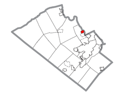 Location of Coplay in Lehigh County
 Location of Coplay in Pennsylvania
 Location of Pennsylvania in the United States
Website: http://www.boroughofcoplay.org Contents
Geography
Coplay is located at 40°40′14″N 75°29′43″W / 40.67056°N 75.49528°W (40.670521, -75.495395)[1].
According to the United States Census Bureau, the borough has a total area of 0.6 square miles (1.6 km2), of which, 0.6 square miles (1.6 km2) of it is land and 0.04 square miles (0.10 km2) of it (3.08%) is water. The Borough of Coplay is situated along the Lehigh River, about 5 miles (8.0 km) north of Allentown.
History
Coplay was part of the 400 acres (1.6 km2) of land John Jacob Schreiber bought from the William Penn heirs in 1740. For a long time it was known as Schreibers. Later it was known as the Lehigh Valley, because of the Lehigh Valley Iron Furnaces that were located here. Lehigh Valley was then changed to Coplay. This name came from "Kolapechka". The son of the Indian chief, Paxanosa, who lived at the head of the creek near Schnecksville. The Borough of Coplay seceded from Whitehall Township in 1869 and was incorporated as a borough on April 7, 1869.
Gradually Coplay changed from a farming area into an Industrial Community. The Thomas Iron Company started the change. They brought in workers and built homes for them. When the Iron Company was liquidated, other industries gradually came to Coplay; the Cement Mill, the Silk Mill, the Cigar Factory and Knitting Mill.
Coplay became a "melting pot" of many nationalities. The Pennsylvania Dutch and Germans, who were the agricultural element. Due to growth of the Iron Industry, immigrants from Ireland came. Then, in the early nineteen hundreds, the Cement Mills attracted immigrants from Austria, Hungary, Czechoslovakia, Poland and the Ukrainian Countries. It was thus that our town had its early beginnings.
It appears nobody famous has ever came out of Coplay. It seems it will not change any time soon.
Demographics
As of the census[2] of 2000, there were 3,387 people, 1,431 households, and 953 families residing in the borough. The population density was 5,373.1 people per square mile (2,075.8/km²). There were 1,484 housing units at an average density of 2,354.2 per square mile (909.5/km²). The racial makeup of the borough was 96.84% White, 1.56% African American, 0.09% Native American, 0.32% Asian, 0.53% from other races, and 0.65% from two or more races. Hispanic or Latino of any race were 2.27% of the population.
There were 1,431 households out of which 28.8% had children under the age of 18 living with them, 49.3% were married couples living together, 13.5% had a female householder with no husband present, and 33.4% were non-families. 29.3% of all households were made up of individuals and 14.4% had someone living alone who was 65 years of age or older. The average household size was 2.34 and the average family size was 2.90.
In the borough the population was spread out with 23.0% under the age of 18, 5.3% from 18 to 24, 29.9% from 25 to 44, 20.9% from 45 to 64, and 20.9% who were 65 years of age or older. The median age was 40 years. For every 100 females there were 86.2 males. For every 100 females age 18 and over, there were 83.3 males.
The median income for a household in the borough was $38,679, and the median income for a family was $46,278. Males had a median income of $31,519 versus $24,983 for females. The per capita income for the borough was $18,580. About 5.6% of families and 7.0% of the population were below the poverty line, including 13.8% of those under age 18 and 5.3% of those age 65 or over.
Public education
The Borough is served by the Whitehall-Coplay School District and the Parkland School District for certain areas of Coplay.
Borough officials
- John Milander - Mayor
- Marvin Mann - Council President
- Mike Mazur - Council Vice President
- Charlene Piskula
- Dave Royer
- Lou Bodish
- Joe Bundra
References
- ^ "US Gazetteer files: 2010, 2000, and 1990". United States Census Bureau. 2011-02-12. http://www.census.gov/geo/www/gazetteer/gazette.html. Retrieved 2011-04-23.
- ^ "American FactFinder". United States Census Bureau. http://factfinder.census.gov. Retrieved 2008-01-31.
External links

Egypt Cementon Northampton Stiles 
Northampton  Coplay

Whitehall Hokendauqua North Catasauqua Lehigh Valley States Counties Three Cities Cities and towns
100k-250kCities and towns
50k-99kCities and towns
10-50kBethlehem Township • Easton • Emmaus • Forks Township • Hanover Township • Lehigh Township • Lower Macungie Township • Lower Saucon Township • North Whitehall Township • Palmer Township • Phillipsburg • Salisbury Township • South Whitehall Township • Upper Macungie Township • Upper Saucon Township • Whitehall TownshipPeople List of people from the Lehigh ValleyMunicipalities and communities of Lehigh County, Pennsylvania County seat: Allentown Cities 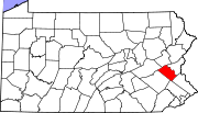
Boroughs Alburtis | Catasauqua | Coopersburg | Coplay | Emmaus | Fountain Hill | Macungie | Slatington
Townships Hanover | Heidelberg | Lower Macungie | Lower Milford | Lowhill | Lynn | North Whitehall | Salisbury | South Whitehall | Upper Macungie | Upper Milford | Upper Saucon | Washington | Weisenberg | Whitehall
CDPs Unincorporated
communitiesBreinigsville | Cementon | Center Valley | Cetronia | Colesville‡ | Dorneyville | East Texas | Egypt | Fogelsville | Hensingersville‡ | Hosensack | Ironton | Kuhnsville | Lanark | Laurys Station | Lehigh Gap‡ | Limeport | Lynnport | Neffs | New Tripoli | New Smithville | Newtown | Old Zionsville | Orefield | Pleasant Corners | Powder Valley | Schoenersville‡ | Shimerville | Slatedale | Summit Lawn | Trexlertown | Vera Cruz | Wescosville | West Catasauqua | Zionsville
Footnotes ‡This populated place also has portions in an adjacent county or counties
Categories:- Populated places established in 1799
- Boroughs in Lehigh County, Pennsylvania


Wikimedia Foundation. 2010.