- Schnecksville, Pennsylvania
Geobox Settlement
name = Schnecksville
native_name =
other_name =
other_name1 =
category =Census-designated place
image_size =
image_caption =
flag_size =
symbol =
symbol_size =
nickname =
motto =
country = United States
state = Pennsylvania
region = Lehigh
region_type = County
district_type = Township
district = North Whitehall
area_imperial = 1.3
area_land_imperial = 1.3
area_water_imperial = 0.0
area_water_percentage = auto
area_percentage_round = 2
area_round = 1
location =
lat_d = 40
lat_m = 40
lat_s = 33
lat_NS = N
long_d = 75
long_m = 36
long_s = 59
long_EW = W
elevation_imperial = 663
elevation_round = 1
population_as_of = 2000
population = 1989
population_density_imperial = 1572.5
population_density_round = 1
government_type =
government =
established_type =
established =
mayor =
timezone = EST
utc_offset = -5
timezone_DST = EDT
utc_offset_DST = -4
postal_code =
postal_code_type =
area_code = 610
area_code_type =
code2_type =
code2 =
free_type =
free =
free1_type =
free1 =
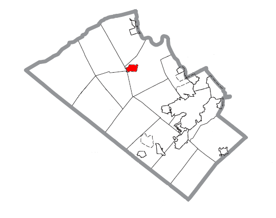
map_caption = Location of Schnecksville in Lehigh County
map1 = Pennsylvania Locator Map.png
map1_locator = Pennsylvania
map2 = Map of USA PA.svg
map2_caption = Location of Pennsylvania in the United States
website =Schnecksville is a
census-designated place (CDP) in North Whitehall Township,Lehigh County, Pennsylvania , in theUnited States . Schnecksville is a suburb ofAllentown, Pennsylvania , in theLehigh Valley region of the state.The population of Schnecksville was 1,989 at the 2000 census. Its U.S. postal code (zip code) is 18078.
History
Schnecksville was first settled in 1756 by Adam Schneck, who owned a tract of land in the area. His log home is still standing at the time of this writing, although relocated across the street. In 1840 Schnecksville was laid out by Daniel Schneck. He and his son Moses Schneck owned a hotel and other buildings. A George Rau opened a store. There was a post office here in 1846 with Peter Gross as postmaster. In 1880 the population was 160 persons. There were two hotels, a store, twenty two dwellings, a school and a church. Actually, there is reference made to two churches, an Evangelical church dated from 1871, and a frame church owned by the United Brethren, the date not given.
Geography
Schnecksville is located at coor dms|40|40|33|N|75|36|59|W|city (40.675741, -75.616260).GR|1
According to the
United States Census Bureau , the CDP has a total area of 1.3square mile s (3.3km² ), all of it land. The elevation of Schnecksville is 663 feet above sea level.Demographics
As of the
census GR|2 of 2000, there were 1,989 people, 715 households, and 592 families residing in the CDP. Thepopulation density was 1,572.5 people per square mile (609.5/km²). There were 738 housing units at an average density of 583.5/sq mi (226.1/km²). The racial makeup of the CDP was 97.89% White, 0.35% African American, 0.10% Native American, 1.06% Asian, 0.50% from other races, and 0.10% from two or more races. Hispanic or Latino of any race were 1.21% of the population.The ancestry of its residents is as follows: German (47.0%), Irish (10.0%), Italian (9.8%), English (9.2%), Welsh (7.1%), Slovak (6.1%).
There were 715 households out of which 43.1% had children under the age of 18 living with them, 73.8% were married couples living together, 7.4% had a female householder with no husband present, and 17.2% were non-families. 14.7% of all households were made up of individuals and 5.2% had someone living alone who was 65 years of age or older. The average household size was 2.78 and the average family size was 3.09.
In the CDP the population was spread out with 29.0% under the age of 18, 4.7% from 18 to 24, 28.9% from 25 to 44, 28.0% from 45 to 64, and 9.4% who were 65 years of age or older. The median age was 40 years. For every 100 females there were 93.9 males. For every 100 females age 18 and over, there were 94.0 males.
The median income for a household in the CDP was $74,808, and the median income for a family was $78,519. Males had a median income of $51,716 versus $35,714 for females. The
per capita income for the CDP was $27,533. About 1.2% of families and 1.3% of the population were below thepoverty line , including 1.5% of those under age 18 and none of those age 65 or over.Education
The community is served by the
Parkland School District . Schnecksville is also home to Lehigh Carbon Community College (also known LCCC, or "L-tri-C"), a public community college with 2,145 full-time students.chnecksville Community Fair
Every summer since 1981, a country fair is held in Schnecksville. In recent years, it has been held at the Schnecksville Fire Company on
Pennsylvania Route 309 , near the community's southern entrance.References
External links
* [http://www.lccc.edu Lehigh Carbon Community College Official Web Site] .
* [http://www.schnecksvillefair.com Schnecksville Community Fair Official Web Site] .
Wikimedia Foundation. 2010.