- North Whitehall Township, Lehigh County, Pennsylvania
-
Not to be confused with South Whitehall Township, Lehigh County, Pennsylvania, Whitehall Township, Lehigh County, Pennsylvania, or Whitehall, Allegheny County, Pennsylvania.
North Whitehall Township Township Country United States State Pennsylvania County Lehigh Elevation 627 ft (191.1 m) Coordinates 40°37′27″N 75°37′25″W / 40.62417°N 75.62361°W Area 28.9 sq mi (74.9 km2) - land 28.5 sq mi (74 km2) - water 0.3 sq mi (1 km2), 1.04% Population 14,731 (2000) Density 516.5 / sq mi (199.4 / km2) Timezone EST (UTC-5) - summer (DST) EDT (UTC-4) Area code 610 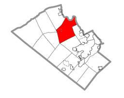 Location of North Whitehall Township in Lehigh County
 Location of North Whitehall Township in Pennsylvania
 Location of Pennsylvania in the United States
Website: http://www.northwhitehall.org North Whitehall Township is a township in Lehigh County, Pennsylvania, in the United States. It is a suburb of Allentown, Pennsylvania, in the Lehigh Valley region of the state.
The population of North Whitehall Township was 14,731 at the 2000 census.
Contents
Geography
According to the United States Census Bureau, the township has a total area of 28.9 square miles (74.8 km²), of which, 28.5 square miles (73.9 km²) of it is land and 0.3 square miles (0.9 km²) of it (1.21%) is water. It is drained by the Lehigh River, which separates it from Northampton County.
The township's numbered routes include 309, 873, 329, and 145. Another thoroughfare is Mauch Chunk Road, which runs from 329 in Ballietsville into Allentown. North Whitehall's villages include Ballietsville, Coffeetown, Ironton, Kernsville, Laurys Station, Mechanicsville (also in North Whitehall,) Meyersville (also in North Whitehall,) Neffs (also in Washington Township,) Orefield (also in North Whitehall,) Ormrod, Ruchsville, Scheidy, and Schnecksville.
Adjacent municipalities
- Whitehall Township (east)
- South Whitehall Township (south)
- Upper Macungie Township (tangent to the southwest)
- Lowhill Township (west)
- Heidelberg Township (west)
- Washington Township (northwest)
- Lehigh Township, Northampton County (north)
- Allen Township, Northampton County (northeast)
- Northampton, Northampton County (tangent to the east)
Demographics
As of the census[1] of 2000, there were 14,731 people, 5,250 households, and 4,131 families residing in the township. The population density was 516.5 people per square mile (199.4/km²). There were 5,473 housing units at an average density of 191.9/sq mi (74.1/km²). The racial makeup of the township was 96.84% White, 0.83% African American, 0.09% Native American, 0.72% Asian, 0.01% Pacific Islander, 0.58% from other races, and 0.93% from two or more races. Hispanic or Latino of any race were 1.66% of the population.
There were 5,250 households out of which 40.0% had children under the age of 18 living with them, 68.7% were married couples living together, 6.7% had a female householder with no husband present, and 21.3% were non-families. 17.1% of all households were made up of individuals and 6.3% had someone living alone who was 65 years of age or older. The average household size was 2.74 and the average family size was 3.11.
In the township the population was spread out with 29.0% under the age of 18, 5.1% from 18 to 24, 31.2% from 25 to 44, 24.5% from 45 to 64, and 10.2% who were 65 years of age or older. The median age was 38 years. For every 100 females there were 98.9 males. For every 100 females age 18 and over, there were 96.3 males.
The median income for a household in the township was $60,618, and the median income for a family was $65,013. Males had a median income of $48,040 versus $27,576 for females. The per capita income for the township was $24,983. About 2.7% of families and 3.8% of the population were below the poverty line, including 5.3% of those under age 18 and 8.0% of those age 65 or over.
Politics and government
Legislators
- State Representative Gary Day, Republican, 187th district
- State Senator Pat Browne, Republican, 16th district
- US Representative Charlie Dent, Republican, 15th district
Board of Supervisors
- Ronald Stahley, Chairman
- Terry Stoudt, Vice-chair
- Ronald Heintzelman
Public education
The Township is served by the Parkland School District along with South Whitehall and Upper Macungie Townships. Ironton, Kernsville, and Schnecksville Elementary Schools are located in North Whitehall and its secondary students attend Orefield Middle School and Parkland High School. [1] It is also home to Lehigh Carbon Community College in Schnecksville.
References
- ^ "American FactFinder". United States Census Bureau. http://factfinder.census.gov. Retrieved 2008-01-31.
External links
Lehigh Valley States Counties Three Cities Cities and towns
100k-250kCities and towns
50k-99kCities and towns
10-50kBethlehem Township • Easton • Emmaus • Forks Township • Hanover Township • Lehigh Township • Lower Macungie Township • Lower Saucon Township • North Whitehall Township • Palmer Township • Phillipsburg • Salisbury Township • South Whitehall Township • Upper Macungie Township • Upper Saucon Township • Whitehall TownshipPeople List of people from the Lehigh ValleyMunicipalities and communities of Lehigh County, Pennsylvania Cities 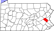
Boroughs Alburtis | Catasauqua | Coopersburg | Coplay | Emmaus | Fountain Hill | Macungie | Slatington
Townships Hanover | Heidelberg | Lower Macungie | Lower Milford | Lowhill | Lynn | North Whitehall | Salisbury | South Whitehall | Upper Macungie | Upper Milford | Upper Saucon | Washington | Weisenberg | Whitehall
CDPs Unincorporated
communitiesBreinigsville | Cementon | Center Valley | Cetronia | Colesville‡ | Dorneyville | East Texas | Egypt | Fogelsville | Hensingersville‡ | Hosensack | Ironton | Kuhnsville | Lanark | Laurys Station | Lehigh Gap‡ | Limeport | Lynnport | Neffs | New Tripoli | New Smithville | Newtown | Old Zionsville | Orefield | Pleasant Corners | Powder Valley | Schoenersville‡ | Shimerville | Slatedale | Summit Lawn | Trexlertown | Vera Cruz | Wescosville | West Catasauqua | Zionsville
Footnotes ‡This populated place also has portions in an adjacent county or counties
Categories:- Townships in Lehigh County, Pennsylvania


Wikimedia Foundation. 2010.