- Pilibhit district
-
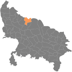
This article is about the district. For its eponymous headquarters, see Pilibhit.This article is about Pilibhit, a district situated in the Bareilly Division of the Indian state of Uttar Pradesh.. For others, see Pilibhit (disambiguation).
Pilibhit District
ज़िला पीलीभीत
ضلع پیلی بھیت— district — Coordinates Country India Region Rohilkhand State Uttar Pradesh Division Bareilly District(s) Pilibhit Population
• Density
2,037,225 (2011[update])
• 559 /km2 (1,448 /sq mi)
Sex ratio 889 ♂/♀ Time zone IST (UTC+05:30) Area
3,504 square kilometres (1,353 sq mi)
• 172 metres (564 ft)
Climate
• Precipitation
Temperature
• Summer
• Winter
• 780 mm (31 in)
• 36.8 °C (98.2 °F)
• 14.5 °C (58.1 °F) Portal: Uttar Pradesh
 Website www.pilibhit.nic.in Pilibhit district (Hindi: ज़िला पीलीभीत, Urdu: ضلع پیلی بھیت) is one of the districts in the state of Uttar Pradesh in India, and Pilibhit city is the district headquarters. Pilibhit district is a part of Bareilly Division.The city is famous for its contribution to Bollywood, Urdu literature and its involvement in Politics of India. Pilibhit has produced as many as three song writers for Bollywood namely Anjum Pilibhiti, Akhtar Pilibhiti, and lesser know Rafiq Alam. The district has elected eleven central ministers in 14 parliamentary elections. The sitting member of 14th parliament from Pilibhit constituency Smt. Menaka Gandhi is India's first lady member of parliament, who was elected more than five times from a single constituency.
Due to dense Sikh population in the district, it is also known as Mini Punjab as after Partition of India in 1947, the a large number of people of Sikh community came from Pakistan to this area, and government resettled them in the area. The district Pilibhit is also home to thousands of Bengali people, who came here after 1947.
A new Tiger Reserve Area is come up with name as Pilibhit Tiger Reserve in Sept 2008.
Contents
Demographics
According to the 2011 census Pilibhit district has a population of 2,037,225,[1] roughly equal to the nation of Slovenia[2] or the US state of New Mexico.[3] This gives it a ranking of 226th in India (out of a total of 640).[1] The district has a population density of 567 inhabitants per square kilometre (1,470 /sq mi) .[1] Its population growth rate over the decade 2001-2011 was 23.83 %.[1] Pilibhit has a sex ratio of 889 females for every 1000 males,[1] and a literacy rate of 63.58 %.[1]
Figures about Pilibhit District
Total Area District - 3504 km²[4]
Total Area city - 68.76 km²Population (as 2011)[5]
Type No. Male 1,078,525 Female 958,700 Total 2,037,225 Rural 14,26,057 Urban 611,167 SC 2,89,235 ST 2156 Scheduled Castes (Largest three) ( As in Sept, 2007)[6]
Scheduled Castes No. Chamar etc. 92,574 Pasi etc. 41,941 Dhobi 37,930
Minority Populations[7] ( As in Sept, 2007)
Minority Population Percent of total population Muslims 390773 23.75 % Sikhs 75479 4.587% Buddhists 1828 0.12% Christians 1787 0.1086% Scheduled Tribes (Largest three) ( As in Sept, 2007)[6]
Scheduled Tribes No. Tharu etc. 1,222 Bhotia etc. 225 Generic Tribes etc. 190 Literacy (as 2001)
Gender No. Percentage Male 5,42,084 62.49% Female 2,77,714 35.11% Total 8,19,798 49.81% Administrative Set up (2007–08) [8]
Administrative Set ups No. Lok Sabha seats 1 Legislative Assembly seats 4 Tehsil 5 Block 7 Panchayat Ghar 208 Gram Panchayat 599 Nayay Panchayat 78 No. of Villages ( As in Sept, 2007)[9]
Village No. Total 1443 Inhabited 1125 Uninhabited 318 Important Towns (Largest three) (As in Sept, 2007)[6]
Towns Population Pilibhit (MB) 1,62,625 Bisalpur (MB) 60,681 Puranpur (MB) 37,233 No. of Town (As in Sept, 2007)
Civic System No. Total 20 Nagar Palika 5 Nagar Panchayat 15 Police Station (As in Sept, 2007)
Social Security Center No. Total Police Station 28 Urban Police Station 11 Rural Police Station 17 RoadWays (As in Sept, 2007)[9]
Roadways No. Bus Station 152 Urban 56 Rural 94 Railways (As in Sept, 2007)[9]
Railways No. Railway Station 20 Railway Line 285 KM Post Offices (As in Sept, 2007)[9]
Post Office No. Rural Post Office 104 Urban Post Office 61 Telegram Offices 1 Communication (As in Sept, 2007)[9]
Services No. of Connections Operator Land Lines 14511 BSNL, Reliance, Airtel Mobile 7457 BSNL, Vodafone, Airtel, Cellphone, Reliance No. of PCOs 331 BSNL Banks (As in Sept, 2007)[10]
Banks No. of Branchs Nationalised Banks 63 Private Sector Banks 2 Gramin Banks 19 Co-Operative Bank 37 Aricultural and Rural Bank 7 Fair Price Shops (Governmental) (As in Sept, 2007)
Fair Price Shope No. Urban 809 Rural 270 Plants (As in Sept, 2007)
Plants No. Bio Gas Plant 7898 Cold Storage 31 Agriculture Production (As in Sept, 2007)
Produce Amount Wheat 547 ('000 M.Ton), Sugar Cane 454 ('000 hectares) Oilseeds 1.84 ('000 M.Ton) Potato 63 ('000 M.Ton) sown 42('000 M.Ton) Irrigation (As in Sept, 2007)[11]
Irrigation Area Net Irrigated Area 307 ('000 hectares) Gross Irrigated Area 454 ('000 hectares) Water System (As in Sept, 2007)
Water System No. Length of canal 138 km Govt. tubewell 484 Pvt. Tubewell 9327 Total Hand pumps 2110 Rural Hand pumps 1286 Urban Hand pumps 820 Dairy (As in Sept, 2007)[12]
Livestock No. Total Livestock 109781 Veterinary Hospital 16 Livestoc Development Centre 25 Artificial Insemination Centre 15 Agricultural Socity (As in Sept, 2007)[13]
Agricultural Societies No. Primary Agri Loan Society 76 Society Member 169842 Industries (As in Sept, 2007)
Industries No. Regd. Industries under Industry Act 1948 557 Small scale Industry 30792 No. of workers 75961 Education (As in Sept, 2007) [14]
Education Center No. Junior Basic School 1608 Senior Basic School 730 Higher Sec. School 102 College 24 PG College 8 I.T.I 1 Polytechnic College 2 Teacher Training Inst. 1 Sanskrit College. 1 Engineering College 2 Medical College (Ayurvedic) 1 Law College 1 Nursing College 1 Public Health (As in Sept, 2007)
Public Health Center No. Beds available Allopathic Health Centers[15] 7 595 Ayurvedic Health Centers[16] 36 138 Homeopathic Health Centers[16] 20 0 Unani Health Centers[16] 2 4 Primary Health Centre 68 508 Comm. Health Centre 7 79 Family and Maternity Centre[17] 9 Nil Family and Maternity Sub-Centre[17] 206 Nil Special Hospitals (As in Sept, 2007)
Special Hospital No. TB Hospital 1 Leprosy Hospital 1 Infectious Diseases 1 Total Roads (As in Sept, 2007)[18]
Road Length (km) PWD 1350 Total 1895 No. of Villages connected with roads 1005 Electricity - (As in Sept, 2007)[19]
Type No. Villages 982 Town 20 SC slums 1045 No of pump sets 7201 House Type (As in Sept, 2007)[6]
Type of house % of households occupying Permanent 50.9 Semi-permanent 25.7 Temporary 23.3 Cinemas (As in Sept, 2007)
Cinema No. Urban 25 Rural 16 Total 41 Religions (Largest three) (As in Sept, 2007)[6]
Religions No. Hindus 11,73,317 Muslims 3,90,773 Sikhs 75,479 Religious Places (As in Sept, 2007)
Religious Places No. Temples 864 Mosques 287 Gurudwaras 65 Church 7 Facts about Pilibhit District
Rivers in Pilibhit District
No. Rivers 1. Sharda 2. Chauka or Chuka 3. Khanaut 4. Mala 5. Devhuti Ganga or Devha 6. Lohia 7. Ghaghra 8. Rapatua 9. Sundaria & Kailas 10. Absara Lakes & Water Bodies in Pilibhit District
No. Water Bodies or Lakes Place 1. Drumand Lake Pilibhit City 2. Pangaili Fulhar Lake Madhotanda 3. Mahadev lake Jamunia 4. Bari lake Bithora Kalan 5. Anwar ganj lake Anwarganj 6. Balpur lake Balpur mandalia 7. Ramlila Maidan lake Pilibhit city Canals in Pilibhit District
Canal Length (km) Sharda canal 12.64 Hardoi branch 36.80 Kheri branch 31.20 Sharda Sagar feeder 03.90 Outlet channel 03.23 Subsidiary Hardoi branch 21.55 Blocks in Pilibhit District
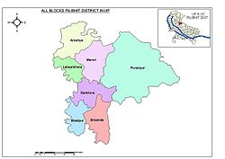
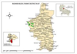
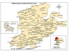
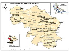
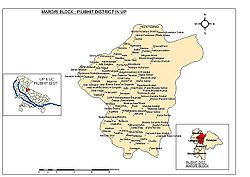
No. Name of Block 1. Amaria 2. Barkhera 3. Bilsanda 4. Bisalpur 5. Lalorikhera 6. Marori 7. Puranpur Tehsil in Pilibhit District
No. Names of Tehsil 1. Pilibhit 2. Barkhera 3. Puranpur 4. Bisalpur Main Educational Institutes in Pilibhit District
No. Names of Educational Institutes Affiliation With 1. Drumand Boys' Government Intermediate College UP Board, Allahabad 2. St.Aloysius Intermediate College CBSE Board, New Delhi 3. Chironji Lal Virendera Pal Saraswati Vidhya Mandir Boys' Intermediate College UP Board, Allahabad 5. Springdale Intermediate College CBSE Board, New Delhi 6. Sanatan Dharam Banke Bhihari Shri Ram Boys' Intermediate College UP Board, Allahabad 7. Lions Bal Vidhya Mandir Intermediate College CBSE Board, New Delhi 8. Girls' Government Intermediate College UP Board, Allahabad 9. Anguri Devi Saraswati Vidhya Mandir Girls' Intermediate College UP Board, Allahabad 10. Baby Adarsh Shishu Mandir UP Board, Allahabad 11. Siddique National Boys' Intermediate College UP Board, Allahabad 12. Ben-Her Intermediate College CBSE Board, New Delhi 13. Upadhi Mahavidhayalaya Rohilkhand University, Bareilly 14. Ram Lubhai Sahani Girls' Degree College Rohilkhand University, Bareilly 15. Pushp Institute of Sciences & Higher Studies[20] Rohilkhand University, Bareilly 16. Hafiz Rahmat Khan Law College[21] Rohilkhand University, Bareilly 17. Sanjay Gandhi School of Nursing Rohilkhand University, Bareilly 18. Shri Lalit Hari Sanskrit Mahavidhiyalaya Sampurnanand Sanskrit University, Varanasi 19. Springdale College of Management Studies[22] Rohilkhand University, Bareilly 20. Guru Nanak Gurdas Vidhyalaya, bhopatpur UP Board, Allahabad Main Roads in City
No. Names of Road 1. Station Road 2. Jai Prakash Road 3. Nai Basti Road or Degree College Road 4. Chudi wali Gali 5. Thandi Road or Katchari Road 6. Mill Road 7. Khakra Road 8. Assam Road 9. Gandhi Stadium Road 10. Jaisantri Road Main Cinema Halls
No. Names of Cinema Hall 1. Vishal Cinema 2. Laxmi Cinema 3. Novalty Cinema List of NGOs Running In Pilibhit
No. Names of NGO 1. Kawarnthi Sewa Dal (KSD) 2. Bal Vikas Samiti (BVS) 3. Mahila Kalyan Samiti (MKS) 4. Medical Sisters Of St. Joseph (MSJ) 5. Ram Krishna Sewa Samiti (RKSS) 6. Samaj Kalyan Evam Vikas Adhyayan Kendra (SKEVAK)[23] 7. The Methodist Church In India (MCI) 8. Uttar Pradesh Drought Relief Committee (UPDRC) 9. Viklang Kalyan & Punrvaas Samiti (VKPS) 10. Vivek Educational foundation of Canada[24] Pin Codes of Various Areas
Area wise PIN codes are as follows.[25][26]
Place PIN Code Place PIN Code Place PIN Code Amaria 262121 Barkhera 262203 Bilsanda 262202 Bisalpur 262201 Ganesh Ganj 262122 Jugraipur 262123 Katra Bazar 262201 Kutchery 262001 Lohia Head 262301 Majhola 262302 Neorila 262305 Pilibhit 262001 Pilibhit Chowk 262001 Pilibhit City 262001 Pilibhit H O 262001 Sultanpur 262125 Abhaipur Bo 262122 Ahirwara Bo 262201 Amaria Dso 262121 Amkhera Bo 262203 Amra Karoor Bo 262201 Amrita Bo 262201 Azampur Barkhera Bo 262201 Bahadurpur Bo 262203 Bahanpur 262001 Bakania Bo 262202 Bamrauli Bo 262202 Banskhera Bo 262121 Baratbhoj 262001 Barehpura Bo 262121 Barhera Bo 262201 Barkhera Chaturaha Bo 262201 Barkhera So 262203 Bauni Bo 262201 Behtim Bo 262202 Bhaden Kanja Bo 243001 Bhadsara Bo 262121 Bhagwantapur Bo 262122 Bhairo Kalan Bo 262122 Bhikaripur 262001 Bhikaripur Bo 262201 Bhopatpura Bo 262203 Bifarcation Bo 262122 Bilsanda So 262202 Bisalpur So 262201 Bithora Kalan 262001 Chandia Hazara Bo 262122 Chandpura Bo 262201 Chandupur 262124 Churra Bo 262201 Dang 262001 Daulatpur Bo 262203 Deohana Bo 243001 Deoria Kalan Bo 262201 Dhakia Bo 262201 Dhuria Palia Bo 262122 Dudhia Khurd Bo 262122 Dunidam Bo 262302 Gajraula Kalan 262001 Ganesh Ganj Ndso 262001 Gehluiya 262001 Ghajhera Bo 262201 Ghatampur Bo 262122 Ghungchai Bo 262122 Gobhia Sarai Bo 262122 Gulabtanda Bo 262122 Harrai Bo 243001 Harraipur Bo 262121 Imalia Gangi Bo 262201 Intgoan Bo 262201 Jahanabad Edso 262001 Jallapur Bo 262201 Jamunia Bo 262124 Jatpura Ndedso 262001 Jeorah Kalyanpur Bo 262203 Kadherchaura Bo 262122 Kali Nagar 262124 Kalyanpur Khas 262001 Kanakore 262001 Kargaina Bo 262121 Karnapur Bo 262122 Karrkhera Bo 262201 Karunapur Karoor Bo 262203 Kasganja Bo 262122 Katra Bazar Ndtso 262201 Kesarpur Saidpur Bo 243123 Khajuria Pachpera Bo 262203 Khakra Ndtso 262001 Khamaria Pull 262001 Khandepur Bo 262201 Khundara 262001 Kishni Bo 262201 Kumirkha Bo 262201 Lalauri Khera 262001 Luhicha Bo 262201 Madhopur Bo 262201 Madhotanda Bo 262122 Madhupuri Bo 262203 Majhola Dso 262302 Maktul 262001 Mala Colony 262001 Meerpur Bahanpur Bo 262201 Meerpur Hamirpur Bo 243001 Mohammadpur Bhanja Bo 262201 Mudia Hulas Bo 262203 Mundalia Bo 262121 Narainpur Bo 262203 Naugawan Santosh Bo 262201 Naujalia Nakatia Bo 262122 Nyoria Husainpur Dso 262305 Neoria Mobile Bo 2623053 Nizamdandi 262001 Paharganj Bo 262201 Pandari Bo 262305 Pania Ramkishan Bo 262203 Parasi Ramkishan Bo 262203 Parewa Vaish Bo 262121 Parsia Bo 262203 Pauta Kalan Bo 262203 Pilibhit Kutchery Ndtso 262001 Pipalia Bo 262121 Piparia Agroo 262001 Piperia Dulai Bo 262122 Piperia Mundan Bo 262203 Piperia Santosh Bo 262124 Puranpur Dso 262122 Ram Nagar Jagatpur Bo 262203 Ramnagra Colony Bo 262122 Rampura Fakire Bo 262122 Ranth Bo 243001 Rasiayankhanpur Bo 262201 Richhaula 262001 Rohania Bo 262201 Rooppur Kamaloo 262001 Rudrapur Bo 262122 Sabalpur Bo 262122 Sakhaula 262001 Sarauri 262001 Sehpura Bo 262203 Shahgarh Bo 262122 Sherpur Bo 262122 Shivnagar Bo 262122 Simra Akbar Ganj Bo 262203 Suhas 262001 Sunpahar Bo 262302 Tirkunia Bo 262121 Udaikaranpur Bo 262122 See also
- Related Pages About Pilibhit
- All pages beginning with "Pilibhit"
- Article about Places in Pilibhit
- Barkhera
- Bilsanda
- Bisalpur
- Gularia Bhindara
- Jahanabad
- Kalinagar
- Madhotanda
- Majhola
- Nyoria Husainpur
- Puranpur
- Article about people from Pilibhit
- Bhanu Pratap Singh
- Harish Kumar Gangawar
- Parshuram Gangwar
- Mohan Swarup
- Md Shamsul Hasan Khan
- Menaka Gandhi
- Mukund Lal Agrawal
- Varun Gandhi
References
- ^ a b c d e f "District Census 2011". Census2011.co.in. 2011. http://www.census2011.co.in/district.php. Retrieved 2011-09-30.
- ^ US Directorate of Intelligence. "Country Comparison:Population". https://www.cia.gov/library/publications/the-world-factbook/rankorder/2119rank.html. Retrieved 2011-10-01. "Slovenia 2,000,092 July 2011 est."
- ^ "2010 Resident Population Data". U. S. Census Bureau. http://2010.census.gov/2010census/data/apportionment-pop-text.php. Retrieved 2011-09-30. "New Mexico - 2,059,179"
- ^ http://pilibhit.nic.in/discover.htm
- ^ "The Population in 2011". Government of India. http://censusindia.gov.in/2011-prov-results/data_files/up/Census2011Data%20Sheet-UP.pdf. Retrieved 2011-05-07.
- ^ a b c d e http://www.censusindia.gov.in/Dist_File/datasheet-0921.pdf
- ^ www.upw.bsnl.co.in/uso/pilibhit.xls
- ^ http://upgov.up.nic.in/spatrika/graphical/table55.asp?formd=260000
- ^ a b c d e http://upgov.up.nic.in/spatrika/graphical/table51.asp?formd=260000
- ^ http://upgov.up.nic.in/spatrika/graphical/table52.asp?formd=260000
- ^ http://www.iwmigiam.org/stats/Details_india_Dist.asp?SelectMap=IND&CONID=101&StateID=33&DistID=71
- ^ http://upgov.up.nic.in/spatrika/graphical/table30.asp?formd=260000
- ^ http://upgov.up.nic.in/spatrika/graphical/table32.asp?formd=260000
- ^ http://upgov.up.nic.in/spatrika/graphical/table38.asp?formd=260000
- ^ http://upgov.up.nic.in/spatrika/graphical/table44.asp?formd=260000
- ^ a b c http://upgov.up.nic.in/spatrika/graphical/table45.asp?formd=260000
- ^ a b http://upgov.up.nic.in/spatrika/graphical/table46.asp?formd=260000
- ^ http://upgov.up.nic.in/spatrika/graphical/table50.asp?formd=260000
- ^ http://upgov.up.nic.in/spatrika/graphical/table48.asp?formd=260000
- ^ http://pushpinstitute.com/academic.htm
- ^ http://www.hrklawcollege.com/indexlaw.html
- ^ http://scmspbt.org/index.html
- ^ http://sevakindia.org/home.html
- ^ http://www.vivekcanada.org/
- ^ http://www.whereincity.com/india/pincode/uttar-pradesh/pilibhit.htm
- ^ http://india.gov.in/outerwin.htm?id=http://www.indiapost.gov.in/pinsearch1.asp
External links

Udham Singh Nagar district, Uttar Pradesh Nepal 
Bareilly district 
Kheri district  Pilibhit district

Shahjahanpur district Categories:- Districts of Uttar Pradesh
- Pilibhit district
- Minority Concentrated Districts in India
Wikimedia Foundation. 2010.

