- Maharajganj district
-
This article is about the district. For its eponymous headquarters, see Maharajganj.
Maharajganj district
महाराजगंज जिला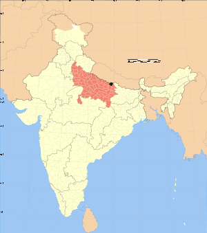
Location of Maharajganj district in Uttar PradeshState Uttar Pradesh,  India
IndiaAdministrative division Gorakhpur Headquarters Mahrajganj, Uttar Pradesh Area 2,934.1 km2 (1,132.9 sq mi) Population 2,173,878 (2001) Population density 737 /km2 (1,910 /sq mi) Literacy 47.72 Sex ratio 934 Tehsils 4 Lok Sabha Constituencies Maharajganj Official website Maharajganj district (Hindi: महाराजगंज जिला) is one of the 71 districts of Uttar Pradesh state in northern India, and the town of Maharajganj is the district headquarters.
Contents
Geography
Ths district is bounded by Nepal on the north, Kushinagar district on the east, Gorakhpur district on the south and Siddharthnagar and Sant Kabir Nagar districts in the west. This district is part of Gorakhpur Division. The district covers an area of 2,951 km². The district has a population of 2,173,878 (2001 Census).[1]
History
This district was carved out from the erstwhile Gorakhpur district on 2 October 1989.
Economy
In 2006 the Ministry of Panchayati Raj named Maharajganj one of the country's 250 most backward districts (out of a total of 640).[2] It is one of the 34 districts in Uttar Pradesh currently receiving funds from the Backward Regions Grant Fund Programme (BRGF).[2]
Divisions
Maharajganj district comprises 4 tehsils: Maharajganj Sadar, Nautanwa, Nichlaul and Pherada. Maharajganj Sadar tehsil has 4 community development blocks: Maharajganj, Ghughali, Paniara and Partawal. Nautanwa tehsil consists 2 community development blocks: Ratanpur and Laxmipur. Nichlaul tehsil has 3 community development blocks: Nichlaul, Mithaura and Siswa. Pherada tehsil also has 3 community development blocks: Bridgmanganj, Dhani and Pheranda. The number of villages in this district is 1258.There are 13 (thirteen) Police Station (P.S.) in Maharajganj district. There are given below 1. Pharenda 2. Nautanwa 3. Purandarpur 4. Kothibhar 5. Thuthibari Kotwali 6. Kolhui 7. Brijmanganj 8. Shyamdeurawa 9. Parsamalik 10. Bargadawa 11. Paniyara 12. Chauk 13. Sonauli Kotwali
Demographics
According to the 2011 census Maharajganj district has a population of 2,665,292,[3] roughly equal to the nation of Kuwait[4] or the US state of Nevada.[5] This gives it a ranking of 151st in India (out of a total of 640).[3] The district has a population density of 903 inhabitants per square kilometre (2,340 /sq mi) .[3] Its population growth rate over the decade 2001-2011 was 22.61 %.[3] Maharajganj has a sex ratio of 938 females for every 1000 males,[3] and a literacy rate of 64.3 %.[3]
References
- ^ "Uttar Pradesh". india,gov,in website. http://india.gov.in/knowindia/districts/andhra1.php?stateid=UP. Retrieved 7 May 2010.
- ^ a b Ministry of Panchayati Raj (September 8, 2009). "A Note on the Backward Regions Grant Fund Programme". National Institute of Rural Development. http://www.nird.org.in/brgf/doc/brgf_BackgroundNote.pdf. Retrieved September 27, 2011.
- ^ a b c d e f "District Census 2011". Census2011.co.in. 2011. http://www.census2011.co.in/district.php. Retrieved 2011-09-30.
- ^ US Directorate of Intelligence. "Country Comparison:Population". https://www.cia.gov/library/publications/the-world-factbook/rankorder/2119rank.html. Retrieved 2011-10-01. "Kuwait 2,595,62"
- ^ "2010 Resident Population Data". U. S. Census Bureau. http://2010.census.gov/2010census/data/apportionment-pop-text.php. Retrieved 2011-09-30. "Nevada 2,700,551"
External links

Nepal Pashchim Champaran district, Bihar Siddharthnagar district 
 Maharajganj district

Gorakhpur district Kushinagar district Cities and towns in Maharajganj district Maharajganj Cities and towns
in other districtsAgra · Aligarh · Allahabad · Ambedkar Nagar · Auraiya · Azamgarh · Badaun · Bagpat · Bahraich · Ballia · Balrampur · Banda · Barabanki · Bareilly · Basti · Bhimnagar · Bijnor · Bulandshahr · Chandauli · Chitrakoot · Deoria · Etah · Etawah · Faizabad · Farrukhabad · Fatehpur · Firozabad · Gautam Buddha Nagar · Ghaziabad · Ghazipur · Gonda · Gorakhpur · Hamirpur · Hardoi · Jalaun · Jaunpur · Jhansi · Jyotiba Phule Nagar · Kannauj · Kanpur Nagar · Kanshi Ram Nagar · Kaushambi · Kushinagar · Lakhimpur Kheri · Lalitpur · Lucknow · Mahamaya Nagar · Mahoba · Mainpuri · Mathura · Mau · Meerut · Mirzapur · Moradabad · Muzaffarnagar · Panchsheel Nagar · Pilibhit · Prabuddhanagar · Pratapgarh · Raebareli · Ramabai Nagar · Rampur · Saharanpur · Sant Kabir Nagar · Sant Ravidas Nagar · Shahjahanpur · Shravasti · Siddharthnagar · Sitapur · Sonbhadra · Sultanpur · Unnao · Varanasi
Divisions and Districts of Uttar Pradesh, India Agra division Aligarh division Aligarh · Etah · Mahamaya Nagar · Kanshi Ram Nagar
Allahabad division Azamgarh division Bareilly division Badaun · Bareilly · Pilibhit · Shahjahanpur
Basti division Chitrakoot division Banda · Chitrakoot · Hamirpur · Mahoba
Devipatan division Faizabad division Gorakhpur division Deoria · Gorakhpur · Kushinagar · Maharajganj
Jhansi division Kanpur division Auraiya · Etawah · Farrukhabad · Kannauj · Kanpur Nagar · Ramabai Nagar
Lucknow division Meerut division Bagpat · Bulandshahr · Gautam Buddha Nagar · Ghaziabad · Meerut · Panchsheel Nagar
Mirzapur division Moradabad division Bhimnagar · Bijnor · Jyotiba Phule Nagar · Moradabad · Rampur
Saharanpur division Prabuddhanagar · Muzaffarnagar · Saharanpur
Varanasi division
Categories:- Districts of Uttar Pradesh
- Maharajganj district
- Uttar Pradesh geography stubs

Wikimedia Foundation. 2010.