- Gorakhpur district
-
This article is about the district. For its eponymous headquarters, see Gorakhpur.
Gorakhpur district
گورکھپور ضلع
गोरखपुर ज़िला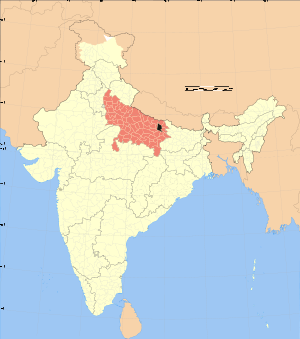
Location of Gorakhpur district in Uttar PradeshState Uttar Pradesh,  India
IndiaAdministrative division Gorakhpur Headquarters Gorakhpur Area 3,483.8 km2 (1,345.1 sq mi) Population 3,769,456 (2001) Urban population 19.60% Literacy 43.3% Sex ratio 959 Lok Sabha Constituencies Gorakhpur, Bansgaon Major highways NH 28 Official website Gorakhpur district (Hindi: गोरखपुर ज़िला, Urdu: گورکھپور ضلع) is a district of Uttar Pradesh state in India. Gorakhpur is the administrative headquarters of the district.
Contents
History
The district was ceded by the Nawab of Awadh to the British East India Company in 1801. With this cession, Gorakhpur was raised to the status of a district. The first district collector was Mr. Routledge. In 1829, Gorakhpur was made the headquarters of Gorakhpur Division, comprising the districts of Gorakhpur, Ghazipur and Azamgarh. Mr. R.M. Biad was first appointed Commissioner.
In 1865 Basti District was carved out from Gorakhpur. The latter was further split up in 1946 to form Deoria District. The third division of Gorakhpur led to the creation of Maharajganj District in 1989.
Geography
Gorakhpur district lies between latitude 26° 46´ N and longitude 83° 22´ E. The district covers an area of 3,483.8 square kilometres (1,345.1 sq mi). It is bounded by Maharajganj district to the north, Kushinagar and Deoria districts in the east, Ambedkar Nagar, Azamgarh, and Mau districts to the south, and Sant Kabir Nagar district to the west. The district is part of Gorakhpur Division.[1]
Economy
In 2006 the Ministry of Panchayati Raj named Gorakhpur one of the country's 250 most backward districts (out of a total of 640).[2] It is one of the 34 districts in Uttar Pradesh currently receiving funds from the Backward Regions Grant Fund Programme (BRGF).[2]
Demographics
According to the 2011 census Gorakhpur district has a population of 4,436,275,[3] roughly equal to the nation of Croatia[4] or the US state of Kentucky.[5] This gives it a ranking of 40th in India (out of a total of 640).[3] The district has a population density of 1,336 inhabitants per square kilometre (3,460 /sq mi) .[3] Its population growth rate over the decade 2001-2011 was 17.69 %.[3] Gorakhpur has a sex ratio of 944 females for every 1000 males,[3] and a literacy rate of 73.25 %.[3]
Languages
Vernaculars spoken in Gorakhpur include Urdu hindi Bhojpuri, a language in the Bihari language group with almost 40 000 000 speakers, written in both the Devanagari and Kaithi scripts.[6]
References
- ^ "Gorakhpur". Gorakhpur district administration. http://gorakhpur.nic.in/. Retrieved 2010-08-05.
- ^ a b Ministry of Panchayati Raj (September 8, 2009). "A Note on the Backward Regions Grant Fund Programme". National Institute of Rural Development. http://www.nird.org.in/brgf/doc/brgf_BackgroundNote.pdf. Retrieved September 27, 2011.
- ^ a b c d e f "District Census 2011". Census2011.co.in. 2011. http://www.census2011.co.in/district.php. Retrieved 2011-09-30.
- ^ US Directorate of Intelligence. "Country Comparison:Population". https://www.cia.gov/library/publications/the-world-factbook/rankorder/2119rank.html. Retrieved 2011-10-01. "Croatia 4,483,804 July 2011 est."
- ^ "2010 Resident Population Data". U. S. Census Bureau. http://2010.census.gov/2010census/data/apportionment-pop-text.php. Retrieved 2011-09-30. "Kentucky 4,339,367"
- ^ M. Paul Lewis, ed (2009). "Bhojpuri: A language of India". Ethnologue: Languages of the World (16th edition ed.). Dallas, Texas: SIL International. http://www.ethnologue.com/show_language.asp?code=bho. Retrieved 2011-09-30.
External links

Siddharthnagar district Maharajganj district Kushinagar district Sant Kabir Nagar district 
Deoria district  Gorakhpur district

Ambedkar Nagar district Azamgarh district Mau district Divisions and Districts of Uttar Pradesh, India Agra division Aligarh division Aligarh · Etah · Mahamaya Nagar · Kanshi Ram Nagar
Allahabad division Azamgarh division Bareilly division Badaun · Bareilly · Pilibhit · Shahjahanpur
Basti division Chitrakoot division Banda · Chitrakoot · Hamirpur · Mahoba
Devipatan division Faizabad division Gorakhpur division Deoria · Gorakhpur · Kushinagar · Maharajganj
Jhansi division Kanpur division Auraiya · Etawah · Farrukhabad · Kannauj · Kanpur Nagar · Ramabai Nagar
Lucknow division Meerut division Bagpat · Bulandshahr · Gautam Buddha Nagar · Ghaziabad · Meerut · Panchsheel Nagar
Mirzapur division Moradabad division Bhimnagar · Bijnor · Jyotiba Phule Nagar · Moradabad · Rampur
Saharanpur division Prabuddhanagar · Muzaffarnagar · Saharanpur
Varanasi division Gorakhpur division topics General Mythology, history Districts Rivers, dams, lakes Ghaghara • West RaptiLanguages, people Transport Lok Sabha constituencies See also Cities and towns in Deoria district • Cities and towns in Gorakhpur district • Cities and towns in Kushinagar district • Cities and towns in Maharajganj district • Villages in Deoria district • Villages in Gorakhpur district • Villages in Maharajganj district • People from Deoria • People from Gorakhpur • People from Kushinagar • People from MaharajganjOther Divisions Agra • Aligarh • Allahabad • Azamgarh • Bareilly • Basti • Chitrakoot • Devipatan • Faizabad • Jhansi • Kanpur • Lucknow • Meerut • Mirzapur • Moradabad • Saharanpur • VaranasiCategories:- Districts of Uttar Pradesh
- Gorakhpur district
- Uttar Pradesh geography stubs

Wikimedia Foundation. 2010.