- Mirzapur district
-
This article is about the district. For its eponymous headquarters, see Mirzapur.
Mirzapur district
मीरज़ापुर ज़िला
مرزا پور ضلع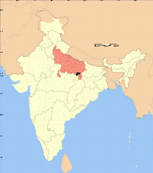
Location of Mirzapur district in Uttar PradeshState Uttar Pradesh,  India
IndiaAdministrative division Mirzapur Headquarters Mirzapur Area 4,521 km2 (1,746 sq mi) Population 2,074,709 (2001) Tehsils 4 Lok Sabha Constituencies Mirzapur Average annual precipitation 1043 mm Official website Mirzapur district (Hindi: मीरज़ापुर ज़िला, Urdu: مرزا پور ضلع) is one of the 70 districts of Uttar Pradesh state in northern India. The district is bounded on the north by Sant Ravidas Nagar and Varanasi districts, on the east by Chandauli district, on the south by Sonbhadra district and on the norhwest by Allahabad district. The district occupies an area of 4521 km2. Mirzapur town is the district headquarters. Mirzapur district is a part of Mirzapur division. This district is known for the Vindhyavasini temple in Vindhyachal. It consist of several Ghats where historical sculptures are still present. During Ganga festival these Ghats are decorated with lights and diyas. It is currently a part of the Red Corridor.[1]
Contents
Divisions
The district consists four Tahsils. These are Mirzapur, Lalganj, Marihan and Chunar. These four tahsils are further divided into twelve blocks.
Economy
In 2006 the Ministry of Panchayati Raj named Mirzapur one of the country's 250 most backward districts (out of a total of 640).[2] It is one of the 34 districts in Uttar Pradesh currently receiving funds from the Backward Regions Grant Fund Programme (BRGF).[2]
Demographics
According to the 2011 census Mirzapur district has a population of 2,494,533,[3] roughly equal to the nation of Kuwait[4] or the US state of Nevada.[5] This gives it a ranking of 174th in India (out of a total of 640).[3] The district has a population density of 561 inhabitants per square kilometre (1,450 /sq mi) .[3] Its population growth rate over the decade 2001-2011 was 17.89 %.[3] Mirzapur has a sex ratio of 900 females for every 1000 males,[3] and a literacy rate of 70.38 %.[3]
Languages
Languages spoken include Agariya, an Austro-Asiatic tongue with approximately 72 000 speakers;[6] Bagheli, which has a lexical similarity of 72-91% with Hindi[7] (compared to 60% for German and English)[8] and is spoken by about 7 800 000 in Bagelkhand;[7] and Bhojpuri, a tongue in the Bihari language group with almost 40 000 000 speakers, written in both the Devanagari and Kaithi scripts.[9]
References
- ^ "83 districts under the Security Related Expenditure Scheme". IntelliBriefs. 2009-12-11. http://intellibriefs.blogspot.com/2009/12/naxal-menace-83-districts-under.html. Retrieved 2011-09-17.
- ^ a b Ministry of Panchayati Raj (September 8, 2009). "A Note on the Backward Regions Grant Fund Programme". National Institute of Rural Development. http://www.nird.org.in/brgf/doc/brgf_BackgroundNote.pdf. Retrieved September 27, 2011.
- ^ a b c d e f "District Census 2011". Census2011.co.in. 2011. http://www.census2011.co.in/district.php. Retrieved 2011-09-30.
- ^ US Directorate of Intelligence. "Country Comparison:Population". https://www.cia.gov/library/publications/the-world-factbook/rankorder/2119rank.html. Retrieved 2011-10-01. "Kuwait 2,595,62"
- ^ "2010 Resident Population Data". U. S. Census Bureau. http://2010.census.gov/2010census/data/apportionment-pop-text.php. Retrieved 2011-09-30. "Nevada 2,700,551"
- ^ M. Paul Lewis, ed (2009). "Agariya: A language of India". Ethnologue: Languages of the World (16th edition ed.). Dallas, Texas: SIL International. http://www.ethnologue.com/show_language.asp?code=agi. Retrieved 2011-09-28.
- ^ a b M. Paul Lewis, ed (2009). "Bagheli: A language of India". Ethnologue: Languages of the World (16th edition ed.). Dallas, Texas: SIL International. http://www.ethnologue.com/show_language.asp?code=bfy. Retrieved 2011-09-28.
- ^ M. Paul Lewis, ed (2009). "English". Ethnologue: Languages of the World (16th edition ed.). Dallas, Texas: SIL International. http://www.ethnologue.com/show_language.asp?code=eng. Retrieved 2011-09-28.
- ^ M. Paul Lewis, ed (2009). "Bhojpuri: A language of India". Ethnologue: Languages of the World (16th edition ed.). Dallas, Texas: SIL International. http://www.ethnologue.com/show_language.asp?code=bho. Retrieved 2011-09-30.
External links

Sant Ravidas Nagar district Varanasi district Allahabad district 
Chandauli district  Mirzapur district

Rewa district, Madhya Pradesh Singrauli district, Madhya Pradesh Sonbhadra district Cities and towns in Mirzapur district Mirzapur Cities and towns
in other districtsAgra · Aligarh · Allahabad · Ambedkar Nagar · Auraiya · Azamgarh · Badaun · Bagpat · Bahraich · Ballia · Balrampur · Banda · Barabanki · Bareilly · Basti · Bhimnagar · Bijnor · Bulandshahr · Chandauli · Chitrakoot · Deoria · Etah · Etawah · Faizabad · Farrukhabad · Fatehpur · Firozabad · Gautam Buddha Nagar · Ghaziabad · Ghazipur · Gonda · Gorakhpur · Hamirpur · Hardoi · Jalaun · Jaunpur · Jhansi · Jyotiba Phule Nagar · Kannauj · Kanpur Nagar · Kanshi Ram Nagar · Kaushambi · Kushinagar · Lakhimpur Kheri · Lalitpur · Lucknow · Mahamaya Nagar · Maharajganj · Mahoba · Mainpuri · Mathura · Mau · Meerut · Moradabad · Muzaffarnagar · Panchsheel Nagar · Pilibhit · Prabuddhanagar · Pratapgarh · Raebareli · Ramabai Nagar · Rampur · Saharanpur · Sant Kabir Nagar · Sant Ravidas Nagar · Shahjahanpur · Shravasti · Siddharthnagar · Sitapur · Sonbhadra · Sultanpur · Unnao · Varanasi
Divisions and Districts of Uttar Pradesh, India Agra division Aligarh division Aligarh · Etah · Mahamaya Nagar · Kanshi Ram Nagar
Allahabad division Azamgarh division Bareilly division Badaun · Bareilly · Pilibhit · Shahjahanpur
Basti division Chitrakoot division Banda · Chitrakoot · Hamirpur · Mahoba
Devipatan division Faizabad division Gorakhpur division Deoria · Gorakhpur · Kushinagar · Maharajganj
Jhansi division Kanpur division Auraiya · Etawah · Farrukhabad · Kannauj · Kanpur Nagar · Ramabai Nagar
Lucknow division Meerut division Bagpat · Bulandshahr · Gautam Buddha Nagar · Ghaziabad · Meerut · Panchsheel Nagar
Mirzapur division Mirzapur · Sant Ravidas Nagar · Sonbhadra
Moradabad division Bhimnagar · Bijnor · Jyotiba Phule Nagar · Moradabad · Rampur
Saharanpur division Prabuddhanagar · Muzaffarnagar · Saharanpur
Varanasi division
Categories:- Districts of Uttar Pradesh
- Mirzapur district
- Uttar Pradesh geography stubs

Wikimedia Foundation. 2010.