- Deoria district
-
This article is about the district. For its eponymous headquarters, see Deoria, Uttar Pradesh.
Deoria district
देवरिया जिला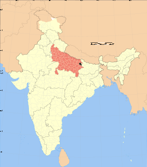
Location of Deoria district in Uttar PradeshState Uttar Pradesh,  India
IndiaAdministrative division Gorakhpur Headquarters Deoria Area 2,535 km2 (979 sq mi) Population 2,730,376 (2001) Population density 1,077 /km2 (2,790 /sq mi) Lok Sabha Constituencies Deoria Average annual precipitation 864.38 mm Official website Deoria district is one of the districts of Uttar Pradesh state of India, and Deoria town is the district headquarters. Deoria district is a part of Gorakhpur division.
Contents
History
Ancient
The area now known as the Deoria District was once a part of the Kosala Kingdom - a prime centre of ancient Aryan culture surrounded by the Himalayas in the north, the Shyandika river in the south, the Panchala Kingdom in the west and the Magadh Kingdom in Bihar to the east. Apart from the many legends told about this area, archaeological remains, such as statues, coins, bricks, temples, and Budh Maths, have been discovered at many locations in this district, showing that there was a developed and organised society long ago.
Ancient history of the district is related with the Ramayana times when the Lord of Kosala, Ram, appointed his elder son Kusa the king of Kushwati, which is present-day Kushinagar. Before the Mahābhārat era, this area had been related with Chakravorty Samrat Mahasudtsan Mall and his kingdom. Kushinagar was well developed and prosperous. Close to the border of his kingdom was the thick forested area called the Mahavan. This area was under the control of the Maurya rulers, the Gupta rulers, the Bihar rulers, and then the Garhwal ruler Govinda Chandra from 1114 AD until 1154 AD.
Modern
The Deoria District came into existence on March 16, 1946, being separated from the Gorakhpur District. It is believed that the name Deoria is derived from Devaranya or possibly Devpuria. According to official gazetteers, the district was named "Deoria" after its headquarters in Deoria, and the term Deoria generally means a place where there are temples. The name Deoria probably developed because of the existence of important temples to Shiva, called Somnath Temple, and the goddess Durga, called Deorahi Temple on the northern bank of the Kurna river.
The Kushinagar (Padrauna) district was formed in May 1994 by separating the north-east portion of the Deoria District.
Geography
Deoria district is located between 26 ° 6' and 27° 8' north latitude to 83° 29' and 84° 26' east longitude. It is surrounded by Kushinagar district in the north, Gopalganj and Siwan districts of Bihar in the east, Mau and Ballia districts in the south and Gorakhpur district in the west.[1]
Ghaghara, Rapti and Chhoti Gandak are the main rivers in the district.[1] Salempur & Bhatpar Rani are the major cities apart from Deoria.
Deoria district consists of 5 tehsils:
- Barhaj
- Bhatpar Rani
- Deoria
- Rudrapur
- Salempur
Demographics
According to the 2011 census Deoria district has a population of 3,098,637,[2] roughly equal to the nation of Mongolia[3] or the US state of Iowa.[4] This gives it a ranking of 114th in India (out of a total of 640).[2] The district has a population density of 1,220 inhabitants per square kilometre (3,200 /sq mi) .[2] Its population growth rate over the decade 2001-2011 was 14.23 %.[2] Deoria has a sex ratio of 1013 females for every 1000 males,[2] and a literacy rate of 73.53 %.[2]
Languages
Vernaculars spoken in Deoria include Bhojpuri, a language in the Bihari language group with almost 40 000 000 speakers, written in both the Devanagari and Kaithi scripts.[5]
References
- ^ a b "Deoria". Deoria district administration. http://deoria.nic.in/. Retrieved 2010-08-05.
- ^ a b c d e f "District Census 2011". Census2011.co.in. 2011. http://www.census2011.co.in/district.php. Retrieved 2011-09-30.
- ^ US Directorate of Intelligence. "Country Comparison:Population". https://www.cia.gov/library/publications/the-world-factbook/rankorder/2119rank.html. Retrieved 2011-10-01. "Mongolia 3,133,318 July 2011 est."
- ^ "2010 Resident Population Data". U. S. Census Bureau. http://2010.census.gov/2010census/data/apportionment-pop-text.php. Retrieved 2011-09-30. "Iowa 3,046,355"
- ^ M. Paul Lewis, ed (2009). "Bhojpuri: A language of India". Ethnologue: Languages of the World (16th edition ed.). Dallas, Texas: SIL International. http://www.ethnologue.com/show_language.asp?code=bho. Retrieved 2011-09-30.
External links

Kushinagar district Gopalganj district, Bihar Gorakhpur district 
Siwan district, Bihar  Deoria district

Mau district Ballia district Divisions and Districts of Uttar Pradesh, India Agra division Aligarh division Aligarh · Etah · Mahamaya Nagar · Kanshi Ram Nagar
Allahabad division Azamgarh division Bareilly division Badaun · Bareilly · Pilibhit · Shahjahanpur
Basti division Chitrakoot division Banda · Chitrakoot · Hamirpur · Mahoba
Devipatan division Faizabad division Gorakhpur division Deoria · Gorakhpur · Kushinagar · Maharajganj
Jhansi division Kanpur division Auraiya · Etawah · Farrukhabad · Kannauj · Kanpur Nagar · Ramabai Nagar
Lucknow division Meerut division Bagpat · Bulandshahr · Gautam Buddha Nagar · Ghaziabad · Meerut · Panchsheel Nagar
Mirzapur division Moradabad division Bhimnagar · Bijnor · Jyotiba Phule Nagar · Moradabad · Rampur
Saharanpur division Prabuddhanagar · Muzaffarnagar · Saharanpur
Varanasi division Gorakhpur division topics General Mythology, history Districts Rivers, dams, lakes Ghaghara • West RaptiLanguages, people Transport Lok Sabha constituencies See also Cities and towns in Deoria district • Cities and towns in Gorakhpur district • Cities and towns in Kushinagar district • Cities and towns in Maharajganj district • Villages in Deoria district • Villages in Gorakhpur district • Villages in Maharajganj district • People from Deoria • People from Gorakhpur • People from Kushinagar • People from MaharajganjOther Divisions Agra • Aligarh • Allahabad • Azamgarh • Bareilly • Basti • Chitrakoot • Devipatan • Faizabad • Jhansi • Kanpur • Lucknow • Meerut • Mirzapur • Moradabad • Saharanpur • VaranasiCategories:

Wikimedia Foundation. 2010.