- Mirzapur Upazila
-
Mirzapur
িমর্জাপুর— Upazila — Location in Bangladesh
 Mirzapur
Coordinates: 24°6.5′N 90°5.5′E / 24.1083°N 90.0917°ECoordinates: 24°6.5′N 90°5.5′E / 24.1083°N 90.0917°E Country  Bangladesh
Division Dhaka Division District Tangail District Area - Total 373.89 km2 (144.4 sq mi) Population (1991) - Total 337,496 - Density 903/km2 (2,338.8/sq mi) Time zone BST (UTC+6) Website Official Map of Mirzapur Mirzapur (Bengali: মির্জাপুর) is an Upazila of Tangail District in the Division of Dhaka, Bangladesh.
Contents
Geography
Mirzapur is located at 24°06′30″N 90°05′30″E / 24.1083°N 90.0917°E . It has 61479 units of house hold and total area 373.89 km².
Demographics
As of the 1991 Bangladesh census, Mirzapur has a population of 337496. Males constitute are 50.31% of the population, and females 49.69%. This Upazila's eighteen up population is 178312. Mirzapur has an average literacy rate of 32.9% (7+ years), and the national average of 32.4% literate.[1]
Administration
MP:Md.Akabbar Hossain, from Awami League
'Chairman:Mir Enayet Hossain [monto],From Awami League
Vice Chairman: Shorkar Heetesh Chondro (Poolok), from Awami League
Woman Vice Chairman:Ms.Salma Salam [Urmi] from Awami League
Upazila Nirbahi Officer (UNO):Md.Mahmudul Hassan.
There are also some political leader such as: Mir Sharif mahmud, Abdur Razzak bsc, Kayem Uddin sharker, Nurul islam, etc.
Bashtail union in the center of "mirzapur upozila Awami League"
Administrative
Mirzapur has 13 Unions/Wards, 207 Mauzas/Mahallas, and 219 villages.
Famous organizations
The famous organizations of Mirzapur are "Kumudini Hospital"; "Varateswary Homes"; "Mirzapur Cadet College" etc. Mirzapur is the birthplace of Mr. Ronada Proshad Shaha, the founder of Kumudini Kallayan Trust.There is an ideal union in mirzapur name as "Bashtail".There is a famous school here, name as "Bashtail M M A high school".There are also a collage, a madrasha, a primary school, and many kinder garden school.Actually Bashtail is very developed in sports.The foodball team of Bashtail is the champion among the district.
The businesses of the people
The main business of the peoples is Agriculture. Rice and Jute are the main crops of this area. Other seasonal crops like mustered oil, potatoes are also grown here. The rest of the people of the upazila are related with other occupations like Business, School Teacher, Public Service, Private Service etc. Nowadays, a number of NGOs have been working in this area and many local people are linked with the activities of these NGOs.Besides,people get huge amount remittance of this area.At list one member of a family go abroad.For this reason the economical system is better of this upozila.Now a days people are changing their fortune by doing the works of agricultural.
The communication systems
Mirzapur is directly linked with the highway from Dhaka to Tangail (connected to Bangbandhu Bridge on Jamuna River). Also there is a Dual-Gauge Rail-line from Dhaka to Rajshahi and Khulna.
But the internal communication system is very poor. The roads within the upazila, connected to different unions and villages, are badly less developed. Maximum people are to come to the Upazila Head Quarter on foot or bicycles. There is no scope to run any vehicle. Especially, the road from Mirzapur to Nagarpur via Nagar Bhad Gram is in odd situation.
See also
References
- ^ "Population Census Wing, BBS.". Archived from the original on 2005-03-27. http://web.archive.org/web/20050327072826/http://www.bangladeshgov.org/mop/ndb/arpc91_v1/tables04.htm. Retrieved November 10, 2006.
 Upazilas of the Dhaka Division
Capital: Dhaka Dhaka District 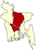
Faridpur District Gazipur District Gopalganj District Jamalpur District Kishoreganj District Astagram · Bajitpur · Bhairab · Hossainpur · Itna · Karimganj · Katiadi · Kishoreganj · Kuliarchar · Mithamain · Nikli · Pakundia · TarailMadaripur District Manikganj District Munshiganj District Mymensingh District Bhaluka · Dhobaura · Phulbari · Gaffargaon · Gauripur · Haluaghat · Ishwargan Mymensingh · Muktagachha · Nandail · Phulpur TrishalNarayanganj District Narsingdi District Netrokona District Atpara · Barhatta · Durgapur · Khaliajuri · Kalmakanda · Kendua · Madan · Mohanganj · Netrokona · PurbadhalaRajbari District Shariatpur District Sherpur District Tangail District Categories:- Upazilas of Tangail District
- Dhaka Division geography stubs


Wikimedia Foundation. 2010.