- Dhobaura Upazila
-
Dhobaura
ধোবাউড়া— Upazila — Location in Bangladesh
 Dhobaura
Coordinates: 25°5.5′N 90°32′E / 25.0917°N 90.533°ECoordinates: 25°5.5′N 90°32′E / 25.0917°N 90.533°E Country  Bangladesh
Division Dhaka Division District Mymensingh District Government – Upzilla Chairman Furkan Uddin Selim Mirdha Area – Total 251.05 km2 (96.9 sq mi) Population (1991) – Total 157,027 – Density 625/km2 (1,618.7/sq mi) Time zone BST (UTC+6) Website Official Map of Dhobaura Dhobaura (Bengali: ধোবাউড়া ) is an Upazila of Mymensingh District in the Division of Dhaka, Bangladesh.
Contents
Location of Dhobaura Upazila
Dhobaura Upazila (mymensingh district) with an area of 251.05 sq km, is bounded by Meghalaya (Indian) on the north, phulpur and purbadhala upazilas on the south, durgapur upazila on the east, haluaghat upazila on the west. Main rivers are Nitai and kangsa. There are many hillocks on the north region of the upazila.
Geography
Dhobaura is located at 25°05′30″N 90°32′00″E / 25.0917°N 90.5333°E . It has 30491 units of house hold and total area 251.05 km². this Upazila have 7 union.
Demographics
As of the 1991 Bangladesh census, Dhobaura has a population of 157027. Males constitute are 50.52% of the population, and females 49.48%. This Upazila's eighteen up population is 75591. Dhobaura has an average literacy rate of 18.7% (7+ years), and the national average of 32.4% literate.[1]
Description
Dhobaura thana, now an upazila, was established in 1976. The upazila consists of 7 union parishads, 96 mouzas and 158 villages. Dhobaura (Town) consists of 1 mouza. The area of the town is 3.82 sq km. It has a population of 3027; male 51.93% and female 48.07%; population density per sq km 792. Literacy rate among the town people is 34.2%. The town has one dakbungalow.
Administrative
Dhobaura has 7 Unions, 96 Mauzas/Mahallas, and 158 villages. Muslim, hindu and Garo this three religious people live in Dhoboura upazila with together The name of the Union are given in the follow, 1) Dhobaura 2) Purakandolia 3) Gusgaw 4) Gamaritola 5) Dhokinmije Para 6) Guatola 7) Baghber/Munshirhat
Population
357027; male 50.52%, female 49.48%; Muslim 88.73%; Hindu 4.49%, Christian 6.36%, Buddhist 0.15% and others 0.27%.
Literacy and educational institutions
Average literacy 28.7%; male 23.6% and female 13.6%. Educational institutions: college 4, high school 11, junior high school 6, madrasa 23, government primary school 43, non-government 39 and kinder garden school 6.
See also
References
- ^ "Population Census Wing, BBS.". Archived from the original on 2005-03-27. http://web.archive.org/web/20050327072826/http://www.bangladeshgov.org/mop/ndb/arpc91_v1/tables04.htm. Retrieved November 10, 2006.
 Upazilas of the Dhaka DivisionCapital: Dhaka
Dhaka District 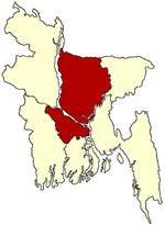
Faridpur District Gazipur District Gopalganj District Jamalpur District Kishoreganj District Astagram · Bajitpur · Bhairab · Hossainpur · Itna · Karimganj · Katiadi · Kishoreganj · Kuliarchar · Mithamain · Nikli · Pakundia · TarailMadaripur District Manikganj District Munshiganj District Mymensingh District Bhaluka · Dhobaura · Phulbari · Gaffargaon · Gauripur · Haluaghat · Ishwargan Mymensingh · Muktagachha · Nandail · Phulpur TrishalNarayanganj District Narsingdi District Netrokona District Atpara · Barhatta · Durgapur · Khaliajuri · Kalmakanda · Kendua · Madan · Mohanganj · Netrokona · PurbadhalaRajbari District Shariatpur District Sherpur District Tangail District Categories:- Upazilas of Mymensingh District
- Dhaka Division geography stubs


Wikimedia Foundation. 2010.