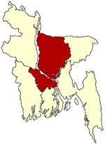
- Charbhadrasan Upazila
-
Charbhadrasan
চর ভদ্রাসন— Upazila — Location in Bangladesh Coordinates: 23°33.5′N 90°5′E / 23.5583°N 90.083°ECoordinates: 23°33.5′N 90°5′E / 23.5583°N 90.083°E Country  Bangladesh
Division Dhaka Division District Faridpur District Area - Total 141.59 km2 (54.7 sq mi) Population (1991) - Total 69,876 - Density 494/km2 (1,279.5/sq mi) Time zone BST (UTC+6) Website Official Map of Charbhadrasan Charbhadrasan (Bengali: চর ভদ্রাসন) is an Upazila of Faridpur District in the Division of Dhaka, Bangladesh.
Contents
Geography
Charbhadrasan is located at 23°33′30″N 90°05′00″E / 23.5583°N 90.0833°E . It has 12415 units of house hold and total area 141.59 km².
Demographics
As of the 1991 Bangladesh census, Charbhadrasan has a population of 69876. Males constitute are 51.36% of the population, and females 48.64%. This Upazila's eighteen up population is 34758. Charbhadrasan has an average literacy rate of 20.5% (7+ years), and the national average of 32.4% literate.[1] (Great Sharat Chandra Tikadar was born in this upazilla. He was as well as a doctor (Ayurveda), social worker and was the member of district board.) Only one son of Sheikh Abdur Rob Mia, Designer Mohammad Golam Mostafa, also known as Mostafa Al Sheikh (مصطفى الشيخ) born in 13 June 1982, in this upazilla.
Administrative
Charbhadrasan has 4 Unions/Wards, 25 Mauzas/Mahallas, and 129 villages.
See also
References
- ^ "Population Census Wing, BBS.". Archived from the original on 2005-03-27. http://web.archive.org/web/20050327072826/http://www.bangladeshgov.org/mop/ndb/arpc91_v1/tables04.htm. Retrieved November 10, 2006.
 Upazilas of the Dhaka Division
Capital: Dhaka Dhaka District 
Faridpur District Gazipur District Gopalganj District Jamalpur District Kishoreganj District Astagram · Bajitpur · Bhairab · Hossainpur · Itna · Karimganj · Katiadi · Kishoreganj · Kuliarchar · Mithamain · Nikli · Pakundia · TarailMadaripur District Manikganj District Munshiganj District Mymensingh District Bhaluka · Dhobaura · Phulbari · Gaffargaon · Gauripur · Haluaghat · Ishwargan Mymensingh · Muktagachha · Nandail · Phulpur TrishalNarayanganj District Narsingdi District Netrokona District Atpara · Barhatta · Durgapur · Khaliajuri · Kalmakanda · Kendua · Madan · Mohanganj · Netrokona · PurbadhalaRajbari District Shariatpur District Sherpur District Tangail District
Categories:- Upazilas of Faridpur District
- Dhaka Division geography stubs
Wikimedia Foundation. 2010.

