- Dohar Upazila
-
"Dohar" redirects here. For the capital of Qatar, see Doha.
Dohar
দোহার— Upazila — Location in Bangladesh
 Dohar
DoharCoordinates: 23°35.7′N 90°7.3′E / 23.595°N 90.1217°ECoordinates: 23°35.7′N 90°7.3′E / 23.595°N 90.1217°E Country  Bangladesh
Division Dhaka Division District Dhaka District Area - Total 161.49 km2 (62.4 sq mi) Population (1991) - Total 175,842 - Density 1,089/km2 (2,820.5/sq mi) Time zone BST (UTC+6) Dohar 1330 Website Official Map of Dohar Dohar (Bengali: দোহার) is an Upazila of Dhaka District in the Division of Dhaka, Bangladesh. The Upazilla is situated in the southern most part of Dhaka District. The mighty river of Padma borders the southern part of the upazilla.
Contents
Geography
Dohar is located at 23°35′45″N 90°07′20″E / 23.5958°N 90.1222°E . It has 31645 units of house hold and total area 161.49 km². One of the largest rivers of Bangladesh, Padma is situated in the southern and South-western part of Dohar. This Upazila is bordered by Nawabganj Sri Nagar and a small part by Sirajdikhan which is an Upazila of the district Munshiganj formerly known as Bikrampur.
Demographics
As of the 1991 Bangladesh census, Dohar has a population of 175,842. Males constitute 49.41% of the population and females 50.59%. This Upazila's eighteen up population is 86,196. Dohar has an average literacy rate of 32.9% (7+ years) and the national average of 32.4% literate.[1] A large number of people of this area live abroad in pursuit of earning a living. Most of them stay in the Middle East and European countries. Now they are going to Australia and Japan]. But the rate of literacy is increasing nowadays.
The history of Dohar is old in British period. The British government forced to cultivate Nil but the farmers refused and went of strike the moment Mahatma Gandhi came.Welcome to Dohar
Administrative
Dohar has 8 Unions and 1 porosova, 93 Mauzas/Mahallas, and 139 villages. The names of the Unions are as below,
- Nayabari
- Kushumhati
- Raypara
- Char Mohammadpur
- Sutarpara
- Narisha
- Mokshedpur
- Bilaspur (the chairman of Bilaspur PU is SM Nazrul Islam)
The name of porosova is Dohar. The largest village in the Bilaspur Union is Debinagar]. Chotogolla is another village.
The parliamentary set no 1 (Dohar and Nowabgong are one set).
দোহার উঃ শিমুলিয়া মৃধ্যা বাড়ী[[File:Example[2].jpg]]
References
- ^ "Population Census Wing, BBS.". Archived from the original on 2005-03-27. http://web.archive.org/web/20050327072826/http://www.bangladeshgov.org/mop/ndb/arpc91_v1/tables04.htm. Retrieved November 10, 2006.
- ^ mirdha home
 Upazilas of the Dhaka Division
Capital: Dhaka Dhaka District 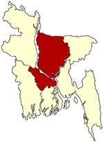
Faridpur District Gazipur District Gopalganj District Jamalpur District Kishoreganj District Astagram · Bajitpur · Bhairab · Hossainpur · Itna · Karimganj · Katiadi · Kishoreganj · Kuliarchar · Mithamain · Nikli · Pakundia · TarailMadaripur District Manikganj District Munshiganj District Mymensingh District Bhaluka · Dhobaura · Phulbari · Gaffargaon · Gauripur · Haluaghat · Ishwargan Mymensingh · Muktagachha · Nandail · Phulpur TrishalNarayanganj District Narsingdi District Netrokona District Atpara · Barhatta · Durgapur · Khaliajuri · Kalmakanda · Kendua · Madan · Mohanganj · Netrokona · PurbadhalaRajbari District Shariatpur District Sherpur District Tangail District
Categories:- Upazilas of Dhaka District
- Dhaka Division geography stubs


Wikimedia Foundation. 2010.