- Durgapur, Netrokona
-
Durgapur
দূর্গাপুর— Upazila — Location in Bangladesh
 Durgapur
Coordinates: 25°7.5′N 90°41.3′E / 25.125°N 90.6883°ECoordinates: 25°7.5′N 90°41.3′E / 25.125°N 90.6883°E Country  Bangladesh
Division Dhaka Division District Netrokona District Area - Total 293.42 km2 (113.3 sq mi) Population (1991) - Total 169,135 - Density 576/km2 (1,491.8/sq mi) Time zone BST (UTC+6) Website Official Map of Durgapur Durgapur (Bengali: দূর্গাপুর) is an Upazila of Netrokona District in the Division of Dhaka, Bangladesh.
Contents
Geography
Durgapur is located at 25°07′30″N 90°41′15″E / 25.1250°N 90.6875°E . It has 32245 units of house hold and total area 293.42 km². Durgapur Upazila is such a unique place where river of clean water, hills, sands make a heavenly natural environment.
Demographics
As of 1991[update] Bangladesh census, Durgapur has a population of 169135. Males constitute are 50.49% of the population, and females 49.51%. This Upazila's eighteen up population is 83795. Durgapur has an average literacy rate of 23% (7+ years), compared to the national average of 32.4%.[1]
Ethnic Composition of Durgapur Thana
Durgapur is rich in a diversity of indigenous peoples, heritage, and culture. Ethnic Composition of Durgapur Thana (In Alphabetical Order) is given below:
Source: Small Ethnic Groups of Bangladesh: A Mapping Exercise; By: Mohammad Rafi; Panjeree Publications; Year: 2006
Total Households: 8,250
1. Banai; Total Village: 1; Total Household: 6; Language Practiced: Banai; Religion Practiced: Hinduism;
2. Bangali; Total Village: 48; Total Household: 4,778; Language Practiced: Bangla;
3. Buna / Buno; Total Village: 3; Total Household: 37; Language Practiced: Bangla; Religion Practiced: Hinduism; Buna / Buno in Other Districts: Dhaka, Gazipur, Mymensingh, Rajbari, Sherpur, Tangail, Bagerhat, Jessore, Jhenaidah, Khulna, Kushtia, Magura, Satkhira, Bogra, Dinajpur, Joypurhat, Naogaon, Natore, Nilphamari, Pabna, Rajshahi, Sirajganj, Maulvibazar;
4. Garo; Total Village: 61; Total Household: 2,924; Language Practiced: Achik / Garo (98.08%), Deal (1.92%); Religion Practiced: Christianity (99.96%), Shangsharik (0.04%); Garo in Other Districts: Tangail, Sherpur, Mymensingh, Jamalpur, Banderban, Chittagong, Khagrachhari, Pabna, Maulvibazar, Sunamganj;
5. Hajong; Total Village: 17; Total Household: 505; Language Practiced: Hajong; Religion Practiced: Hinduism; Hajong in Other Districts: Mymensingh, Sherpur, Sunamganj;
Administrative
Durgapur has 7 Unions/Wards, 134 Mauzas/Mahallas, and 215 villages.
See also
Useful Websites for Durgapur
- [1] - Banglapedia: Durgapur Upazila
- [2] - "Bangladesh Government District Portal for Netrokona"
- [3] - "Shusung Mahabidyalaya"
- [4] - "Durgapur Mohila (Women's) Degree College"
- [5] - Facebook Group: "Shusong Durgapur, Netrokona", a community portal with comprehensive information about Shusong Durgapur and Its People, as well information on Tourism, Travel, Accommodation, etc
References
- ^ "Population Census Wing, BBS.". Archived from the original on 2005-03-27. http://web.archive.org/web/20050327072826/http://www.bangladeshgov.org/mop/ndb/arpc91_v1/tables04.htm. Retrieved November 10, 2006.
 Upazilas of the Dhaka Division
Capital: Dhaka Dhaka District 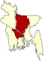
Faridpur District Gazipur District Gopalganj District Jamalpur District Kishoreganj District Astagram · Bajitpur · Bhairab · Hossainpur · Itna · Karimganj · Katiadi · Kishoreganj · Kuliarchar · Mithamain · Nikli · Pakundia · TarailMadaripur District Manikganj District Munshiganj District Mymensingh District Bhaluka · Dhobaura · Phulbari · Gaffargaon · Gauripur · Haluaghat · Ishwargan Mymensingh · Muktagachha · Nandail · Phulpur TrishalNarayanganj District Narsingdi District Netrokona District Atpara · Barhatta · Durgapur · Khaliajuri · Kalmakanda · Kendua · Madan · Mohanganj · Netrokona · PurbadhalaRajbari District Shariatpur District Sherpur District Tangail District Categories:- Upazilas of Netrokona District
- Dhaka Division geography stubs


Wikimedia Foundation. 2010.