- Daulatpur Upazila, Manikganj
-
Daulatpur
দৌলতপুর— Upazila — Location in Bangladesh
 Daulatpur
Coordinates: 23°57.7′N 89°50.5′E / 23.9617°N 89.8417°ECoordinates: 23°57.7′N 89°50.5′E / 23.9617°N 89.8417°E Country  Bangladesh
Division Dhaka Division District Manikganj District Area - Total 216.24 km2 (83.5 sq mi) Population (1991) - Total 138,606 - Density 641/km2 (1,660.2/sq mi) Time zone BST (UTC+6) Website Official Map of Daulatpur Daulatpur (Bengali: দৌলতপুর) is an Upazila of Manikganj District in the Division of Dhaka, Bangladesh.
Contents
Geography
Daulatpur is located at 23°57′40″N 89°50′30″E / 23.9611°N 89.8417°E . It has 26,720 units of house hold and total area 216.24 km².
Demographics
As of 1991[update] Bangladesh census, Daulatpur has a population of 138,606. Males constitute are 49.62% of the population, and females 50.38%. This Upazila's eighteen up population is 69586. Daulatpur has an average literacy rate of 20% (7+ years), and the national average of 32.4% literate.[1]
Administrative
Daulatpur has 8 Unions/Wards, 172 Mauzas/Mahallas, and 170 villages.
See also
References
- ^ "Population Census Wing, BBS.". Archived from the original on 2005-03-27. http://web.archive.org/web/20050327072826/http://www.bangladeshgov.org/mop/ndb/arpc91_v1/tables04.htm. Retrieved November 10, 2006.
 Upazilas of the Dhaka Division
Capital: Dhaka Dhaka District 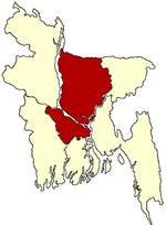
Faridpur District Gazipur District Gopalganj District Jamalpur District Kishoreganj District Astagram · Bajitpur · Bhairab · Hossainpur · Itna · Karimganj · Katiadi · Kishoreganj · Kuliarchar · Mithamain · Nikli · Pakundia · TarailMadaripur District Manikganj District Munshiganj District Mymensingh District Bhaluka · Dhobaura · Phulbari · Gaffargaon · Gauripur · Haluaghat · Ishwargan Mymensingh · Muktagachha · Nandail · Phulpur TrishalNarayanganj District Narsingdi District Netrokona District Atpara · Barhatta · Durgapur · Khaliajuri · Kalmakanda · Kendua · Madan · Mohanganj · Netrokona · PurbadhalaRajbari District Shariatpur District Sherpur District Tangail District Categories:- Upazilas of Manikganj District
- Dhaka Division geography stubs


Wikimedia Foundation. 2010.