- Manikganj District
-
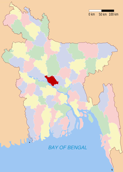
Manikganj — District — Location of Manikganj in Bangladesh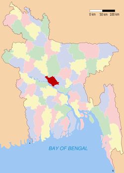
Coordinates: 23°51′N 90°01′E / 23.85°N 90.01°ECoordinates: 23°51′N 90°01′E / 23.85°N 90.01°E Country  Bangladesh
Division Dhaka Division Area – Total 1,378.99 km2 (532.4 sq mi) Population (1991) – Total 1,274,829 – Density 924.5/km2 (2,394.4/sq mi) Literacy rate – Total 26.9% Time zone BST (UTC+6) – Summer (DST) BDST (UTC+7) Website http://www.dcmanikganj.gov.bd/ Manikganj (Bengali: মানিকগঞ্জ [mɑnɪkˈɡəndʒ]) is a district in central Bangladesh. It is a part of the Dhaka Division.
Geography
Manikganj District (Dhaka Division) with an area of 1378.99 km2, is bounded by Tangail District on the north, Dhaka District on the east, Faridpur and Dhaka districts on the south, the padma, jamuna and the districts of Pabna and Rajbari on the west. Annual temperature: maximum 36 °C and minimum 12.7 °C; annual rainfall 2376 mm. Main rivers are the Padma, Jamuna, Dhaleshwari, Ichamati and Kaliganga. An extensive area of the district especially riverine area of the upazilas of Harirampur, Shivalaya and Daulatpur becomes victim to riverbank erosion every year.
Subdivisions
Manikganj (Town) consists of 9 wards and 49 mahallas. The area of the town is 20.59 km². Administration Manikganj subdivision was established in 1845 and was turned into a district in 1984. It consists of 1 municipality, 7 upazilas, 65 union parishads, 1357 mouzas, 9 wards, 49 mahallas and 1647 villages. The upazillas are Manikganj Sadar Upazila, Singair Upazila, Shivalaya Upazila, Saturia Upazila, Harirampur Upazila, Ghior Upazila and Daulatpur Upazila.
History
Manikganj was formerly a subdivision of Dhaka District. It was turned into a district in 1984.
On the April 26, 1989 Manikganj was the site of, what was at the time, the world's worst tornado in terms of loss-of-life. 1,300 people were initially reported as having been killed with 12,000 injured. The towns of Saturia and Manikganj Sadar were leveled and about 80,000 people were made homeless.
Historical Events
- A decisive battle was fought between the Mughal Army and the combined forces of the Bara Bhuiyans under Musa Khan at Jatrapur and Dakchara on the Ichamati (in present-day Harirampur Upazila). It resulted in the defeat of the Bara Bhuiyans and established the Mughal supremacy over the central Bhati region.
- In the second half of the nineteenth century indigo uprisings spread over the district. On 12 February 1932, the anti-British revolutionists under Hiralal Mohanta of Manikganj town looted the postal despatch.
War of Liberation
During the War of Liberation in 1971 a group of Pakistani intruding soldiers on boats while proceeding towards the Singair camp was attacked by the Mukti Bahini Freedom Fighters on the Nurani-ganga Khal and in the encounter more than three hundred Mukti Bahini Freedom Fighters were killed. In a pitched battle between the Pak-army and the Mukti Bahini Freedom Fighters at Baira under Singair upazila 15 Mukti Bahini Freedom Fighters were killed. The Mukti Bahini Freedom Fighters killed 41 Pakistani armies by gunshot at village Terasree under Ghior upazila on 22 November. The Pak-soldiers attacked the camp of the Mukti Bahini Freedom Fighters at Nayabari under Shivalaya upazila in the month of November and after a fight for four hours the Mukti Bahini Freedom Fighters were compelled of retreat. A battle was fought between the Mukti Bahini Freedom Fighters and the Pakistani intruding soldiers at village Kagajinagar of sadar upazila on 12 December in which the Pak-soldiers being pressed by guerrilla attack dispersed. In an encounter between the Pakistani army and the Mukti Bahini Freedom Fighters at Baliartek on 14 December one Mukti Bahini Freedom Fighters was captured and Mukti Bahini Freedom Fighters Nawsher Molla killed. The Mukti Bahini Freedom Fighters Chand Mia was killed in an encounter at village Manra. A battle was fought between the Mukti Bahini Freedom Fighters and the Pakistani intruding soldiers on 15 December at village Ghazinda in which the Mukti Bahini Freedom Fighters Mohammad Aminur Rahman, Chhakkeluddin, Shariful Islam and Rahijuddin were died. During November 1971, at Mogra under Golaidanga union in Singair upazila, a group of Freedom Fighters attaked the boats carrying the Pakistani intruding soldiers and a terrible battle was occurred. Around 75 PAK soldiers were killed. After this battle, the PAK introding soldiers burnt sevral hundred of houses surrounding villages of the battle place.
Marks of War of Liberation Mass killing site: Saturia Pilot High School compound, Primary Training Institute campus, Tara-ghat, house of Balai Babu; mass grave: by the side of Thana pond; Memorial monument: at a place adjacent to the Manikganj Bus-stand, memorial monument at village Terasree in Ghior upazila.
Renowned Persons
Manikganj district ( then subdivision of Dhaka District ) is the home land of Economist & Nobel Laureate Amartya Sen Manikganj is also birth place of first Indian film makers Ms Motilal Sen and Hiralal Sen. Acharjya Dinesh Chandra Sen -was also born in Manikganj.Tareque a cricketer was also born here.Naimur Rahman Durjoy was a Bangladeshi captain and He also born in Manikgonj.
Archaeological Heritage
Matta Math, Sree Sree Anandamayee Kalibari, Rajani Bhaban and Jhobhat Bhaban, Narayan Sadhu Asram, Sivabari Mandir, Neel-kuthi at Bimile (sadar upazila); Fort at Fordnagar, Baira Neel-kuthi, residence of Datta-Guptas, Ananda Kuthi and Mandir, Senabari and Durga-mandap, Imampara Jami Masjid, tomb of Ibrahim Shah, (Singair upazila); Ekdala Fort, Katasgarh Fort, Fort at Dhaki-jora, Daschira Buddha-vihara and stupa, Navaratna Math, Teota Zamindar Bari, Machain Masjid, tomb of Shah Rustam, Tepra Kali Mandir, Sree-bari, Neel-kuthi at Teota (Shivalaya upazila); Baliati Zamindar Palace, Dhankora Zamindar-bari, tomb of Kalu Shah, Gauranga Math (Saturia upazila); Neel-kuthi at village Sreebari Baratia, Panch-thubi Bauddha-vihara (Ghior); Jhitka Lokmania Dargah (Harirampur).kotkandi game mosque
Population
Manikganj District has a population of 1,274,829; 51.16% male and 48.84% female; the population denisty is 2582. Among the peasants, landless 23%, marginal peasant 29%, small peasant 25%, intermediate 18% and 5% rich.[citation needed]
Religion
The district of Manikganj consists 3575 mosques, 160 temples, 10 churches, five Buddhist temples and a pagoda.
Literacy and education
Literacy and educational institutions Average literacy 26.9%; male 33.7%, female 20.1%. Educational institutions: college 24, high school 130, junior high school 7, primary training institute 1, vocational training institute 1, madrasa 87, music school 1, tol 1, primary school 588, NGO operated school 290, community school 2, adult education centre 225, satellite school 10. Old and noted institutions: Government Devendra College (1942), Government Bhiku Memorial College (1966)- Daragram, Manikganj Government Girl's College (1972), Khondkar Nurul Hossain Law Academy, Manikganj Government High School (1884), Surendra Kumar Government Girl's High School (1938), Primary Training Institute, Baliati Iswar Chandra High School (1919), Ghior Durga Narayan High School(1929), Jaimandap High School (1921), Teota Academy (1891).
Newspapers and periodicals
Newspapers and periodicals (weekly) Karcha, Alor Bani, Muktir Vahana, Manikganjer Khabar, Ababil; (defunct) Paril Bartabaha (1280 BS), Weekly Manikganj (1972), Weekly Budhbar, Weekly Pataka, Navagram (1978), Chalaman (1980), Muktir Dak (1980), Manikganj Barta (1981), Maitree International (1979), Jagarani (1965), Ritu-rang-man (1967), Abahaman (1978), Bitapa (1981), Dishari, Aloklata, Shiuli, Durbachal, Dawal, Ghazikhali, Chhayapalli.
Occupations
Main occupations Agriculture 37.96%, fishing 1.87%, agricultural labourer 22.25%, wage labourer 3.92%, industry 1.15%, commerce 11.97%, construction 1.03%, service 8.43%. transport 1.76% and others 9.66%.
Agriculture
Land use Cultivable land 107897 hectares; fallow land 16193 hectares; single crop 25%, double crop 59.4% and triple crop land 15.6%. Cultivable land under irrigation 40%. Value of land The market value of the first grade arable land is Tk 11,642 per 0.01 hectare. Main crops Paddy, jute, sugarcane, wheat, tobacco, mustard, sesame, potato, ground nut, onion, chilli, garlic, khesari, lentil, leguminous pulse, vegetables.
Extinct and nearly extinct crops Kaun, china, linseed, barley, arahar, maize, sweet potato.
Main fruits Mango, jackfruit, safeda, banana, papaya, guava, coconut, palm, kamranga.
Fisheries, dairies and poultries Fishery 660, livestock and dairy 741, poultry 1375, hatchery 16.
Communication facilities
Communication facilities Roads: pucca 264 km, semi pucca 52 km, mud road 2268 km, waterways 118-nautical-mile (219 km).
Traditional transport Horse, horse carriage, push van, palanquin, bullock cart, buffalo cart. These means of transport are either extinct or nearly extinct.
Manufactories
Manufactories Heavy industry 5, medium industry 15, small industry 945.
Cottage industries Weaving 1107, silk work 23, brass metal work 39, conch work 19, packaging 54, bidi factory 9, welding 294, candle and agar factory 51, molasses production 54, book binding 46, wood work 399, bamboo work 1264, goldsmith 460, blacksmith 382, potteries 953, tailoring 1042, miscellaneous cottage industries 97.
Haat, Bazar and Mela
There are total 166 Haats and Bazars. Besides 54 fairs (Mela) are held in Manikganj.
Main exports
Main exports Tobacco, cotton and silk fabrics, molasses, paddy, jute, wheat, potato, milk, poultry, metal products, ground nut, oil seed, electric pole, gas cylinder.
NGO Activities
NGO activities Operationally important NGOs are brac, proshika, asa, grameen bank, Prism Bangladesh, Sheds, NBCL, Gana Kalyan Trust, Shapla Neer, VON, Sonali Sangstha, Manab Unnayan, TURD, VIRK, Arab, ITCL, iccdr,b, SPUS, Usha, DRRS, CDC, ccdb, Samamana, Dak, OSP, SEEDS (Total NGOs 354).
Health Centres
Health centres Sadar hospital 1, Manikganj Diabetic Samiti (Hospital) 1, maternity and child care centre 2, upazila health complex 6, family planning centre 43, satellite clinic 27, community clinic 30, NGO operated health centre 2, private clinic 5. PASD
Places of interest
Tomb of Shah Rustam, forts at Fordnagar and DhakiJora, Imampara Jami Masjid, Teota Rajbari, Navaratna temple (Teota), Baliati Zamindar Bari, Ekdala fort, Machain Mosque, Dhankora Zamindar bari, Katasgarh fort, Ibrahim Shah tomb are some prominent places to visit in Manikganj.
Among the educational institutions Government Devendra College, Khan Bahadur Awlad Hossain Khan Degree College, Manikganj Model High School, Manikganj Government High School, Surendrakumar Government Girl High School, Khan Bahadur Awlad Hossain Khan High School are prominent.
Gallery
-
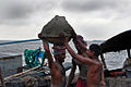
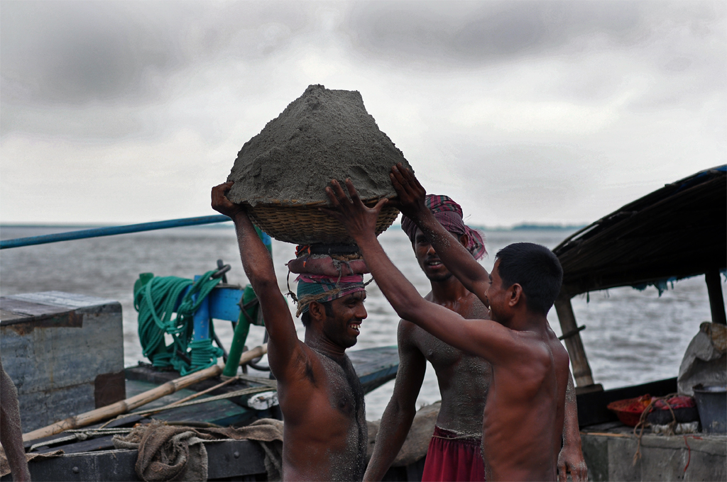
Sand Collectors at work in Aricha Ghat, Manikgonj.
-
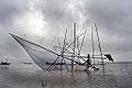
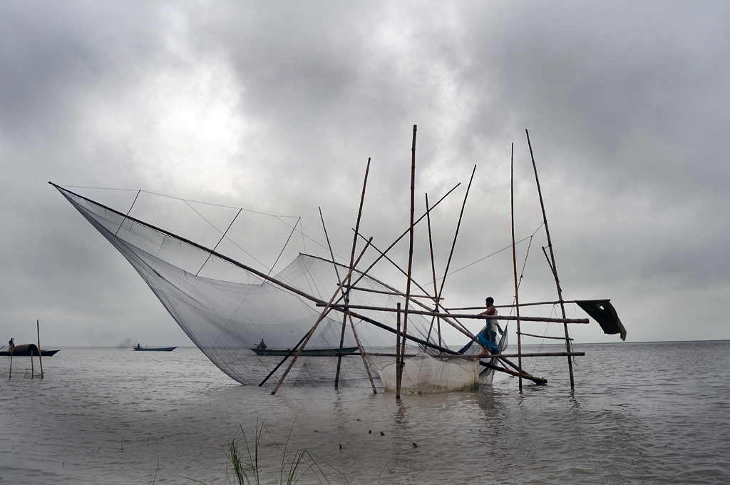
A local fisherman at Aricha Ghat, Manikganj using a unique, home-brewe fishing contraption on the river Padma
References
1. Banglapedia.
See also
 Divisions and districts of Bangladesh
Barisal Division 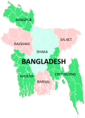
Chittagong Division Bandarban · Brahmanbaria · Chandpur · Chittagong · Comilla · Cox's Bazar · Feni · Khagrachari · Lakshmipur · Noakhali · RangamatiDhaka Division Dhaka · Faridpur · Gazipur · Gopalganj · Jamalpur · Kishoreganj · Madaripur · Manikgonj · Munshiganj · Mymensingh · Narayanganj · Narsingdi · Netrokona · Rajbari · Shariatpur · Sherpur · TangailKhulna Division Rajshahi Division Rangpur Division Sylhet Division Categories:

Wikimedia Foundation. 2010.