- Dhamrai Upazila
-
Dhamrai,Dhaka
ধামরাই— Upazila — Location in Bangladesh
 Dhamrai,Dhaka
Coordinates: 23°54.5′N 90°13′E / 23.9083°N 90.217°ECoordinates: 23°54.5′N 90°13′E / 23.9083°N 90.217°E Country  Bangladesh
Division Dhaka Division District Dhaka District Area – Total 307.4 km2 (118.7 sq mi) Population (1991) – Total 312,777 – Density 1,017/km2 (2,634/sq mi) Time zone BST (UTC+6) Website Official Map of Dhamrai Dhamrai (Bengali: ধামরাই) is an Upazila of Dhaka District in the Division of Dhaka, Bangladesh.
Contents
Geography
Dhamrai is located at 23°54′30″N 90°13′00″E / 23.9083°N 90.2167°E. It has 57297 units of household. The total area 307.4 km².[1]
Demographics
At the 1991 Bangladesh census, Dhamrai had a population of 312,777. Males constituted 50.37% of the population, and females constituted 49.63%. The population of citizens 18 years and older was 163,449. Dhamrai had an average literacy rate of 29.5% (7+ years), lower than the national average of 32.4%.[2]
Administrative
Dhamrai has 16 Unions/Wards, 281 Mauzas/Mahallas/Mouzas, and 398 villages.[1]
Culture
The annual Jagannath Rathyatra is a famous Hindu festival attracting thousands of people. It starts on the last day of Choitro, the last month of Bangla calendar.
Dhamrai is also popular for Chaitali Mela.
Dhamrai is famous for craftsmen making metal idols by the lost wax casting (cire perdue) method.
See also
References
- ^ a b Md Ilias Uddin. "Dhamrai Upazila". In Sirajul Islam. Banglapedia: National Encyclopedia of Bangladesh. Asiatic Society of Bangladesh. http://www.banglapedia.org/httpdocs/HT/D_0182.HTM.
- ^ "Population Census Wing, BBS.". Archived from the original on 2005-03-27. http://web.archive.org/web/20050327072826/http://www.bangladeshgov.org/mop/ndb/arpc91_v1/tables04.htm. Retrieved November 10, 2006.
 Upazilas of the Dhaka DivisionCapital: Dhaka
Dhaka District 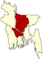
Faridpur District Gazipur District Gopalganj District Jamalpur District Kishoreganj District Astagram · Bajitpur · Bhairab · Hossainpur · Itna · Karimganj · Katiadi · Kishoreganj · Kuliarchar · Mithamain · Nikli · Pakundia · TarailMadaripur District Manikganj District Munshiganj District Mymensingh District Bhaluka · Dhobaura · Phulbari · Gaffargaon · Gauripur · Haluaghat · Ishwargan Mymensingh · Muktagachha · Nandail · Phulpur TrishalNarayanganj District Narsingdi District Netrokona District Atpara · Barhatta · Durgapur · Khaliajuri · Kalmakanda · Kendua · Madan · Mohanganj · Netrokona · PurbadhalaRajbari District Shariatpur District Sherpur District Tangail District
Categories:- Upazilas of Dhaka District
- Dhaka Division geography stubs


Wikimedia Foundation. 2010.