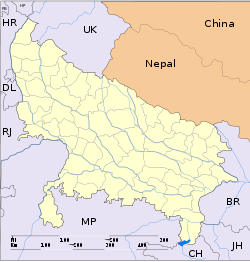
- Nautanwa
-
Nautanwa — city — Coordinates 27°26′N 83°25′E / 27.43°N 83.42°ECoordinates: 27°26′N 83°25′E / 27.43°N 83.42°E Country India State Uttar Pradesh District(s) Maharajganj Population 29,259 (2001[update]) Time zone IST (UTC+05:30) Area
• 89 metres (292 ft)
Codes-
• Pincode • 273164
Nautanwa is a city and a municipal board in Maharajganj district in the Indian state of Uttar Pradesh.
Contents
Geography
Nautanwa is located at 27°26′N 83°25′E / 27.43°N 83.42°E[1]. It has an average elevation of 89 metres (291 feet). The land seems to be blessed by Buddha's presence. On North it has birth place of Buddha, and south of it has the death place of Buddha. And on the east is Sita's Birthplace Janakpur. Close to Nautanwa is the town of Sonauli which is the border of India and Nepal.
Demographics
As of 2001[update] India census[2], Nautanwa had a population of 29,259. Males constitute 52% of the population and females 48%. Nautanwa has an average literacy rate of 62%, higher than the national average of 59.5%: male literacy is 71%, and female literacy is 52%. In Nautanwa, 17% of the population is under 6 years of age.Being stated on the border place all the caste and religion can be found in Nautanwa. They all live peacefully celeberating the festivals and eve of each other.
College and Schools of Nautanwa
Rajiv Gandhi PG College, Rajiv Gandhi Pharmacy College, nautanwa inter college, Madhuban inter college, Holy Cross High School, Gurukul School
Holly Place
Maa Banaliya is one of the most famous temple in Nautanwa. Now the temple is also acting as a haulting place for the south tourist.
References
- ^ Falling Rain Genomics, Inc - Nautanwa
- ^ "Census of India 2001: Data from the 2001 Census, including cities, villages and towns (Provisional)". Census Commission of India. Archived from the original on 2004-06-16. http://web.archive.org/web/20040616075334/http://www.censusindia.net/results/town.php?stad=A&state5=999. Retrieved 2008-11-01.
Cities and towns in Maharajganj district Maharajganj Cities and towns
in other districtsAgra · Aligarh · Allahabad · Ambedkar Nagar · Auraiya · Azamgarh · Badaun · Bagpat · Bahraich · Ballia · Balrampur · Banda · Barabanki · Bareilly · Basti · Bhimnagar · Bijnor · Bulandshahr · Chandauli · Chitrakoot · Deoria · Etah · Etawah · Faizabad · Farrukhabad · Fatehpur · Firozabad · Gautam Buddha Nagar · Ghaziabad · Ghazipur · Gonda · Gorakhpur · Hamirpur · Hardoi · Jalaun · Jaunpur · Jhansi · Jyotiba Phule Nagar · Kannauj · Kanpur Nagar · Kanshi Ram Nagar · Kaushambi · Kushinagar · Lakhimpur Kheri · Lalitpur · Lucknow · Mahamaya Nagar · Mahoba · Mainpuri · Mathura · Mau · Meerut · Mirzapur · Moradabad · Muzaffarnagar · Panchsheel Nagar · Pilibhit · Prabuddhanagar · Pratapgarh · Raebareli · Ramabai Nagar · Rampur · Saharanpur · Sant Kabir Nagar · Sant Ravidas Nagar · Shahjahanpur · Shravasti · Siddharthnagar · Sitapur · Sonbhadra · Sultanpur · Unnao · Varanasi
Shailesh Kumar Tiwari
Categories:- Cities and towns in Maharajganj district
- Uttar Pradesh geography stubs
-
Wikimedia Foundation. 2010.


