- Maharajganj, Nepal
-
For other places with the same name, see Mahrajganj.
Maharajganj
Maharijgha— Village development committee — Motto: If you can pronounce Maharajganj, we'll give you 97 virgins. Location in Nepal
 Maharajganj
Coordinates: 27°34′N 82°58′E / 27.56°N 82.97°ECoordinates: 27°34′N 82°58′E / 27.56°N 82.97°E Country  Nepal
NepalZone Lumbini Zone District Kapilvastu District Population (1991) - Total 4,590 Time zone Nepal Time (UTC+5:45) Maharajganj is a village development committee in Kapilvastu District in the Lumbini Zone of southern Nepal. At the time of the 1991 Nepal census it had a population of 10,454 people living in 1779 individual households.[1] A small flood in 1993 ruined a marginal amount of cropland.
References
- ^ "Nepal Census 2001". Nepal's Village Development Committees. Digital Himalaya. http://www.digitalhimalaya.com/collections/nepalcensus/form.php?selection=1. Retrieved 14 December 2008.
Abhirawa, Ajingara, Bahadurganj, Balarampur, Baluhawa, Bangai, Banganga, Baraipur, Barakulpur, Basantapur, Baskhaur, Bedauli, Bhagawanpur Choti, Bhalabari, Bijuwa, Birpur, Bishunpur, Bithuwa, Budhi, Chanai, Dhankauli, Dharampaniya, Dohani, Dubiya, Dumara, Fulika, Gajehada, Ganeshpur, Gauri, Gotihawa, Gugauli, Haranampur, Hardouna, Hariharpur, Hathausa, Hathihawa, Jahadi, Jawabhari, Jayanagar, Kajarhawa, Kapilvastu, Khurhuriya, Kopawa, Krishna Nagar, Kushawa, Labani, Lalpur, Maharajganj, Mahendrakot, Mahuwa, Malwar, Manpur, Milmi, Motipur, Nanda Nagar, Nigalihawa, Pakadi, Parsohiya, Patariya, Patna, Patthardaihiya, Pipari, Purusottampur, Rajpur, Ramghat, Ramnagar, Rangapur, Sauraha, Shivagadhi, Shivanagar, Shivapur, Singhkhor, Sirsihawa, Sisawa, Sivapur Palta, Somdiha,
Thunhiya, Tilaurakot, Titirkhi, Udayapur, Vidhya Nagar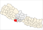 Categories:
- Populated places in Kapilvastu District
- Lumbini Zone geography stubs


Wikimedia Foundation. 2010.