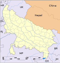
- Miranpur
-
Miranpur — city — Coordinates 29°18′N 77°56′E / 29.3°N 77.93°ECoordinates: 29°18′N 77°56′E / 29.3°N 77.93°E Country India State Uttar Pradesh District(s) Muzaffarnagar Population 26,101 (2001[update]) Time zone IST (UTC+05:30) Area
• 230 metres (750 ft)
Miranpur is a town and a nagar panchayat in Muzaffarnagar district in the Indian state of Uttar Pradesh. Miranpur is a noted for a temple of Jainism's twentieth Thirthankar Munisuvrata.[citation needed]
Contents
Demographics
As of 2001[update] India census,[1] Miranpur had a population of 26,101. Males constitute 53% of the population and females 47%. Miranpur has an average literacy rate of 53%, lower than the national average of 59.5%: male literacy is 61%, and female literacy is 45%. In Miranpur, 19% of the population is under 6 years of age.
Geography
Founded by Sayyed Miran in medivial period after his name. The town is located in southern Muzaffarnagar District, between Jasnath and Bijnor at the junction of the Delhi Pauri National highway and Panipat Khatima State Highway. Muzaffarnagar, the district headquarters, is about 33 km north of Miranpur.
Economics
Miranpur is primarily farm land, with large mango orchards being the most significant crop.[citation needed]
References
- ^ "Census of India 2001: Data from the 2001 Census, including cities, villages and towns (Provisional)". Census Commission of India. Archived from the original on 2004-06-16. http://web.archive.org/web/20040616075334/http://www.censusindia.net/results/town.php?stad=A&state5=999. Retrieved 2008-11-01.
Historical regions of Rohilkhand Bareilly district Pilibhit district Rampur district Shahjahanpur district Moradabad district Badaun district Lakhimpur Kheri district Categories:- Cities and towns in Muzaffarnagar district
- Uttar Pradesh geography stubs
Wikimedia Foundation. 2010.


