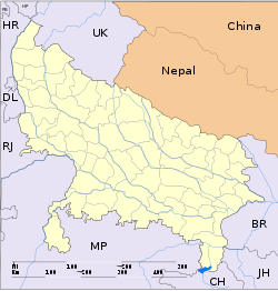
- Nawabganj, Bareilly
-
For other places with the same name, see Nawabganj (disambiguation).
Nawabganj — town — Coordinates 28°32′24″N 79°37′59″E / 28.540°N 79.633°ECoordinates: 28°32′24″N 79°37′59″E / 28.540°N 79.633°E Country India State Uttar Pradesh District(s) Bareilly Population 30,601 (2001[update]) Time zone IST (UTC+05:30) Area
• 393 metres (1,289 ft)
Codes-
• Vehicle • ua 25
Nawabganj is a city and a municipal board in Bareilly district in the Indian state of Uttar Pradesh.
There are forests nearby. The population of town is 30,000.
Demographics
Nawabganj is situated on National Highway 74 between the cities of Bareilly and Pilibhit. The nearest railway station is Bijauria.
The literacy rate is 63%. Male literacy is 72% and female literacy is 54%.[citation needed]
The languages spoken are Hindi, Urdu, Punjabi and English. Khariboli is also spoken.
Hindus and Muslims live there.
Sugarcane,Paddy and wheat are the main crops.
Tourism
Nearby points of interest include:
- Bareilly (32 km)
- Nainital (142 km)
- Pilibhit (21 km)
- Dudhwa National Park (120 km)
References
Historical regions of Rohilkhand Bareilly district Bareilly · NawabganjPilibhit district Rampur district Shahjahanpur district Moradabad district Badaun district Lakhimpur Kheri district Categories:- Cities and towns in Bareilly district
- Bareilly division geography stubs
-
Wikimedia Foundation. 2010.


