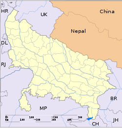
- Nawabganj, Barabanki
-
Nawabganj
नवाबगंज
نوابگنج— city — Coordinates 26°56′N 81°11′E / 26.94°N 81.19°ECoordinates: 26°56′N 81°11′E / 26.94°N 81.19°E Country India State Uttar Pradesh District(s) Barabanki Chairman Hafeez Bharti Population 806,929[1] (2001[update]) Official languages Hindi, Urdu Time zone IST (UTC+05:30) Area
• 93 metres (305 ft)
Website http://nppnawabganj.in/ Nawabganj is a town in Barabanki district in the state of Uttar Pradesh, India.It is a tehsil and nagar parishad for Barabanki town[2]. It is one of the constituent entities of Barabanki city, which is District HQ of Barabanki district.
Contents
Geography
Nawabganj is located at 26°56′N 81°11′E / 26.94°N 81.19°E. It has an average elevation of 93 metres (305 feet).
Demographics
As of 2001[update] India census[3], Nawabganj had a population of 75,087. Males constitute 52% of the population and females 48%. Nawabganj has an average literacy rate of 66%, higher than the national average of 59.5%: male literacy is 70%, and female literacy is 62%. In Nawabganj, 12% of the population is under 6 years of age.
Administration
Tehsil Nawabganj
Tehsil Nawabganj has 4 Block panchayats[4], they are:
Nagar Parishad Nawabganj
The Municipal Board Nawabganj, Barabanki, was the first to be constituted in the district and came in to existence on 16 July 1884, under the North-Western provinces and Oudh Municipalities Act, 1883. It had Nine members of whom four were elected, the rest including the chairman were nominated officials, later it came to be administered under the North-Western provineces and Oudh Municipalities Act, 1883. Its affairs were managed by a board of 09 members and a Chairman, who used to be the Deputy Commissinoer. The income of the board was derived mainly from house tax, boll tax and tax on weigh man and brokers. Other sources of income included octori, license fee, rent, tahbazari and fines. However the U.P. Municiplalities Act 1916 liberalised the municipal constitution, introduced communal representation and relaxed government control over the finances of nagar palika.
Nagar Palika Parishad, Nawabganj, Barabanki has been put under the category of first-class board, covering an area of 12 km². Comprising a population of 75,741 according to census 2001. There are seventeen substantive post of certralised services, thirty-two post of 3rd graded employees and 362 of all category of fourth-class employees, in this Palika. It consists of seven sections for providing civic amenities to its citizens, they are:
- Revenue Section
- Public Works Section
- Health and Sanitation Section
- Water Works
- Street Light
- Nazul
- Accounts, Establishment & Records
Nagar Palika Parishad Nawabganj has 25 wards[5], they are:
Ward No. 'Name' Population(2001) 1 Gandhi Nagar 3148 2 Valmiki Nagar 5309 3 Peer Batawan Saravgi 1913 4 Begumganj Saravgi 3060 5 Kanoongoyan Poorvi 3000 6 Poorvi Peerbatawan 3180 7 Police Line 2259 8 Lajpat Nagar 2216 9 Gularia Gaarda 2782 10 Azad Nagar 3208 11 Kanoongoyan 2574 12 Tehsil Colony 2948 13 Katra Baradari 2969 14 Satypremi Nagar 2103 15 Kailash Ashram 3412 16 Durgapuri 3788 17 Nehru Nagar 2680 18 Munshiganj 1882 19 Bheetri Peerbatawan 4526 20 Barhiyan Tola 3174 21 Barhiyan Pashchimi 3253 22 Dushehrabagh 4603 23 Bheetri Poorvi 3424 24 Saravgi 1489 25 Rasoolpur 2591 Health infrastructure
Tehsil Nawabganj has following health infrastructure[6]:
- Health centres – 7
- PHCs – 8
- Sub centres – 17
References
- ^ [1] Nawabganj Population
- ^ [2] Barabanki Information on District Administration
- ^ "Census of India 2001: Data from the 2001 Census, including cities, villages and towns (Provisional)". Census Commission of India. Archived from the original on 2004-06-16. http://web.archive.org/web/20040616075334/http://www.censusindia.net/results/town.php?stad=A&state5=999. Retrieved 2008-11-01.
- ^ http://www.indiademographics.com/india/Villages/population.asp?tname=25480030Nawabganj&secid=10936] Population
- ^ http://nppnawabganj.in/population.aspx
- ^ http://jsk.gov.in/hindi/up/up_barabanki.pdf
Categories:- Cities and towns in Barabanki district
- Uttar Pradesh geography stubs
Wikimedia Foundation. 2010.


