- Pilibhit
Infobox Indian Jurisdiction
native_name = Pilibhit
base_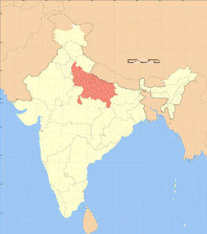
other_name = पीलीभीत
پیلی بھیت
type = District HQ
type_2 = City
State = Uttar Pradesh
Country = India
latd = 28.623
longd = 80.274
skyline =
skyline_caption =
locator_position = right
state_name = Uttar Pradesh
division =Bareilly
region =Rohilkhand
district = Pilibhit
altitude = 172
population_as_of = 2001
population_rank_in_state = 38
population_total = 16,45,183
population_cite = 1,62,625
population_density = 469.51
population_cite = 4279.60
sex_ratio = 877 female per 1000 male
area_total = 3504
area_cite = 38
distance_1 = 274
direction_1 = NW
destination_1 = New Delhi
mode_1 = land
distance_2 = 270
direction_2 = SE
destination_2 = Lucknow
mode_2 = land
area_telephone = 05882
postal_code = 262001
vehicle_code_range = UP-26
unlocode = IN-PBT
inset_map_marker = Yes
base_map_label = Yes
map_caption = Pilibhit District HQ
portal = www.districts.gov.in
website = www.pilibhit.nic.in
footnotes = The word 'Pilibhit' means 'A Wall of Yellow Mud'(English:Pilibhit,
Hindi :पीलीभीत,Urdu :پیلی بھیت,Telugu :పిలిభిట్,Tamil :பிளிப்திட்,Kannada :ಪಿಲಿಭಿತ್,Malayalam :പിളിഭിട്ട്,Gujrati :પિલિભિત,Bengali :পিলিভিট্,Oriya :ପିଲିଭିଟ୍ ,Punjabi :ਪਿਲਿਭਿਟ੍,Nepali :पिलिभित,Marathi :पिलिभिટ્ )Pilibhit audio|Pilibhit.ogg|pronunciation is a city and a
municipal board in Pilibhit district in theIndia n state ofUttar Pradesh . Pilibhit is the north-eastern most district ofBareilly division , which is situated inRohilkhand region of the sub Himalayan belt on the boundary ofNepal . According toGovernment of India , the district Pilibhit is one of theMinority Concentrated Districts in India on the basis of the 2001 census data on population, socio-economic indicators and basic amenities indicators. [http://pib.nic.in/release/release.asp?relid=28770]Geography
Pilibhit lies between the parallels of 2806' and 28053' north latitude and the meridians of 79057' and 80027' east longitude. In the north side of the district is covered by
Udham Singh Nagar ofUttarakhand state, along with the territory ofNepal , andShahjahanpur lies in the south side Pilibhit district, on the east the district is flanked for a short distance byLakhimpur Kheri and the remaining distance is swathed by theShahjahanpur and on the west the district toches the limits ofBareilly .In its general appearance the district presents diverse features and topographically may be divided into several distinct tracts. In the north and north-west the tract is a continuation of the Terai. The southern portion of the
Bisalpur tehsil is similar in most respect to the adjacent tract ofBareilly andShahjahanpur . The eastern and smaller section approximates rather to undeveloped forest areas ofLakhimpur Kheri , though with the spread of cultivation the dissimilarity betweenPuranpur and the rest of the district is gradually becoming less marked. There are 1227Villages in the district Pilibhit , out of which 964 are electrified.The district has more than 10 small to medium sized rivers amd 9 small to medium sized water bodies. The origin of river
Gomti , Gumti or Gomati ( _hi. गोमती), which is atributary of theGanges River , is from a small lake Gomat Taal situated in Madhotnada in thePuranpur tehsil region. [http://timesofindia.indiatimes.com/articleshow/1924395.cms] Another important river in the district isRiver Sharda ( _hi. शारदा नदी), which runs through on the eastern part of the district. The city Pilibhit receives water from the river Devhahuti Ganga or Devha ( _hi. देवहुति गंगा or देवहा) the north - west side of the city and the river Ghaghra or Khakra ( _hi. घाघरा or खाकरा) on the north-east side of the city. Pilibhit city also have a few water bodies in its limits, one being onTanakpur road in front of Dramond college gate, another being at the Degree College chauraha. Every year during winters this water body attracts thousands of migratory birds. The main source of water in the district is the ground water and the canals. District Pilibhit is swathed by a big net of canals. The district has 6 main feeders or canals, which run through almost 138 km in the district.Major part of Pilibhit District is covered by dense forest. Total 78,478 hectare is forest. [http://pilibhit.nic.in/discover.htm] Till 1978, 63% area of the district was a dense forest, but deforestation has scaled done the total forest cover to 23% in 2004. [http://sevakindia.org/environment_wildlife.html] The Sharda canal is the main canal of the district, the others being its branches. Total length of canals in the district is 138 km. Apart from the canal system, district also has a few water bodies, which are being using for agriculture purposes.
The National Highway No. 74 runs through the district in order to connect
Haridwar toBareilly via Kiccha,Kashipur andNagina city. Apart from National Highway, The district is well connected withShahjahanpur in south,Lakhimpur Kheri and Indian International Border (IIB) with the territory ofNepal in east,Nanital and town Khatima in north, and the city ofBareilly in the west by roadways and Rail ways. The district of Pilibhit also has several places of religious importance in or around the district. A mainGurudwara ofSikh community is placed in Nanakmatta town around 46 KM from the city. [http://www.sikhiwiki.org/index.php/Gurdwara_Nanakmata]One of the biggest and the most important temple of the region, Sri Purnagiri Temple is in the nearby
Champawat district ofUttaranchal . Thousands of lakhs of people from the holes and corners ofUttar Pradesh comes to this temple and Pilibhit is one of the halting point for the pilgrims.Demographics
IndiaCensusPop
title= Population Growth of District Pilibhit [http://upgov.nic.in/upinfo/census01/cen01-8.htm]
1901= 470369
1911= 487632
1921= 431604
1931= 448824
1941= 490699
1951= 504391
1961= 616301
1971= 752151
1981= 1008332
1991= 1283103
2001= 1645183
estimate= 2064869
estyear= 2011
estref= [http://nrlp.iwmi.org/PDocs/DReports/Phase_01/01.a.Demographic%20Projections%20-%20Aslam%20Mahmood.pdf]
footnote=
Source : [http://upgov.nic.in/upinfo/census01/cen01-8.htm http://upgov.nic.in/]As of 2001 India
census , [http://www.censusindia.gov.in/Dist_File/datasheet-0921.pdf] District Pilibhit had a population of 16,45,183 [http://india.gov.in/knowindia/districts/andhra1.php?stateid=UP] occupying 38th position in theDistricts of Uttar Pradesh . Males constitute 53.26% of the population and females 46.73%. Pilibhit has an average literacy rate of 49.81%, lower than the national average of 59.5%, male literacy is 62.49%, and female literacy is 35.11%. In Pilibhit, 13% of the population is under 6 years of age. Population of district Pilibhit for 2011 has been estimated as many as 20,64,869 by a study done inJawaharlal Nehru University ,New Delhi .According to the central statistical organization, the district Pilibhit had an area of 3504 km2 on Sept 1, 2007, occupying 33th position in the state and the total area of the pilibhit city is 38.76 Km2. Pilibhit city has much higer population density than the rest of district. The population density of the city is 4279.60 per km2, on the other hand the district has only 469.51 per Km2.
Prior to the abolition of
zamindari the zamindars owned large tracts of arable and forest land. The farm labour was brought from easternUttar Pradesh andBihar . Afterzamindari was abolished the excess cultivable land was distributed amongst the landless agricultural labour. In the post independence period large number of displaced persons fromPakistan were settled in the area. They were provided cultivable land mainly by clearing private forests. Large tracts were cleared and wetlands were drained and brought under the plough. The inhabitants of the landscape generally belong to the following major groups – those from easternUttar Pradesh , those fromPakistan includingPunjabis andBengalis , migrants from Punjab and the locals.The common property lands and resources are worst affected in
Puranpur tehsil. The population density of the tehsil has increased considerably over the last two decades. The population groups constantly endeavour to maintain their interests and identity. The immigrant labour and theBengalis are the weakest economically but have a growing political clout. ThePunjabi displaced persons and migrants are financially the strongest and wield considerable political clout. [http://www.pingalwaraonline.org/articles/articles_mason.htm] The locals are always anxious to safeguard their interests against the immigrants. The locals are strongest in the process of decision making.Amongst the locals are also the
Thar u tribals. [http://h.ebharat.in/tharu-rana] They are settled cultivators, keep large herd ofcattle , somesheep andgoat s. They have a distinct cultural identity. There are someTharu villages in the proximity of Katerniyaghat Sanctuary. They are related to theTharu s in the terai areas ofNepal . TheTharu s depend on the forests for food, fodder, medicine, small timber for construction of huts and agricultural implements, handicrafts, social and religious ceremonies. The majorTharu groups include the Ranas, Dingoras and Katharias. Marriages between these groups are very uncommon. Once their habitations were forest villages but now these are revenue villages. The tribal area development schemes have benefited these people. They have adopted modern farming techniques and have slowly shifted from subsistence level farming to raising cash crops. Some now own tractor and other farm implements. The eco development initiatives have largely focused on theseTharu villages.Climate
climate chart
Pilibhit
4.0|14.1|7
9.6|20.6|24
14.4|29.2|30
22.6|35.8|46
30.7|38.9|81
34.2|41.9|121
32.5|39.5|132
27.4|36.4|140
25.0|34.3|110
19.7|30.1|31
13.6|20.2|23
5.9|10.6|12
35.0|42.2|723
float=right
clear=both
units=mmPilibhit experiences three distinct seasons: summer,
monsoon and winter. Typical summer months are from March end to June, with maximum temperatures ranging from convert|36|°C|°F|0 to convert|42|°C|°F|0. Contrary to most of the Himalyan Plateau where June is the warmest month, the warmest months in Pilibhit is May. The city starts receiving heavy thundershowers with sharp downpours in Mid June. Though the temperatures plunge in this month, the summer heat accompanied by high humidity can be occasionally quite oppressive.Monsoon winds blowing from the south India are a welcome relief in mid of June, bringing with them heavy showers in July, August. Pilibhit receives excessive rainfall in the month of August & September. The city receives an annual rainfall of 723 mm, mainly between June and September as the result of southwest monsoon. August is the wettest month of the year. The spells of continuous rainfall may stretch to many days or even a few weeks. Pilibhit has, on record, received rainfall for 17 consecutive days (days when rainfall is greater than 21.7 mm) in 1967.As the monsoon winds recede, the day temperatures starts decline in October with cooler nights signalling the onset of winter. Pilibhit experiences winter from November to February. it experience pleasant windy days, clear skies and cool nights in the month of November till February ends, Which makes it the most enjoyable time of the year. The day temperature hovers around convert|14|°C|°F|0 while night temperature is below convert|7|°C|°F|0 for most of December and January, often dropping to convert|3|°C|°F|0 or convert|4|°C|°F|0. On particularly cold days, wind may appear to be very chilly due to the dryness of air.
Rain is very expected in month of February. [http://www.wunderground.com/auto/virtuallythere/global/stations/42190.html]Reported Climatic Variations: [http://www.imd.ernet.in/main_new.htm]
* The highest temperature recorded in district Pilibhit was convert|48.5|°C|°F|0 on 29 May 1989.
* The lowest temperature recorded in district Pilibhit was convert|-0.2|°C|°F|0) on 17 January 1949.
* District Pilibhit has received snow fall once in Jan 1949, which was the coolest year in the region. The temperature reached below zero this year in the region.Etymology
The city Pilibhit derived its name from a near by small village name 'Old Pilibhit', whose existence has been traced in mid of 15th Century, this village still exist on the bank of the river Ghaghra or Khakra in the north-east from the city on the way to
Nyoria Husainpur town. It is believed and as official documents say, this village was occupied by theBhanjara (Local community) of Periya clan, which used to live in the houses, made of mud and other raw material, available in the forest. This community made a wall of yellow mud around their locality in order to secure their house from wild animal, as that area was a dense forest, so the people use to call the locality as Pili (Yellow)- Bhit (Wall). Eventually, the nearest town (present city) adopted the name as 'Pilibhit'. According to a document fromBritish Library 'the city Pilibhit' has its existence when in the late 18th century (1770-1780 AC)Maratha s invaded theRohilkhand region. With this invasion,Kurmi community came to this region and in the due course of time, the city Pilibhit enlarged it boundaries. [http://banjaratimes.com/18022/18127.html? *session*id*key*=*session*id*val*/] Another evidence of the city existence is found in anNepali literture, which metions a city named as Pilibhit, which provided shelter to the last king ofShah dynasty , Deepa Shah, who was attacked by theGorakha King in 1789 AD. [http://www.indus-intl.com/bookdetails.cfm?bookid=IN-02404] TheRohella rulerHafiz Rahmat Khan , aPashtun ancestor ofAfgan s in the area, developed Pilibhit as an city and administrative unit .History
In 1801 when
Rohilkhand was ceded to the British, Pilibhit was a pargana of the district ofBareilly , which lost it in 1833, the arrangement being temporary and the tract being again united withBareilly in 1841. In 1871 was formed the Pilibhit subdivision comprising Jahanabad, Pilibhit andPuranpur which was eventually converted into a separate district in 1879. At the introduction of the British rule the parganas of Pilibhit, Jahanabad &Bisalpur was formed into separate tehsils.Puranpur was united for this purpose with Khutar. A redistribution of the area was effected in 1824, when theBisalpur tehsil contained the parganas ofBisalpur and Maurari, which afterward become a single area; Jahanabad was joined with Richha to form tehsil Pareva & Pilibhit with Bilheri, the HQ being at Pilibhit. In 1851 Bilheri and the other tarai pargana were taken under direct management and in 1863 Richha was attached to the new Baheri tehsil, pargana Jahanabad being assigned to Pilibhit which also receivedPuranpur on its transfer in 1865. The latter, in 1871, a became subtehsil dependent on Pilibhit. The promotion ofPuranpur into a full tehsil occurred in 1879, whileBisalpur throughout remained a separate subdivision. Thus the area is now divided into three tehsils and four parganas.Puranpur &Bisalpur constituting individual tehsils and parganas & the tehsil of Pilibhit comprising the paraganas of Pilibhit and Jahanabad. [http://pilibhit.nic.in/discover.htm]Rare Historical Facts about Pilibhit
1. It is believed that Pilibhit was ruled by a ancient king named Mayurdhwaja or Moredheaja, who were a great devotee of lord
Krishna and a loyal friend ofArjun , whose name and geography of his kingdom, can be traced in Hindu epicMahabharat .2. Pilibhit was invaded by the
Maratha s in 1772 AC. This was the time when theKurmi Community came in this region. TheMaratha s were the ancestor ofKurmi community, which is one of the major community in the region. [http://www.reallifelog.com/labana/History_P2/]3.The last king of Shah dynasty of
Nepal got shalter in Pilibhit by ruler ofRampur subaFaizullah Khan in 1789 AC, when he was attacked byGorakha king ofNepal . [http://www.indus-intl.com/bookdetails.cfm?bookid=IN-02404]4. The city Pilibhit was an administrative unit in the
Mughal era underBareilly suba, so for the security purpose, TheMughal subedarAli Mohammed Khan constructed four magnificent gate around the administrative building in 1734 AC. These gate were named asBareilly darwaza in west, Hussaini darwaza in east, Jahanabadi darwaza in north and Dakhini darwaza in south, but due to lack of proper maintainence, all gate have been lost, only ruins are remaining now. [ for further reference, please read http://www.ingentaconnect.com/content/brill/sho/1996/00000039/00000004/art00019]5. The freedom fighter Maulana Enayetulla was from Pilibhit. Who voluntarily played host in exile of Queen of
Avadh ,Begum Hazrat Mahal to reachNepal in late 1859. [http://oudh.tripod.com/bhm/bhmvalq.htm] [http://oudh.tripod.com/bq/lastking.htm]6. There is one memorial place at Khakra chouki (Current police chouki), where 21 freedom fighter were hanged on 14 Jan 1907, monday, on the day of
Makar Sankranti , Who denied to follow English government orders and rebelled against them. In the respect of these 21 Martyrs, a rock (named all martyrs) has been founded in the compound of police chouki.7.
Mahatama Gandhi addressed a huge rally on 12 Nov 1929 in the field of Gauri Shankar temple along with Kasturba and Mirabehn and planted a tree in the temple campus which is still there in the temple. [Please check Chronology for Nov'29 ]8. Due to dense minority population, Pilibhit district is a communally sensitive area. Pilibhit also has seen many man created calamities. some of major in last 150 years are as -
The Deadly Ethnic Riots
Where to stay
5. Suroor Jahanabadi
The pre independence political turmoil, and the social consciousness and the national awakening during the last decade of nineteenth century inspired the Surror Hahanabadi (Full and real name Munshi Shri Durga das Sahai) a promintant poet, to compose poems of very high standards, suffused with patriotic sentiments. He was born in a poorkayastha family of town Jahanbad in Pilibhit district in 1873. His famous collections of Urdu poems are Jama-i-suroor (1911) and Khumkhana-i-surror (1930-posthumous). Some other famous plays written by surror Jahanabadi are Ruksat-i-Shaheb, Gul-i-firdaus, Diwwar-i-khoon. He died in the year of 1911 on day ofHoli .6. Fateh Singh Vatsayan
TheHindi andSanskrit Scholar was born in the Pilibhit city on 13 Jan 1913. He has served 41 years as aHindi andSanskrit Prof in various university in India. Presently he is living in Jodhpur with his family. This nonogenarian was honoured by prestigeous National Literture Award by thePresident of India in 1966 for his work Kamayani Sundarya. He also has received various awards and honours from various state governments and organizations. His famous work is Kamayani Sundarya, Sahitya aur Sundarya, Bhartiya Smaj Sashtra, Dayanad Aur unka Ved Bhasya.Industry & Agriculture
The district Pilibhit has an agriculture-based economy. It has a very furtile land, but it is a bit backward in the area of industry, and has no
mineral extraction area. The industry in the district is mainly based on agricuture. Since main crop in this area issugarcane , So there are four sugar factories at Majhola,Puranpur ,Bisalpur and Pilibhit. Three factories are in co-operative sector and one at Pilibhit is in private sector. The Lalit Hari Sugar Factory is the largest among them. Now, in year 2005-06, The Bajaj Industry has come up with Bajaj Hindustan Sugar factory Ltd, inBarkhera area of the district. Apart from this, District has a few cottage industries too, Main cottage industries are Wooden or Bamboo flute manufacturing, engineering units, brick klins, candles and zari work. The flute made in Pilibhit has a big international demand. These flutes are exported toUS ,Europe ,Japan ,Canada ,UAE and theAfrican countries. Other major units are three solvent plants, four flour mills, one steel plant (a few km from the City) and one Alcohol Distillery in Majhola town.Sugar Mills in District
Members of Legislative Assembly - Uttar Pradesh
Pilibhit Legislative Assembly Constituency Code = 41
Bisalpur Legislative Assembly Constituency Code = 43
Puranpur Legislative Assembly Constituency Code = 44
Barkhera Legislative Assembly Constituency Code = 42Barkhera Legislative Assembly Constituency came into existence in 1967.Minority Populations [www.upw.bsnl.co.in/uso/pilibhit.xls] ( As in Sept, 2007)
Administrative Set up (2007-08)
No. of Town (As in Sept, 2007)
Railways (As in Sept, 2007)
Banks (As in Sept, 2007)
Agriculture Production (As in Sept, 2007)
Dairy (As in Sept, 2007)
Education (As in Sept, 2007)
Total Roads (As in Sept, 2007)
Cinemas (As in Sept, 2007)
Facts about Pilibhit District
Rivers in Pilibhit District
Blocks in Pilibhit District
Main Roads in City
Pin Codes of Various Areas
Area wise PIN codes are as follows. [http://www.whereincity.com/india/pincode/uttar-pradesh/pilibhit.htm] [http://india.gov.in/outerwin.htm?id=http://www.indiapost.gov.in/pinsearch1.asp]
ee also
*Barkhera
*Bilsanda
*Bisalpur
*Gularia Bhindara
*Kalinagar
*Nyoria Husainpur
*Pilibhit - Lok Sabha Constituency
*Pilibhit District - Vidhan Sabha Constituencies
*Pilibhit District - List of Villages
*Pilibhit Tiger Reserve
*Puranpur Further reading
* Harvard reference
Surname1 = William Crooke
Given1 = P
Year = 1999
Edition = 3
title=The Tribes and Castes of the North-Western Provinces and Oudh
publisher= Asian Educational Services
ISBN=8120612108
* Harvard reference
Surname1 = P. C. Kanjilal
Given1 = P
Year = 1982
Edition = 5
title=A Forest Flora for Pilibhit, Oudh, Gorakhpur, and Bundelkhand
publisher= Narendra Pub. House
* Harvard reference
Surname1 = Basil Leonard Clyde Johnson
Given1 = P
Year = 1979
Edition = 6
title=India,: Resources and Development
publisher= Heinemann Educational Books
ISBN=0064933482
* Harvard reference
Surname1 = Govt. of Uttar Pradesh
Given1 = P
Year = 1959
Edition = 2
title=Uttar Pradesh District Gazetteers
publisher= Govt. of Uttar Pradesh
* Harvard reference
Surname1 = Walter C. Neale
Given1 = P
Year = 1962
Edition = 1
title=Economic Change in Rural India: Land Tenure and Reform in Uttar Pradesh:1800-1955
publisher= Yale University Press,
* Harvard reference
Surname1 = Ira Klein
Given1 = P
Year = 1974
Edition = 1
title=Population and Agriculture in Northern India, 1872-1921
publisher= Cambridge University Press,
* Harvard reference
Surname1 = Drwon S. linker
Given1 = P
Year = 1913
Edition = 3
title=The History of Great Maratha invasion in Northern India, 1705-1805
publisher= Oxford University Press,
=References=reflist|2External links
* [http://www.pilibhit.nic.in/ Official Web Site]
* [http://upgov.nic.in/ Government Of Uttar Pradesh - Official Web Site]
* [http://tourism.nic.in/ Tourism Ministry - Government Of India]

Wikimedia Foundation. 2010.