- Haridwar district
Infobox Indian Jurisdiction
native_name = Haridwar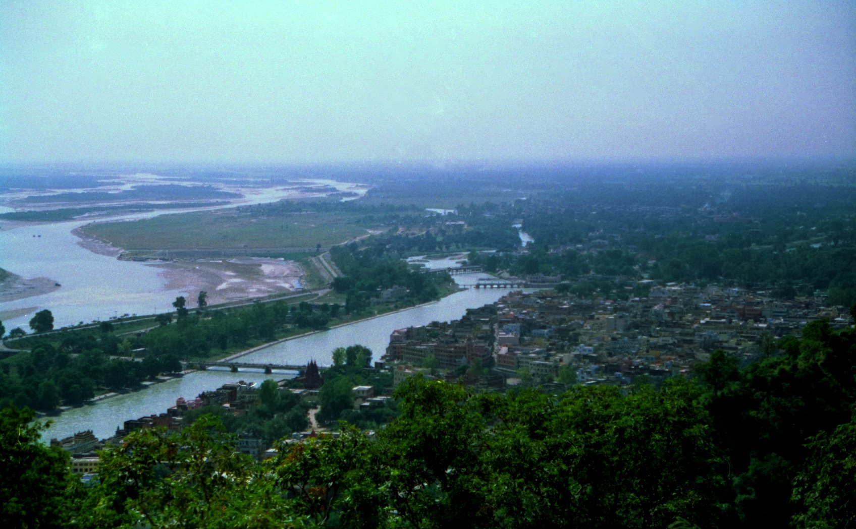
type = district
latd = 29.96 | longd = 78.16| state_name = Uttarakhand
district =
leader_title =
leader_name =
altitude =249.7
population_as_of = 2001 | 14,44,213 [http://haridwar.nic.in/history.htm#Geography Geography of Haridwar] ] population_total = 175,010
population_density =
area_magnitude=
area_total = 2360
area_telephone = 01334
postal_code =
vehicle_code_range =
sex_ratio =
unlocode =
website = http://haridwar.nic.in
footnotes = [http://www.fallingrain.com/world/IN/39/Haridwar.html] [http://haridwar.nic.in/history.htm#Geography] [http://www.euttaranchal.com/uttaranchal/haridwar.php]Haridwar ( _hi. हरिद्वार) audio|Haridwar.ogg|pronunciation is a district of
Uttarakhand state,India . The headquarters is atHaridwar . Other towns in the district are BHEL Ranipur,Dhandera ,Jhabrera ,Laksar ,Landaura ,Manglaur ,Mohanpur Mohammadpur , andRoorkee .The district has a single Parliament Constituency, and 9 Uttarakhand State Legislative Assembly constituencies including, Bhaghwanpur,
Roorkee , Iqbalpur,Manglaur ,Landaura ,Laksar ,Bahadrabad ,Haridwar , and Laldang [ [http://haridwar.nic.in/publicrepresentatives.htm List of Public Representatives from Haridwar] Official wesbite.] .History
The Haridwar district came into existence on
28 December 1988 as part of Saharanpur Divisional Commissionary [http://haridwar.nic.in/history.htm#Geography Geography of Haridwar] ] , and on9 November ,2000 [ [http://india.gov.in/business/investment_incentives/uttarakhand/uttarakhand.php Uttarakhand] Govt. of India, Official website.] , it became part ofUttarakhand , the 27th state in the Republic of India.Geography
Haridwar district, covering an area of about 2360 km² (911 mi²), is in the southwestern part of Uttarakhand state of India. Its latitude and longitude are 29.58 degrees north and 78.13 degrees east respectively. The height from the sea level is 249.7 metres (819 ft).
Administrative organization
The district is administratively subdivided into three
tehsil s: Haridwar,Roorkee , andLaksar . It is further divided into six development blocks: Bhagwanpur,Roorkee , Narsan,Bahadrabad ,Laksar , and Khanpur [ [http://www.north-india.in/uttaranchal/districts/haridwar.htm Haridwar district] ] .References
External links
* [http://haridwar.nic.in/ Haridwar District website]
Wikimedia Foundation. 2010.