- Dehradun district
-
This article is about the district. For its eponymous headquarters, see Dehradun.
Dehradun
देहरादून
— district — Dehradun Railway Station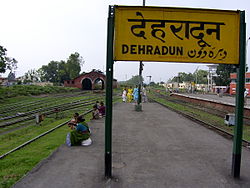
Coordinates 30°20′N 78°04′E / 30.33°N 78.06°ECoordinates: 30°20′N 78°04′E / 30.33°N 78.06°E Country India State Uttarakhand Division Garhwal Headquarters Dehradun Population
• Density
1,282,143
• 1,240 /km2 (3,212 /sq mi)
Time zone IST (UTC+05:30) Area 300 square kilometres (120 sq mi) Website dehradun.nic.in Dehradun district (Hindi: देहरादून जिला)
 pronunciation (help·info) is a district of Uttarakhand state in northern India. The district headquarters is Dehradun, which has also served as the provisional capital of Uttaranchal since its founding in 2000. The district has 6 tehsils, 6 community development blocks, 17 cities and 764 populated villages, and 18 unpopulated villages. As of 2011 it is the second most populous district of Uttarakhand (out of 13), after Haridwar.[1]
The region was seized as a war spoil from the Maharaja of Tehri-Garhwal as a consequence of the Gurkha War of 1814–16, and attached administratively to Saharanpur District to its immediate south, which was already in British hands. Dehradun district also includes the prominent towns of Rishikesh, Mussoorie, Landour and Chakrata. The district stretches from the Ganges river in the east to the Yamuna river in the west, and from the Terai and Shivaliks in the south and southeast to the Great Himalaya in the northwest.
Contents
History
The illustrious history of Dehradun includes various Puranic stories and cultures. It is mentioned in the Ramayana that Lord Rama, along with brother Lakshmana, came to the area after defeating Ravana, the Rakshasa king of Lanka. The area is also linked to Dronacharya, the guru of the Kauravas and Pandavas in the Mahabharata. The area of Rishikesh is mentioned in the Skanda Purana as having been given to rishis(sages) by Lord Vishnu after killing the asuras Madhu-Kaitabh and their companions who tormented the rishis. Ancient temples, statues and archaeological remains have been found at the sites in and around the area that are mentioned in the Ramayana and the Mahabharata. These remains have been dated to be approximately 2000 years old.
The location of the area, the ancient traditions and customs still followed here, folk songs coming down from generations, and their contemporaneous literature point to the fact that the area witnessed various events during the periods of the Ramayana and the Mahabharata. The Pandavas held influence over the region after the battle of the Mahabharata and the area was ruled by the descendants of Subahu as administrators under the Kuru Kingdom at Hastinapur. The discovery of Ashokan edicts at Kalsi near Dehradun show that the area was quite prosperous. Huen Tsang also observed Kalsi as Sudhnagar in the 7th century AD. Archaeological remains from the time of Raja Rasaal have been found at Haripur near Kalsi.
The area was attacked by Mahmud Ghaznavi, Timur in 1368, Rohilla chieftain Najeebuchhaula in 1757 and Ghulam Qadir in 1785. This kept the area in disarray till 1801. The British captured the area in 1816 and found the cities of Landour and Mussourie in 1827-28. The district was added to the Garhwal division in the 1970s. It was established as the capital of Uttarkhand after the establishment of the state as Uttaranchal in the year 2000.
Demographics
As of 2011[update] Indian census provisional figures, the Dehradun district has a population of 16,98,560 the second highest in Uttarakhand after Haridwar (19,27,029). The Decadal growth rate has jumped up from 25% (1991–2001) to 32.48% (2001–2011). This is the third highest in Uttarakhand after Haridwar (33.16%) and Udham Singh Nagar (33.40%). The district has a gender ratio of 902 as against a state average of 963. This has however improved from 887 in the 2001 census. The population density is 550, again the 3rd highest after Haridwar(817) and Udham Singh Nagar (648). The state average is 189. The literacy rate is the highest in the state at 85.24% (90.32 for males, 79.61 for females)[2]
According to the 2011 census Dehradun district has a population of 1,698,560,[1] roughly equal to the nation of Guinea-Bissau[3] or the US state of Idaho.[4] This gives it a ranking of 290th in India (out of a total of 640).[1] The district has a population density of 550 inhabitants per square kilometre (1,400 /sq mi) .[1] Its population growth rate over the decade 2001-2011 was 32.48 %.[1] Dehradun has a sex ratio of 902 females for every 1000 males,[1] and a literacy rate of 85.24 %.[1]
Transport
Dehradun Climate chart (explanation) J F M A M J J A S O N D 471955522952261321321754352023034226313022627302226130203228131124103216Average max. and min. temperatures in °C Precipitation totals in mm Source: Climate of Dehradun District Imperial conversion J F M A M J J A S O N D 1.966412.27248279550.890632.195689.193722586722586721086681.382550.475500.17043Average max. and min. temperatures in °F Precipitation totals in inches There are five railway stations in Dehradun:
- Raiwala(first railway station)
- Rishikesh(gateway of garhwals)
- Doiwala(gorkha fighter shaheed Durga Malla's motherland)
- Harrawala(corner forest)
- Dehradun(capital of Uttrakhand)
Airport
- Jolly grant airport (in middle of three major cities haridwar, rishikesh, dehradun)
Roadway transports
- uttrakhand parivahan(govt. transport)
- car private distant transport
- tempo/autorikshaw local transport
Tourist place
- haridwar
- rishikesh
- dehradun
Languages
- Hindi
- garhwali
- kumauni
- Punjabi
- gorkhali
- English
Culture
Dehradun district is a part of Gadhwal region, therefore local culture is dominant in the district.Apart from Gadhwali, other languages spoken in the region are Hindi and English.People from different religions stay together in harmony and peace. Owing to improved education system, proper transport and good communication system, development of this region has gained appreciable pace.Dehradun is home for many prominent schools in the country.Blue buses are the main way of transport in the city.
Education
Universities
- Uttrakhnad Technical University, dehradun(government)
- H.N.B. Garwal university,(government)
- Doon university (government)
References
- ^ a b c d e f g "District Census 2011". Census2011.co.in. 2011. http://www.census2011.co.in/district.php. Retrieved 2011-09-30.
- ^ "Provisional Population Totals and data products - Census 2011 : Uttarakhand". Census of India. http://www.censusindia.gov.in/2011-prov-results/prov_data_products_utt.html. Retrieved 2011-05-30.
- ^ US Directorate of Intelligence. "Country Comparison:Population". https://www.cia.gov/library/publications/the-world-factbook/rankorder/2119rank.html. Retrieved 2011-10-01. "Guinea-Bissau 1,596,677 July 2011 est."
- ^ "2010 Resident Population Data". U. S. Census Bureau. http://2010.census.gov/2010census/data/apportionment-pop-text.php. Retrieved 2011-09-30. "Idaho 1,567,582"
External links
- Dehradun District Map
- Mussoorie Tourism -: The Queen Of Hill Stations - Detailed Information
- Official website
- Dehra Dun District, Imperial Gazetteer of India, v. 11, p. 210. , 1909
- More about Dehradun District at aboutUttarakhand.com

Shimla district, Himachal Pradesh Uttarkashi district Sirmaur district, Himachal Pradesh 
Tehri Garhwal district  Dehradun district

Saharanpur district, Uttar Pradesh Haridwar district Pauri Garhwal district Cities and towns in Dehradun district Dehradun Chakrata · Clement Town · Dehradun · Dehradun Cantonment · Doiwala · FRI and College Area · Herbertpur · Landour · Mussoorie · Pratitnagar · Raipur · Rishikesh · Veerbhadra · Vikasnagar
Cities and towns
in other districtsAlmora · Bageshwar · Chamoli · Champawat · Haridwar · Nainital · Pauri Garhwal · Pithoragarh · Rudraprayag · Tehri Garhwal · Udham Singh Nagar · Uttarkashi
Divisions and districts of Uttarakhand Kumaon division Almora · Bageshwar · Champawat · Nainital · Pithoragarh · Udham Singh Nagar
Garhwal division Chamoli · Dehradun · Haridwar · Pauri Garhwal · Rudraprayag · Tehri Garhwal · Uttarkashi
Hindu Temples in Uttarakhand Almora Golu Devata • Jageshwar.Nain Kalka, Vishnu templeChamoli Badrinath Temple • Gopinath Mandir • Kalpeshwar • Rudranath • TungnathChampawat Dehradun Haridwar Nainital Pauri Garhwal Rudraprayag Guptakashi • Kedarnath Temple • Madhyamaheshwar • Rudraprayag • Triyuginarayan TempleTehri Garhwal Udham Singh Nagar Moteshwar Mahadev • Maa Balsundari • Nagnath Temple
Uttarkashi Categories:


Wikimedia Foundation. 2010.