- Zemun
-
Zemun
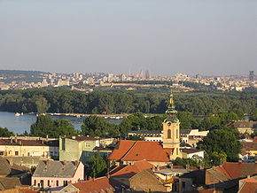
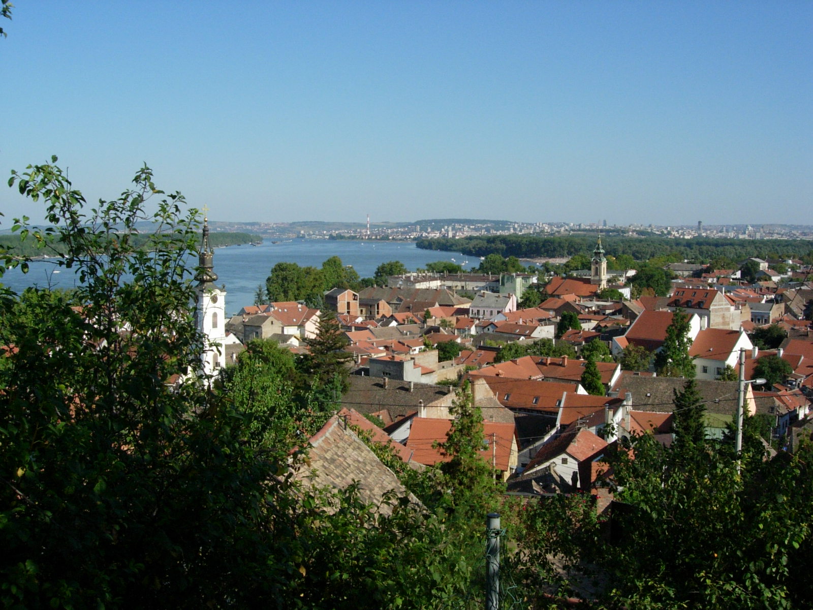
Земун— Municipality — Panoramic view of Zemun

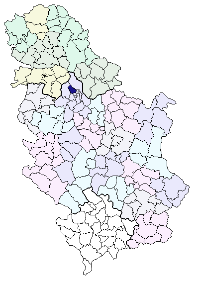
Coat of armsLocation of the municipality of Zemun within Serbia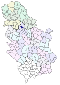
Coordinates: 44°51′N 20°24′E / 44.85°N 20.4°E Country Serbia District Belgrade Settlements 4 Government – Mayor Branislav Prostran (SNS) Area[1] – Municipality 153.56 km2 (59.3 sq mi) Population (2011 census)[2] – Town 145,751 – Municipality 152,950 Time zone CET (UTC+1) – Summer (DST) CEST (UTC+2) Postal code 11080 Area code +381 11 Car plates BG Website www.zemun.rs Zemun (Serbian Cyrillic: Земун, pronounced [zɛ̂muːn]) is a town in Serbia and one of the 17 municipalities which constitute the City of Belgrade, the country's capital. For most of its history, it developed separately from Belgrade, which lies across the Sava river, but the development of New Belgrade in the late 20th century joined them together in a continuous urban area.
Contents
Name
In ancient times, the Celtic and Roman settlement was known as Taurunum. The Frankish chroniclers of the Crusades mentioned it as Mallevila, a toponym from the 9th century. This was also a period when a Slavic name Zemln was recorded for the first time. Believed to be derived from the word zemlja, meaning earth, it was a basis for all other future names of the city: modern Serbian Земун (Cyrillic) or Zemun (Latin), Hungarian Zimony and German Semlin.
History
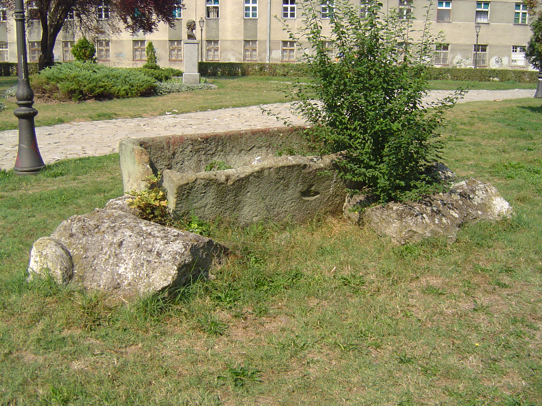
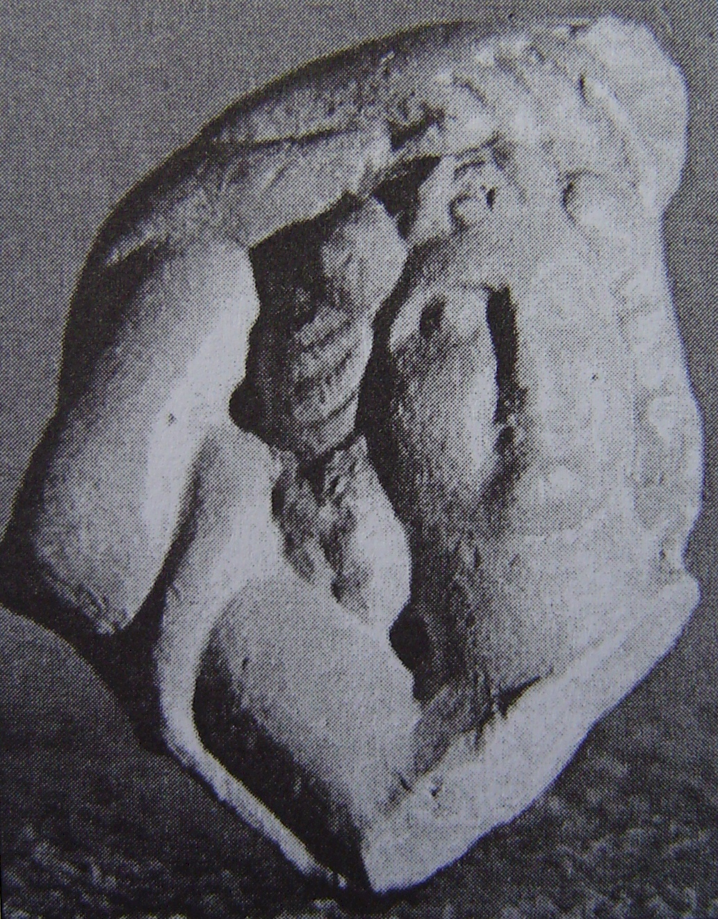
See also: Timeline of Zemun history Roman Sarcophagus
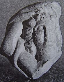
The area of Zemun has been inhabited ever since the Neolithic period. Baden culture graves and ceramics (bowls, anthropomorphic urns) were found in the town.[3] Bosut culture graves were found in nearby Asfaltna Baza.[4] The first Celtic settlements in Taurunum area originate from the 3rd century BC when the Scordisci occupied several Thracian and Dacian areas of the Danube. The Romans came in the 1st century BC, Taurunum became part of the Roman province of Pannonia around 15 AD. It had a fortress[5] and served as a harbour for the Pannonian (Roman) fleet of Singidunum (Belgrade).[6] The pen of Roman poet Publius Ovidius Naso (Ovid) was said to be found in Taurunum.[7] After the Great Migrations the area was under the authority of various peoples and states, including the Byzantine Empire, the Kingdom of the Gepids and the Bulgarian Empire. The town was conquered by the Kingdom of Hungary in the 12th century and in the 15th century it was given as a personal possession to the Serbian despot Đurađ Branković. After the nearby Serbian Despotate fell to the Ottoman Empire in 1459, Zemun became an important military outpost. It was then conquered by the Ottomans on July 12, 1521. In 1541, Zemun was integrated into the Syrmia sanjak of the Budin pashaluk.
Zemun and the southeastern Syrmia were conquered by the Austrian Habsburgs in 1717, after the Ottoman defeat at the Battle of Peterwardein (5 August 1716) and through the Treaty of Požarevac (German: Passarowitz) became a property of the Schönborn family. In 1736, Zemun was the site of a peasant revolt. Its strategic location near the confluence of the Sava and the Danube placed it in the center of the continued border wars between the Habsburg and the Ottoman empires. The Treaty of Belgrade of 1739 finally fixed the border, the Military Frontier was organized in the region in 1746, and the town of Zemun was granted the rights of a military commune in 1749. In 1754, the population of Zemun included 1,900 Orthodox Christians, 600 Catholics, 76 Jews, and about 100 Roma. In 1777, the population of Zemun numbered 1,130 houses with 6,800 residents, half of which were ethnic Serbs, while another half of population was composed of Catholics, Jews, Armenians and Muslims. Among Catholic population, the largest ethnic group were Germans. From this period originates the increased settlement of Germans and Hungarians in the Zemun.
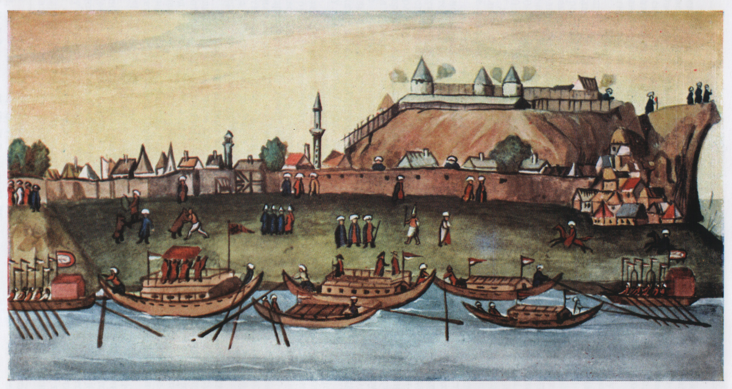
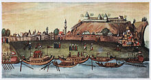 Ottoman Zemun in 1608
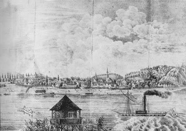
 Panoramic view of Zemun, 19th century
Zemun prospered as an important road intersection and a border city. In 1816 it was greatly expanded by mass resettlement of Germans and Serbs in the new town suburbs of Franzenstal and Gornja Varoš, respectively. In the 19th century, Zemun reached 7,089 residents and 1,310 houses. Zemun also became important in Serbian history as the refuge for Karađorđe in 1813 as well as many other people from the nearby Belgrade and the rest of Karađorđe's Serbia which fell to the Ottoman rule.
During the Revolution of 1848-1849, Zemun was one of the de facto capitals of Serbian Vojvodina, a Serbian autonomous region within Habsburg Empire, but in 1849, it was returned under the administration of the Military Frontier. With the abolishment of the Military Frontier in 1882, Zemun and the rest of Srem was included into Syrmia County of Croatia-Slavonia, which was an autonomous part of the Kingdom of Hungary and Austria-Hungary. The first railway line that connected it to the west was built in 1883, and the first railway bridge over the Sava followed shortly thereafter in 1884.
During the World War I in 1914, Zemun changed hands between Serbia and Austria-Hungary, finally ending up in Serbia on November 5, 1918. The town became part of the Kingdom of Serbs, Croats and Slovenes (later Kingdom of Yugoslavia). The inter-war period was marked by political struggle between the city gentry (organized into the Radical Party, Democratic Party and the Croatian Peasant Party) and the more socialist parties supported by the ethnic Germans.
In 1934 two intra-city bus lines were introduced connecting Zemun with the parts of Belgrade, and the general shift of attention towards this issue was supported by the growing Serbian population of Zemun. The Zemun airbases originally built in 1927 were an important geostrategic objective in the Axis invasion of April 1941. Following the surrender of Yugoslavia that same month, Zemun, along with the rest of Syrmia, was given to the Independent State of Croatia. The city was liberated from Axis occupation in 1944, and since then, it is part of Serbian region known as Central Serbia.
In later years of Slobodan Milošević's regime, Zemun became a stronghold of notorious Zemun clan, one of principal organized crime cartels in Belgrade. Bosses and prominent members of this clan have been tried and convicted for the assassination of Serbian prime minister Zoran Đinđić.
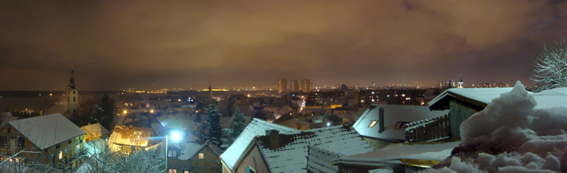 Nocturnal cityscape of Zemun's old town
Geography
Zemun originally developed on three hills, Gardoš, Ćukovac and Kalvarija, on the right bank of the Danube, where the widening of the Danube begins and the Great War Island is formed at the mouth of the Sava river. The core of the city are the neighborhoods of Donji Grad, Gardoš, Ćukovac and Gornji Grad. To the south, Zemun continues into Novi Beograd with which it makes one continuous urban area (neighborhood of Tošin Bunar). In the west it extends into the neighborhoods of Altina and Plavi Horizonti and to the north-west into Galenika, Zemun Polje and further into Batajnica.
The municipality is located in the eastern Syrmia region, in the central-western section of the Belgrade City area. The urban section of Zemun is the both most northern and western section of the urban Belgrade. Zemun borders the province of Vojvodina on the west (municipality of Nova Pazova), and municipalities of Surčin on the south, Novi Beograd on south-east and Palilula and Stari Grad across the Danube (north and east, respectively).
The Danube bank in the north is mostly marshy, so the settlements are built further from the river (Batajnica) separated from it by hillocks (up to 114 m). The city of Zemun itself was built right on the bank, 100 meters above sea level. These are points of the Zemun loess plateau, an extension of the Syrmia loess plateau, which continues into the crescent-shaped Bežanijska Kosa loess hill on the south-east. The yellow loess is thick up to 40 meters and very fertile, with rich, grass-improved, humus chernozem. The uninhabited river islands of Great War Island and Little War Island on the Danube, also belong to the municipality Zemun, too. Municipality has an area of 153 km².
Neighbourhoods and suburbs
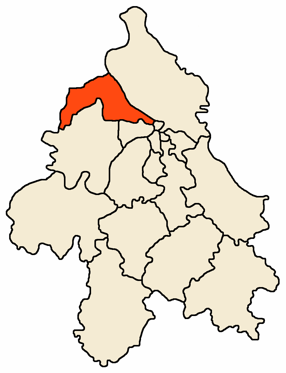
 Location of Zemun within Belgrade
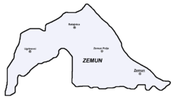 Map of Zemun municipality
Municipality of Zemun has only two official settlements: (City of) Zemun, which is part of the urban Belgrade city proper (uža teritorija grada; statistically it is classified as Belgrade-part) and the village of Ugrinovci (with two hamlets of Grmovac and Busije). Many of the neighbourhoods developed in the last few decades (Altina, Plavi Horizonti, Kamendin, Grmovac, Busije, etc.).
Urban:
- Altina
- Bački Ilovik
- Batajnica
- Crveni Barjak
- Ćukovac
- Donji Grad
- Franjine Rudine
- Galenika
- Gardoš
- Gornji Grad
- Goveđi Brod
- Jelovac
- Kalvarija
- Kamendin
- Kolonija Zmaj
- Lido
- Mala Pruga
- Malo Ratno Ostrvo
- Marija Bursać
- Meandri
- Muhar
- Nova Galenika
- Novi Grad
- Plavi Horizonti
- Retenzija
- Sava Kovačević
- Sutjeska
- Šangaj
- 13. Maj
- Veliko Ratno Ostrvo
- Vojni Put
- Vojni Put I
- Vojni Put II
- Zemun
- Zemun Bačka
- Zemun Polje
- Zemunski Kej
- Železnička Kolonija
Suburban:
Population
As Zemun grew into one of the most populous neighborhoods of Belgrade, population of the municipality had a steady growth since the World War II. Population of the Zemun (in present borders) by the official censuses of population:
Year City Municipality* 1921 18,528 1931 28,083 1948 42,230 1953 44,110 51,129 1961 72,956 74,851 1971 95,142 111,967 1981 116,826 138,702 1991 141,695 2002 145,751 152,950 Municipality figures include populations of today's Surčin municipality, which separated from Zemun in 2004.
Ethnic groups (2002 census)
- Serbs = 133,988 (87.61%)
- Roma = 4,030 (2.64%)
- Yugoslavs = 3,315 (2.17%)
- Croats = 1,970 (1.29%)
- Others.
Administration
 Flag of Zemun
Municipality of Zemun became part of the Belgrade City Area (Teritorija grada Beograda) with the division of Yugoslavia into banovinas by king Alexander I on October 3, 1929. On April 1, 1934, municipality itself was absorbed into the municipality of Belgrade, so the post of the president of the municipality of Zemun was abolished and "Zemun section administrator" was appointed to the Belgrade's city government.
In 1941-44 it was occupied by the German army as the Okupationsgebiet Ostsyrmien. Germany technically recognised Zemun and surroundings as part of the Independent State of Croatia puppet regime but Zemun remained under direct German rule.
After 1945 Zemun was administratively divided into the City of Zemun and Zemun district (srez), unlike rest of Belgrade which was divided into raions. In 1955 both City of Zemun and most of the Zemun district were incorporated into Belgrade again. In 1950s and 1960s, municipalities of Boljevci and Dobanovci were annexed to the municipality of Surčin while Batajnica was annexed to Zemun itself. In 1965 Surčin was annexed to the municipality of Zemun which marked the largest territorial expansion of Zemun (438 km²). However, on November 24, 2003 Belgrade City assembly voted to re-create the municipality of Surčin, but it remained under the administration of Zemun until November 3, 2004, when separate municipal government was established after the local elections. A motion for Batajnica to split from Zemun too was active for a while in early 2000s (see List of former and proposed municipalities of Belgrade).Presidents of the municipality:
- October 3, 1929 - June 20, 1930; Petar S. Marković
- June 20, 1930 - December 8, 1931; Svetislav Popović
- December 9, 1931 - March 31, 1934; Miloš Đorić
Administrator of the Zemun section
- 1934 - April 12, 1941; Nikola Folger
German mayors:
- April 13, 1941 - July 1941; Johannes Moser (d. 1980)
- July 1941 - December 1941; Stefan Seifert
- December 1941 - October 1944; Johannes Moser (2nd time)
Partisan military administrator:
- October 22, 1944 - October 26, 1944; Milan Žeželj (1917–95)
Presidents of the municipal assembly:
- October 26, 1944 - July 8, 1945; Ljubomir Milovanović
- July 8, 1945–1947; Dimitrije Anokić
- 1947 - 1949; Milenko Jovanović
- 1949 - 1950; Božidar Tomić (b. 1914)
- 1950; Lazar Popov (acting)
- 1950 - 1955; Stojan Svilarić (b. 1920)
- 1955 - 1958; Branko Pešić (1922–86)
- 1958 - 1962; Aleksandar S. Jovanović
- 1962 - 1967; Čedomir Jovićević
- 1967 - 1971; Svetozar Papić
- 1971 - 1973; Radojko Filipović
- 1973 - 1974; Pavle Ilić (acting)
- 1974 - 1978; Branko S. Radivojević (b. 1932)
- 1978 - 1982; Ilija Kragović
- 1982 - 1986; Novak Rodić
- 1986 - 1989; Petar Stolica
- 1989; Dobrivoje Perović
- 1989 - 1992; Živko Davidović (b. 1935)
- 1992 - December 1996; Nenad Ribar
- December 1996 - April 1998; Vojislav Šešelj (b. 1954)
- April 1998 - October 17, 2000; Stevo Dragišić (b. 1971)
- October 17, 2000 - November 4, 2004; Vladan Janićijević (b. 1934)
Presidents of the municipality:
- November 4, 2004 – June 4, 2008; Gordana Pop-Lazić (b. 1956)
- June 4, 2008 – March 5, 2009 Slavko Jerković
- March 5, 2009 – July 23, 2009 Zdravko Stanković (acting)
- July 23, 2009 – present; Branislav Prostran (b. 1976)
There is a popular local rivalry between inhabitants of Zemun and Belgrade going on for decades, especially among youth. In general, local population consider Zemun still a separate, and more advanced and cultural city and point out they were born in Zemun rather than Belgrade, while Belgraders consider Zemun an outer suburb of Belgrade.
Economy and transportation
Zemun is one of the most developed municipalities of Belgrade, with developed industries in almost every branch. Zemun has two large and still growing industrial zones, one located along the highway and the other one along the road to Batajnica and further to Novi Sad (Galenika, Goveđi Brod, etc.). Industries include: heavy agricultural machines and appliances (Zmaj), precise and optical instruments and automatized appliances (Teleoptik), clocks (INSA), busses and other heavy vehicles (Ikarbus), pharmaceuticals (Galenika), plastics (Grmeč), shoes (Obuća Beograd), textile (TIZ, Zekstra), food, candies and chocolate (Soko Štark), metals (IMPA, Intersilver), wood and furniture (Gaj, Reprek), recycling (INOS metali and INOS papir), beverages (Coca Cola, Navip), chemicals (Roma), building materials (DIA, Anicom), electronics, leather, etc. In addition to this dozens of halls, and warehouses are built throughout both industrial zones.
Several important roads of Serbia run through the municipality. The Belgrade-Zagreb highway, the old (Batajnički drum) and new (highway) road Belgrade-Novi Sad, the still in construction starting point (Batajnica-Dobanovci) of the future Belgrade beltway (Batajnica-Bubanj Potok), Belgrade-Novi Sad railway, etc. Zemun has no bridges, apart from the seasonal pontoon bridge which connects the mainland with the Great War Island during summer. First bridge over the Danube, Galenika-Borča bridge is still in project.
Batajnica Airbase with a limited civil traffic is also located in the municipality, near the Batajnica settlement.

Culture and education
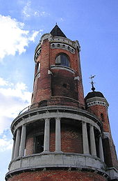 Gardoš tower
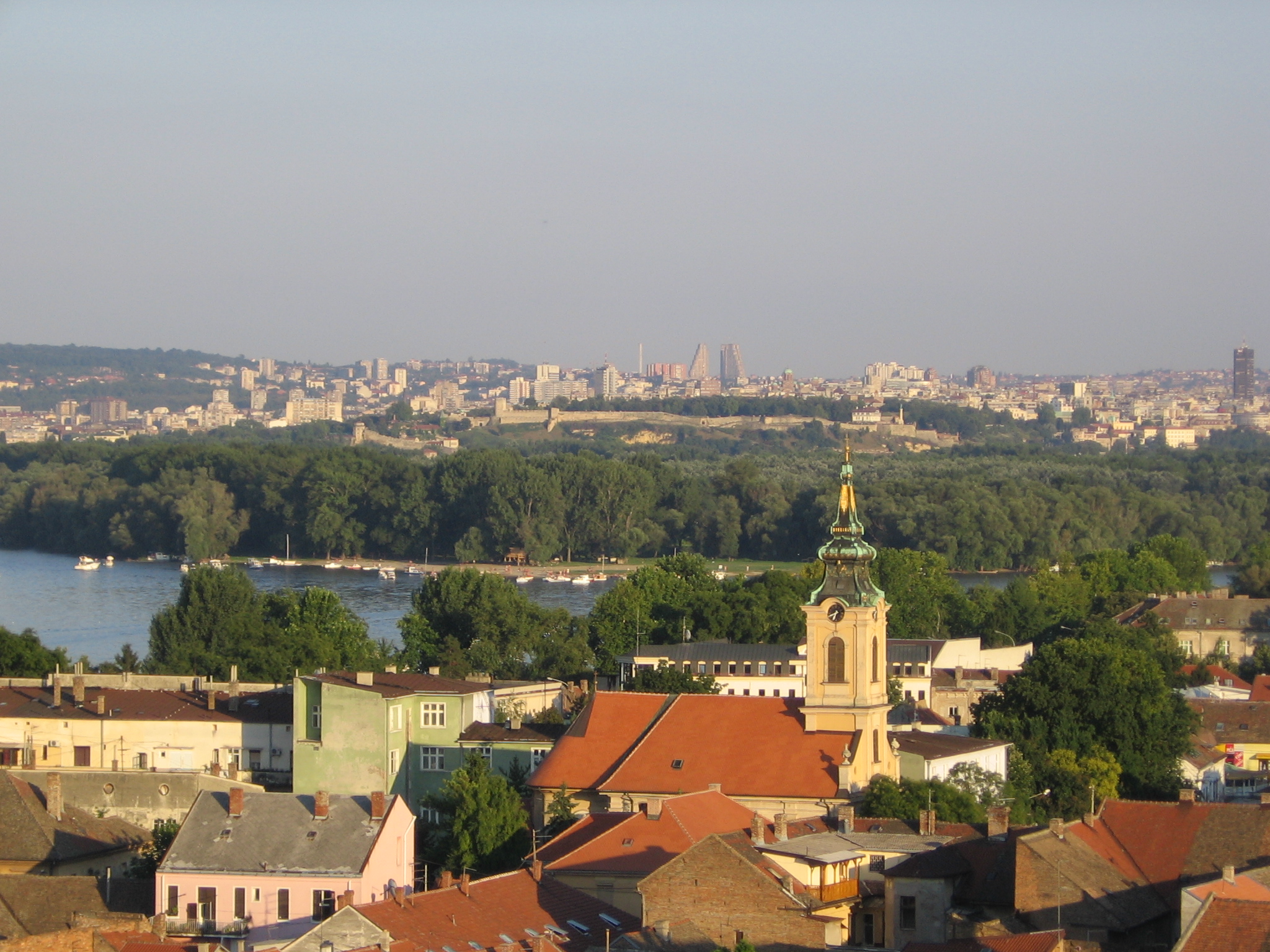
 View of Belgrade
The faculty of agriculture of the Belgrade University is located in Zemun, as well asmany other important higher schools (Internal affairs, Economics, Technics and machines, Medicine, Zemun gymnasium) and institutes (Institute for agriculture and forestry, Institute for mining, world famous Institute for corn in Zemun Polje, Institute for livestock, Institute for the implementation of the nuclear energy in agriculture, Institute for physics). Zemun has a Homeland museum and Madlenianum Opera and Theatre.
Two of Belgrade's major hospitals-clinical centers are located in Zemun: "KBC Zemun" and "KBC Bežanijska Kosa", so as the retirement home "Bežanijska Kosa", the largest one in Belgrade. Churches include the Gardoš cemetery church and the Hariš chapel, Saint Nicholas, Saint Archangel Gabriel and two Roman Catholic churches.
Zemun is known for many squares, though almost all of them are small in size: Magistratski, Senjski, Veliki, Branka Radičevića, Karađorđev, Masarikov, etc. On one of them, the Zemun open green market is located. The bank of the Danube is turned into Zemunski Kej, a kilometers long promenade, with various entertainment facilities along it, including barges-cafés, amusement park and especially formerly largest hotel in Belgrade, Hotel Jugoslavija.
The remnants of the old town which existed during battles between Kingdom of Hungary and Byzantine Empire in 12th century are known as Zemunski Grad (Zemun Town). Today visible ruins however are of the medieval fortress (angular towers and parts of the defending wall) where forces of Kingdom of Hungary, 500 šajkaši crew (led by Croat Marko Skoblić) consisted of Croats and Serbs fought against invading Ottoman army of Suleyman the Magnificent in 1521. Despite hard resistance, Zemun fell on July 12 [8] and Belgrade soon afterwards (see Fall of Belgrade (1521)). On this place, the Kula Sibinjanin Janka (The tower of Janos Hunyadi) or the Millennium tower was erected. It was built and officially opened on August 20, 1896 to celebrate a thousand years of Hungarian settlement in the Pannonian plain. The tower was built as a combination of various styles, mostly influenced by the Roman elements. Being a natural lookout, it was used by Zemun's firemen for decades. Today, the tower is better known after the Janos Hunyadi, who actually died in the old fortress four and a half centuries before the tower was built. In general, Gardoš is today the most recognizable symbol of Zemun. For the most part, the neighborhood preserved its old looks, with narrow, still mostly cobblestoned streets unsuitable for modern vehicles, and individual residential houses.
Zemun is not rich in parks. The largest one is the City park (Gradski park, built in 1880, scheduled for reconstruction in 2008 [9]) and another one is Jelovac in Kalvarija. A small park on Mažuranić square was renovated in November 2007. It is first in Belgrade that has rubber ground under two children playgrounds.[10]
Sport
The city has several stadiums, including those of the FK Zemun and Milutinac, with BSK Batajnica in Batajnica. One of Belgrade's major sports halls, Pinki, is located in Zemun too.
Several football squads were existing in Zemun in the past. City gave clubs like Šparta [11] (worker's club) and ZAŠK, that in 1939 merged into SK Zemun.
During the short time of existence of Independent State of Croatia (1941–1944), a World War II puppet state of Nazi Germany, in Zemun there were four Croat football clubs: HŠK Građanski, HŠK Zemun, HŠK Dunav and HŠK Hajduk, as well as two German football clubs: DSV Victoria and SK Liet.
Later, Zemun gave a football squad that occasionally played in Yugoslav 1. division, Galenika, later renamed into FK Zemun. Today, there're also squads Teleoptik, Zmaj and Milutinac.
International relations
See also: List of twin towns and sister cities in SerbiaTwin towns — Sister cities
See also
- Subdivisions of Belgrade
- List of Belgrade neighborhoods and suburbs
References
Bibliography
- Mala Enciklopedija Prosveta, Third edition (1985); Prosveta; ISBN 86-07-00001-2
- Jovan Đ. Marković (1990): Enciklopedijski geografski leksikon Jugoslavije; Svjetlost-Sarajevo; ISBN 86-01-02651-6
Notes
- ^ "Municipalities of Serbia, 2006". Statistical Office of Serbia. http://webrzs.stat.gov.rs/axd/en/Zip/OG2006webE.zip. Retrieved 2010-11-28.
- ^ "2011 Census of Population, Households and Dwellings in the Republic of Serbia – FIRST RESULTS". Bulletin (Statistical Office of the Republic of Serbia) 540. 2011. ISSN 0354-3641. http://media.popis2011.stat.rs/2011/prvi_rezultati.pdf. Retrieved 2011-11-21.
- ^ http://www.rastko.rs/arheologija/srejovic/dsrejovic-eneolit.html
- ^ http://www.balkaninstitut.com/pdf/izdanja/balcanica/balcanica%2035/01%20Tasic.pdf
- ^ A manual of ancient and modern history ... William Cooke Taylor,Caleb Sprague Henry
- ^ Vespasian-Barbara Levick
- ^ Biographia classica: the lives and characters of the Greek and Roman classics, by Edward Harwood.
- ^ (Croatian) Hrvatska riječ Hrvatski doprinos zemunskom naslijeđu, May 29, 2009
- ^ Politika daily, November 6, 2007, p.24
- ^ Beoinfo
- ^ (Serbian) Sport u Zemunu
- ^ [1] Stalna konferencija gradova i opština. Retrieved on 2007-06-18.
See also
External links
- Municipality of Zemun
- Gardoš Zemun 360 Virtual tour
- Osnovna škola Gornja Varoš Zemun
Municipalities of Belgrade Municipalities Barajevo · Čukarica · Grocka · Lazarevac · Mladenovac · Novi Beograd · Obrenovac · Palilula · Rakovica · Savski Venac · Sopot · Stari Grad · Surčin · Voždovac · Vračar · Zemun · Zvezdara
Municipalities and cities of Serbia Central Serbia Belgrade (Barajevo • Čukarica • Grocka • Lazarevac • Mladenovac • Novi Beograd • Obrenovac • Palilula • Rakovica • Savski Venac • Sopot • Stari Grad • Surčin • Voždovac • Vračar • Zemun • Zvezdara) • Čačak • Jagodina • Kragujevac (Aerodrom • Pivara • Stanovo • Stari Grad • Stragari) • Kraljevo • Kruševac • Leskovac • Loznica • Niš (Crveni Krst • Medijana • Niška Banja • Palilula • Pantelej) • Novi Pazar • Požarevac • Smederevo • Šabac • Užice • Valjevo • Vranje • Zaječar Aleksandrovac • Aleksinac • Aranđelovac • Arilje • Babušnica • Bajina Bašta • Batočina • Bela Palanka • Blace • Bogatić • Bojnik • Boljevac • Bor • Bosilegrad • Brus • Bujanovac • Crna Trava • Čajetina • Ćićevac • Ćuprija • Despotovac • Dimitrovgrad • Doljevac • Gadžin Han • Golubac • Gornji Milanovac • Ivanjica • Kladovo • Knić • Knjaževac • Koceljeva • Kosjerić • Krupanj • Kučevo • Kuršumlija • Lajkovac • Lapovo • Lebane • Lučani • Ljig • Ljubovija • Majdanpek • Mali Zvornik • Malo Crniće • Medveđa • Merošina • Mionica • Negotin • Nova Varoš • Osečina • Paraćin • Petrovac • Pirot • Požega • Preševo • Priboj • Prijepolje • Prokuplje • Rača • Raška • Ražanj • Rekovac • Sjenica • Smederevska Palanka • Sokobanja • Surdulica • Svilajnac • Svrljig • Topola • Trgovište • Trstenik • Tutin • Ub • Varvarin • Velika Plana • Veliko Gradište • Vladičin Han • Vladimirci • Vlasotince • Vrnjačka Banja • Žabari • Žagubica • Žitorađa
Vojvodina 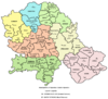 Ada • Alibunar • Apatin • Bač • Bačka Palanka • Bačka Topola • Bački Petrovac • Bečej • Bela Crkva • Beočin • Čoka • Inđija • Irig • Kanjiža • Kikinda • Kovačica • Kovin • Kula • Mali Iđoš • Nova Crnja • Novi Bečej • Novi Kneževac • Odžaci • Opovo • Pećinci • Plandište • Ruma • Sečanj • Senta • Šid • Srbobran • Sremski Karlovci • Stara Pazova • Temerin • Titel • Vrbas • Vršac • Žabalj • Žitište
Kosovo Dečani • Đakovica • Dragaš • Glogovac • Gnjilane • Istok • Kačanik • Klina • Kosovo Polje • Kosovska Kamenica • Kosovska Mitrovica • Leposavić • Lipljan • Mališevo • Novo Brdo • Obilić • Orahovac • Peć • Podujevo • Priština • Prizren • Štimlje • Srbica • Štrpce • Suva Reka • Uroševac • Vitina • Vučitrn • Zubin Potok • Zvečan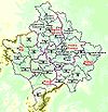 New Municipalities: Đeneral Janković • Gračanica • Junik • Klokot-Vrbovac • Mamuša • Parteš • RanilugCategories:
- Zemun
- Populated places in Central Serbia
- Places in Syrmia
- Municipalities of Belgrade
- Neighborhoods of Belgrade
- Populated places on the Danube
- Roman towns and cities in Serbia


Wikimedia Foundation. 2010.