- Kula (Serbia)
-
Kula
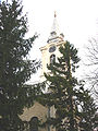
Кула— Municipality and Town — Town center of Kula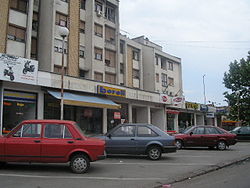
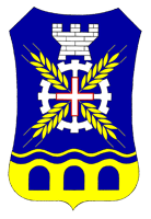
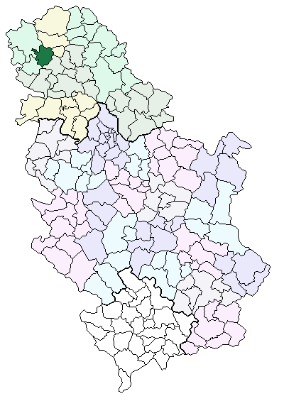
Coat of armsLocation of the municipality of Kula within Serbia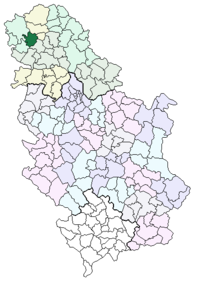
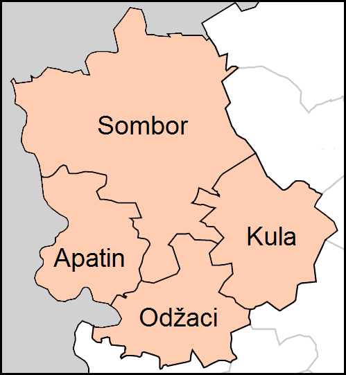
Coordinates: 45°36′N 19°32′E / 45.6°N 19.533°E Country Serbia District West Bačka Settlements 7 Government – Mayor Svetozar Bukvić Area[1] – Municipality 481 km2 (185.7 sq mi) Population (2011 census)[2] – Town 19,301 – Municipality 48,353 Time zone CET (UTC+1) – Summer (DST) CEST (UTC+2) Postal code 25230 Area code +381 25 Car plates SO Website www.kula.rs  Map of Kula municipality
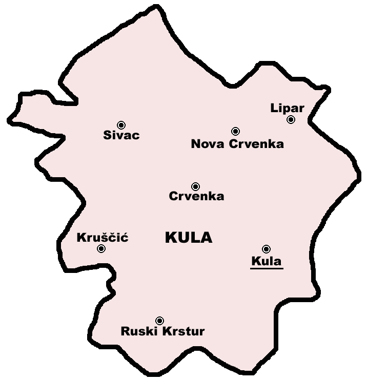
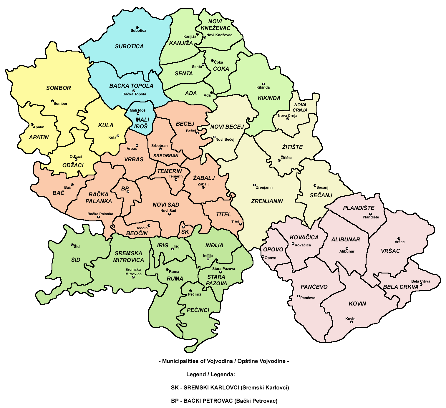
Kula (Кула) is a town and municipality in the West Bačka District of Vojvodina, Serbia. The town Kula has a population of 19,293, while the Kula municipality has a population of 48,306.
Contents
Name
In Serbian, the town is known as Kula (Кула); in Rusyn as Кула, in Hungarian as Kula, in Croatian as Kula, in German as Wolfsburg, and in Turkish as Kula.
The name Kula means "tower" in Turkish and Serbian. In the 16th-17th century, a tower with Ottoman military garrison existed at this location, hence the name of the town. However, it cannot be said for sure whether Ottoman Turks or local Serbs gave this name to the town.
History
In the middle of the 17th century, during Ottoman administration, two settlements with this name were mentioned - Gornja Kula and Donja Kula. These settlements were part of the Ottoman Sanjak of Segedin and were populated by ethnic Serbs. From the end of the 17th century, the region was under administration of the Habsburg Monarchy and two settlements were mentioned as Mala Kula and Velika Kula and were unpopulated. In 1714, there was a record about single settlement named Kula that had 14 houses. In 1733, the population of the settlement numbered 251 houses and its inhabitants were Serbs. Hungarians started to settle there in 1740 and Germans in 1780-1785.
Until the middle of the 19th century, the settlement was part of the Batsch-Bodrog County within the Habsburg Kingdom of Hungary. In 1848-1849 it was part of the autonomous Serbian Vojvodina and from 1849 to 1860 it was part of the Voivodeship of Serbia and Banat of Temeschwar, an separate Habsburg crownland. After abolishment of the voivodeship in 1860, the settlement was again included into Batsch-Bodrog County. In the second half of the 19th century some Rusyns were settled here as well. After 1867, colonization of Hungarians was intensified, and until the beginning of the 20th century they replaced Serbs as largest ethnic group in Kula. According to the 1910 census the population of Kula was ethnically mixed: from the total population of 9,119 there was 3,679 speakers of Hungarian, 2,510 speakers of Serbian, 2,425 speakers of German, and 456 speakers of Rusyn.
After 1918, the settlement was part of the Kingdom of Serbs, Croats and Slovenes (later renamed to Yugoslavia). In 1918-1919, it was part of the Banat, Bačka and Baranja region, and also (from 1918 to 1922) part of the Novi Sad County. From 1922 to 1929, it was part of the Bačka Oblast, and from 1929 to 1941 part of the Danube Banovina. During World War II, From 1941 to 1944, Kula was under Axis occupation and was attached to the Horthy's Hungary. In 1944, the Soviet Red Army and Yugoslav partisans expelled Axis troops from the region and Kula was included into autonomous province of Vojvodina within new socialist Yugoslavia. Since 1945, Vojvodina is part of the People's Republic of Serbia within Yugoslavia. According to 1953 census, Hungarians were largest ethnic group in the town, while subsequent censuses recorded Serb ethnic plurality. German community left from Kula in the end of World War II, while sizable number of ethnic Montenegrins from Montenegro settled here instead of Germans. Today, Montenegrins are second largest ethnic community in Kula. After the breakup of Yugoslavia (1991-1992) and Serbia and Montenegro (2006), town became part of an independent Republic of Serbia.
Inhabited places
The Kula municipality includes the towns of Kula and Crvenka, and also the following villages:
Demographics (2002 census)
Ethnic groups in the Kula municipality
- Serbs (52.01%)
- Montenegrins (16.34%)
- Rusyns (11.16%)
- Hungarians (8.44%)
- Ukrainians (3%)
- Croats (1.66%)
- Yugoslavs (1.53%)
Settlements by ethnic majority
Settlements with a Serb ethnic majority are: Lipar, Nova Crvenka, Sivac, and Crvenka. The settlement with a Rusyn ethnic majority is Ruski Krstur. Ethnically mixed settlements are: Kula (with a relative Serb majority) and Kruščić (with a relative Montenegrin majority).
Ethnic groups in the Kula town
- Serbs (49.86%)
- Montenegrins (15.66%)
- Hungarians (14.19%)
- Ukrainians (5.83%)
- Rusyns (3.76%)
- Yugoslavs (2.31%)
- Croats (1.67%)
Languages in the Kula municipality
77% of the inhabitants of the Kula municipality declared Serbian as their mother language in a 2002 census.
Politics
There is an initiative among the inhabitants of Crvenka and Ruski Krstur that these two settlements become their own municipalities, completelly separate from Kula.
Sports
There is a football club named FK Hajduk Kula in the town. It play in the Serbian SuperLiga.
Gallery
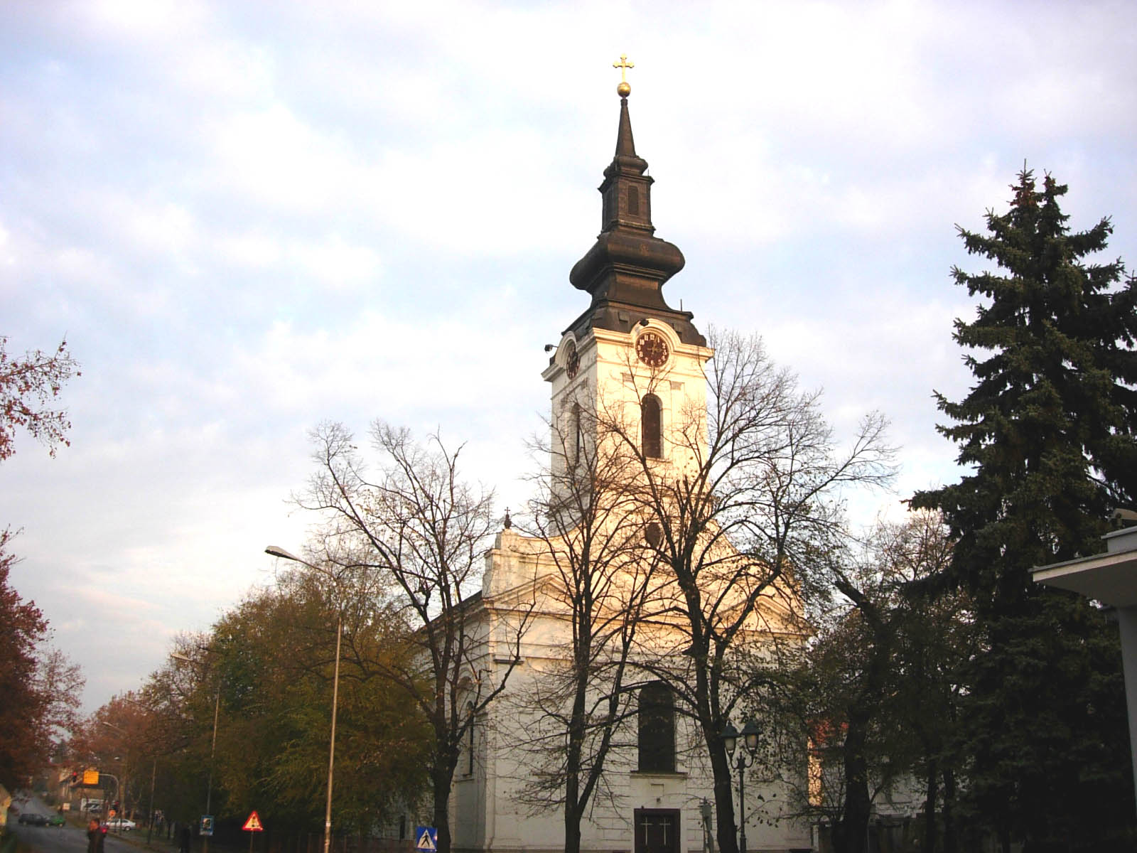
-
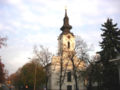
The Orthodox church.
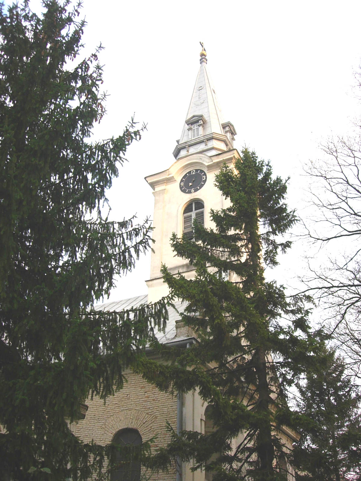
-
Saint George the Martyr Catholic Church.
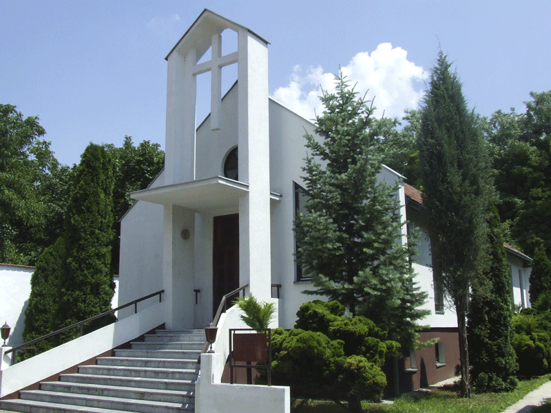
-

Seventh-day Adventist Church.
References
- ^ "Municipalities of Serbia, 2006". Statistical Office of Serbia. http://webrzs.stat.gov.rs/axd/en/Zip/OG2006webE.zip. Retrieved 2010-11-28.
- ^ "2011 Census of Population, Households and Dwellings in the Republic of Serbia – FIRST RESULTS". Bulletin (Statistical Office of the Republic of Serbia) 540. 2011. ISSN 0354-3641. http://media.popis2011.stat.rs/2011/prvi_rezultati.pdf. Retrieved 2011-11-21.
External links
- Official site
- Unofficial site
- KulaWiFi
- Kula online community
- “A Home for Town Planning Kula-Odzaci” Kula
- LDP Kula - Liberal Democratic Party M.O. Kula
- History of Kula (Hungarian)
Cities, towns and villages in the West Bačka District Sombor Aleksa Šantić · Bački Breg · Bački Monoštor · Bezdan · Gakovo · Doroslovo · Kljajićevo · Kolut · Rastina · Riđica · Svetozar Miletić · Stanišić · Stapar · Telečka · Čonoplja
Apatin Kula Odžaci bold are municipalitiesCategories:- Places in Bačka
- Populated places in Vojvodina
- Municipalities of Vojvodina
- Kula (Serbia)


Wikimedia Foundation. 2010.