- Crveni Krst, Niš
-
Crveni Krst
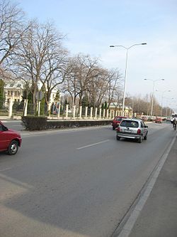
Црвени Крст— Municipality and Town — A boulevard in Crveni Krst 
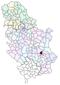
Coat of armsLocation of the municipality of Crveni Krst within Serbia Country Serbia District Nišava Settlements 24 Government – Mayor Dragan Bojković (SRS) Area[1] – Municipality 181.5 km2 (70.1 sq mi) Population (2011 census)[2] – Town 12,223 – Municipality 31,762 Time zone CET (UTC+1) – Summer (DST) CEST (UTC+2) Postal code 18000 Area code +381 18 Car plates NI Crveni Krst (Serbian Cyrillic: Црвени Крст, trans. Red Cross) is one of the municipalities in the City of Niš, Serbia. The municipality of Crveni Krst has a population of 31,762 inhabitants
Contents
Geography
The municipality borders Aleksinac municipality in the north-west, Svrljig municipality in the north-east, Pantelej municipality in the east, Medijana municipality in the south-east, Palilula municipality in the south, and Merošina municipality in the south-west.
History
Crveni Krst Municipality was formed on June 6, 2002. It was the site of a concentration camp during World War II.
Neighborhoods
Neighborhoods of municipality of Crveni Krst include:
- Crveni Krst
- Beograd Mala
- Jagodin Mala (partly)
- Šljaka
- Komren (mostly)
Suburbs
- Berčinac
- Vele Polje
- Vrtište
- Gornja Toponica
- Gornja Trnava
- Gornji Komren
- Donja Toponica
- Donja Trnava
- Donji Komren
- Kravlje
- Leskovik
- Medoševac
- Mezgraja
- Miljkovac
- Paligrace
- Paljina
- Popovac
- Rujnik
- Sečanica
- Supovac
- Trupale
- Hum
- Čamurlija
See also
References
- ^ "Municipalities of Serbia, 2006". Statistical Office of Serbia. http://webrzs.stat.gov.rs/axd/en/Zip/OG2006webE.zip. Retrieved 2010-11-28.
- ^ "2011 Census of Population, Households and Dwellings in the Republic of Serbia – FIRST RESULTS". Bulletin (Statistical Office of the Republic of Serbia) 540. 2011. ISSN 0354-3641. http://media.popis2011.stat.rs/2011/prvi_rezultati.pdf. Retrieved 2011-11-21.
Categories:- Municipalities of Niš
Wikimedia Foundation. 2010.

